Page is loading ...


This device complies with Part 15 of the FCC rules. Operation is subject to the following
two conditions:
• This device may not cause harmful interference.
• This device must accept any interference received, including interference, that may
cause undesired operation.
Copyright Notice
Hemisphere GPS, Inc. Precision GPS Applications
© Copyright Hemisphere GPS, Inc. 2007. All rights reserved.
No part of this manual may be reproduced, transmitted, transcribed, stored in a retrieval
system or translated into any language or computer language, in any form or by any
means, electronic, mechanical, magnetic, optical, chemical, manual or otherwise, without
the prior written permission of Hemisphere GPS.
Trademarks
Hemisphere GPS and the Hemisphere GPS logo, Satloc and the Satloc logo, Mapstar, Air
Star Outback Guidance and eDrive are trademarks of Hemisphere GPS, Inc., Other
trademarks are the properties of their respective owners.
Notice to Customers
Contact your local dealer for technical assistance. To find the authorized dealer near you,
call or write us at:
Hemisphere GPS
4110 9th Street S.E.
Calgary, AB Canada
T2G-3C4
Telephone number:
Fax number:
E-mail address:
(403) 259-3311
(403) 259-8866
www.hemispheregps.com


Warranty Notice
Covered Products
This warranty covers all products manufactured by Hemisphere GPS, Inc.(the "Products").
Hemisphere GPS Limited Warranty
Hemisphere GPS hereby warrants solely to the end purchaser of the Products, subject to the exclusions and
procedures set forth herein below, that the Products sold to such end purchaser shall be free, under normal use and
maintenance, from defects in material and workmanship for a period of 12 months from delivery to such end
purchaser. Repairs and replacement components are warranted, subject to the exclusions and procedures set forth
below, to be free, under normal use and maintenance, from defects in material and workmanship for 90 days from
performance or delivery, or for the balance of the original warranty period, whichever is greater.
Purchaser's Exclusive Remedy
The end purchaser's exclusive remedy under this warranty shall be limited to the repair or replacement, at the option
of Hemisphere GPS, of any defective Products or components thereof. The end user shall notify Hemisphere GPS or
a Hemisphere GPS approved service center immediately of any claimed defect. Repairs shall be made through a
Hemisphere GPS approved service center only.
Exclusions
Hemisphere GPS does not warrant damage occurring in transit or due to misuse, abuse, improper installation,
neglect, lightning (or other electrical discharge) or fresh/salt water immersion of Products. Repair, modification or
service of Hemisphere GPS products by any party other than a Hemisphere GPS approved service center shall render
this warranty null and void. Hemisphere GPS does not warrant claims asserted after the end of the warranty period.
Hemisphere GPS does not warrant or guarantee the precision or accuracy of positions obtained when using
Products. Products are not intended for primary navigation or for use in safety of life applications. The potential
accuracy of Products as stated in Hemisphere GPS literature and/or Product specifications serves to provide only an
estimate of achievable accuracy based on:
• Specifications provided by the US Department of Defense for GPS Positioning,
• DGPS service provider performance specifications.
Hemisphere GPS reserves the right to modify Products without any obligation to notify, supply or install any
improvements or alterations to existing Products.
No Other Warranties
THE FOREGOING WARRANTY IS EXCLUSIVE OF ALL OTHER WARRANTIES, WHETHER WRITTEN, ORAL, IMPLIED
OR ARISING BY STATUTE, COURSE OF DEALING OR TRADE USAGE, IN CONNECTION WITH THE DESIGN, SALE,
INSTALLATION, SERVICE OR USE OF ANY PRODUCTS OR ANY COMPONENTS THEREOF, INCLUDING, BUT NOT
LIMITED TO, ANY WARRANTY OF MERCHANTABILITY OR FITNESS FOR A PARTICULAR PURPOSE.
Limitation of Liability
THE EXTENT OF HEMISPHERE GPS' LIABILITY FOR DAMAGES OF ANY NATURE TO THE END PURCHASER OR ANY
OTHER PERSON OR ENTITY WHETHER IN CONTRACT OR TORT AND WHETHER TO PERSONS OR PROPERTY
SHALL IN NO CASE EXCEED, IN THE AGGREGATE, THE COST OF CORRECTING THE DEFECT IN THE PRODUCT OR,
AT HEMISPHERE GPS' OPTION, THE COST OF REPLACING THE DEFECTIVE ITEM. IN NO EVENT WILL HEMISPHERE
GPS BE LIABLE FOR ANY LOSS OF PRODUCTION, LOSS OF PROFITS, LOSS OF USE OR FOR ANY SPECIAL,
INDIRECT, INCIDENTAL, CONSEQUENTIAL OR CONTINGENT DAMAGES, EVEN IF HEMISPHERE GPS HAS BEEN
ADVISED OF THE POSSIBILITY OF SUCH DAMAGES. WITHOUT LIMITING THE FOREGOING, HEMISPHERE GPS
SHALL NOT BE LIABLE FOR ANY DAMAGES OF ANY KIND RESULTING FROM INSTALLATION, USE, QUALITY,
PERFORMANCE OR ACCURACY OF ANY PRODUCTS.

Governing Legislation
To the greatest extent possible, this warranty shall be governed by the laws of the State of Arizona. In the event that
any provision hereof is held to be invalid by a court of competent jurisdiction, such provision shall be severed from
this warranty and the remaining provisions shall remain in full force and effect.
Obtaining Warranty Service
In order to obtain warranty service, the end purchaser must bring the Product to a Hemisphere GPS approved service
center along with the end purchaser's proof of purchase. For any questions regarding warranty service or to obtain
information regarding the location of any of Hemisphere GPS' approved service centers, contact Hemisphere GPS at
the following address:
Hemisphere GPS
7560 East Redfield Road, Suite B
Scottsdale, Arizona 85260
Phone 480.348.9919 Fax 480.348.6370
techsupport@hemispheregps.com
http://www.hemispheregps.com

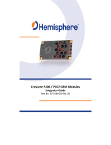
MBX-4 User Guide
i
Table of Contents
1: Introduction . . . . . . . . . . . . . . . . . . . . . . 1
GPS . . . . . . . . . . . . . . . . . . . . . . . . . . . . . . . . . . . .2
How it Works 2
GPS Services 3
Differential GPS . . . . . . . . . . . . . . . . . . . . . . . . . .4
How it Works 4
Real-Time DGPS 4
DGPS Format 5
Radiobeacon DGPS Service 5
Radiobeacon Range 5
Radiobeacon Reception 7
Radiobeacon DGPS 7
Radiobeacon Coverage 8
Factors Affecting Positioning Accuracy . . . . . .10
MBX-4 Beacon Receiver Information . . . . . . . . .13
MGL-4 Combined GPS / Magnetic Field Antenna 14
2: Installation . . . . . . . . . . . . . . . . . . . . . . 15
System Parts List . . . . . . . . . . . . . . . . . . . . . . . .16

ii
Receiver Layout and Connections . . . . . . . . . . .17
Installing the Receiver . . . . . . . . . . . . . . . . . . . .19
Receiver Placement 19
Environmental Considerations 19
Power Considerations 20
Grounding the Receiver 21
Connecting the Receiver To External Devices 21
RS-232 and RS-422 Operation 24
Installing the Antenna . . . . . . . . . . . . . . . . . . . .26
Antenna Placement to Optimize Reception 26
MGL-4 Combined GPS/Beacon Antenna 27
Routing and Securing the Antenna Cable 27
Magnetic Mount 29
Internal Signal Splitter . . . . . . . . . . . . . . . . . . . .30
3: MBX-4 Configuration and Operation . . 33
Front Display and Keypad . . . . . . . . . . . . . . . . .34
Lock Status 35
Factory Default Settings . . . . . . . . . . . . . . . . . . 36
Tune Modes . . . . . . . . . . . . . . . . . . . . . . . . . . . .37
Automatic Beacon Search (ABS) Mode 37
Manual Mode 38
MBX-4 Display Modes . . . . . . . . . . . . . . . . . . . .39

MBX-4 User Guide
iii
BX Mode 39
BX-E Mode 39
MBX-4 Menu System . . . . . . . . . . . . . . . . . . . . .41
Start-Up Sequence 42
Beacon Status 42
Setup 44
Position Status (BX-E Mode Only) 48
Satellites (BX-E Mode Only) 50
Menu System Shortcuts 51
MBX-4 Receiver Performance - SNR Reading . . .53
Operation of MBX-4 with Garmin GPS . . . . . . . 54
Configuring the Receiver . . . . . . . . . . . . . . . . . .55
Change Baud Rate 55
Change Frequency and MSK Rate 55
Select a Beacon By Name 55
Set to Automatic Beacon Search Mode 56
Change Display Mode 56
4: NMEA 0183 Interface . . . . . . . . . . . . . . 59
Interface Protocols . . . . . . . . . . . . . . . . . . . . . . .60
Description of NMEA 0183 60
NMEA Message Elements 61
Hemisphere GPS’ DGPS Command Center 61

iv
MBX-S Supported Messages 62
Response Message 63
NMEA 0183 Commands . . . . . . . . . . . . . . . . . . .64
Standard Commands 64
Proprietary Commands 66
NMEA 0183 Queries . . . . . . . . . . . . . . . . . . . . . .70
Standard Queries 70
Proprietary Queries 71
5: Troubleshooting . . . . . . . . . . . . . . . . . . 73
Troubleshooting . . . . . . . . . . . . . . . . . . . . . . . .74
Appendices . . . . . . . . . . . . . . . . . . . . . . . 77
Appendix A - Specifications . . . . . . . . . . . . . . . .78
Appendix B - Beacon Information . . . . . . . . . . . .82
Further Reading . . . . . . . . . . . . . . . . . . . . . . . . .83


2
1: Introduction
GPS
This chapter provides a brief overview of GPS, differential GPS beacon
technology, and a description of the MBX-4 receiver, antenna, and
mount.
The United States Department of Defense (DoD) operates a reliable, 24
hour a day, all weather Global Positioning System (GPS).
Navstar, the original name given to this geographic positioning and
navigation tool, includes a constellation of 24 satellites (plus active
spares) orbiting the Earth at an altitude of approximately 13,670 miles
(22,000 kilometers).
How it Works
These satellites transmit coded information to GPS users at UHF (1.575
GHz) frequencies that allows user equipment to calculate a range to
each satellite. GPS is essentially a timing system - ranges are calculated
by timing how long it takes for the GPS signal to reach the user’s GPS
antenna.
To calculate a geographic position, the GPS receiver uses a complex
algorithm incorporating satellite coordinates and ranges to each
satellite. Reception of any four or more of these signals allows a GPS
receiver to compute 3D coordinates. Tracking of only three satellites
reduces the position fix to 2D coordinates (horizontal with fixed
vertical).
The GPS receiver calculates its position with respect to the phase center
of the GPS antenna.

MBX-4 User Guide
3
GPS Services
The positioning accuracy offered by GPS varies depending upon the
type of service and equipment available. For security reasons, two GPS
services exist: the Standard Positioning Service (SPS) and the Precise
Positioning Service (PPS). The US Department of Defense (DoD)
reserves the PPS for use by its personnel and authorized partners. The
DoD provides the SPS free of charge, worldwide, to all civilian users.
In order to maintain a strategic advantage, the US DoD has a policy to
artificially degrades the performance of the SPS. Currently the level of
this degradation has been set to zero, however, in years past, this
intentional error limited the positioning accuracy of the SPS to 100
meters 95% of the time. This policy is called Selective Availability (SA).
Without SA, autonomous positioning accuracy is currently about 10 to
15 m 95% of the time.
For many positioning and navigation applications, an accuracy of 10 to
15 meters is insufficient, and differential positioning techniques must be
employed.

4
1: Introduction
Differential GPS
The purpose of differential GPS (DGPS) is to remove the effects of SA (if
present), atmospheric errors, timing errors, and satellite orbit errors,
while enhancing system integrity.
How it Works
DGPS involves setting up a reference GPS receiver at a point of known
coordinates. This receiver makes distance measurements, in real-time,
to each of the GPS satellites. The measured ranges include the errors
present in the system. The base station receiver calculates what the true
range should be without errors, knowing its coordinates and those of
each satellite. The difference between the known and measured range
for each satellite is the range error. This error is the amount that needs
to be removed from each satellite distance measurement in order to
correct for errors present in the system.
Real-Time DGPS
The base station transmits the range error corrections to remote
receivers in real-time. The remote receiver corrects its satellite range
measurements using these differential corrections, yielding a much
more accurate position. This is the predominant DGPS strategy used for
a majority of real-time applications. Positioning using corrections
generated by DGPS radiobeacons will provide a horizontal accuracy of 1
to 5 meters with a 95% confidence. More sophisticated, short-range
DGPS systems (10 to 15 km) can achieve centimeter-level accuracy, but
are very expensive and often limited to precise survey applications due
to technical constraints on their use.

MBX-4 User Guide
5
DGPS Format
For manufacturers of GPS equipment, commonality is essential to
maximize the utility and compatibility of a product. The governing
standard associated with GPS is the Interface Control Document,
ICD-GPS-200, maintained by the US DoD. This document provides the
message and signal structure information required to access GPS.
Like GPS, DGPS data and broadcast standards exist to ensure
compatibility between DGPS networks, and associated hardware and
software. The Radio Technical Commission for Maritime Services
Special Committee 104 has developed the primary DGPS standard
associated with radiobeacon DGPS, designated RTCM SC-104 V2.2.
Various broadcast standards may exist for the beacon networks
installed internationally, controlled by their respective operating
authority. The United States Coast Guard maintains a broadcast
standard that is referenced in the Further Reading section of this
manual.
Radiobeacon Range
The broadcasting range of a 300 kHz beacon is dependent upon a
number of factors including transmission power, free space loss,
ionospheric state, surface conductivity, ambient noise, and atmospheric
losses.
The strength of a signal decreases with distance from the transmitting
station, due in large part to spreading loss. This loss is a result of the
signal’s power being distributed over an increasing surface area as the
signal radiates away from the transmitting antenna.
The expected range of a broadcast also depends upon the conductivity
of the surface over which it travels. A signal will propagate further over
a surface with high conductivity than over a surface with low
conductivity. Lower conductivity surfaces such as dry, infertile soil,

6
1: Introduction
absorb the power of the transmission more than higher conductivity
surfaces, such as sea water or arable land.
A radiobeacon transmission has three components: a direct line of sight
wave, a ground wave, and a sky wave. The line of sight wave is not
significant beyond visual range of the transmitting tower, and does not
have a substantial impact upon signal reception.
The ground wave portion of the signal propagates along the surface of
the earth, losing strength due to spreading loss, atmospheric refraction
and diffraction, and attenuation by the surface over which it travels
(dependent upon conductivity).
The portion of the beacon signal broadcast skywards is known as the
sky wave. Depending on its reflectance, the sky wave may bounce off
the ionosphere and back to Earth causing reception of the ground wave
to fade. Fading occurs when the ground and sky waves interfere with
each other. The effect of fading is that reception may fade in and out.
However, this problem usually occurs in the evening when the
ionosphere becomes more reflective and usually on the edge of
coverage areas. Fading is not usually an issue with overlapping
coverage areas of beacons and their large overall range.
Atmospheric attenuation plays a minor part in signal transmission
range, as it absorbs and scatters the signal. This type of loss is the least
significant of those described.

MBX-4 User Guide
7
Radiobeacon Reception
Various sources of noise affect beacon reception, and include:
• Engine noise
• Alternator noise
• Noise from Power lines
• DC to AC inverting equipment
• Electric devices such as CRT’s electric motors, and solenoids
Noise generated by this type of equipment can mask the beacon signal,
reducing or impairing reception. The “Antenna Placement to Optimize
Reception” section on page 24 presents an effective procedure to
minimize impact of local noise on beacon reception when using this
correction service.
Radiobeacon DGPS
Radiobeacons conforming to the standards of the International
Association of Lighthouse Authorities broadcast a limited selection of
RTCM SC-104 messages, including message types 1, 2, 3, 5, 6, 7, 9, and
16.
• A DGPS beacon will broadcast either Type 1 or Type 9
messages, both of which contain similar information. These
two messages contain pseudorange corrections and range rate
corrections to each GPS satellite.
• The Type 2 message contains delta differential corrections that
are used when the remote receiver is using a different satellite
navigation message than used by the base station.
• The Type 3 message contains the position of the beacon’s
reference station, often accurate to within centimeters with
respect to the WGS-84 reference datum.

8
1: Introduction
• The Type 5 message contains GPS constellation health
information used for improving tracking performance of a GPS
receiver
• The Type 6 message contains null information, and is
broadcast so that a beacon receiver demodulating the data
from the broadcast does not lose lock when the beacon station
has no new data to transmit.
• The Type 7 message contains the radiobeacon almanac
information composed of location, frequency, service range,
and health information of sister stations for the currently tuned
beacon.
• The Type 16 message provides users with a 90 character text
string that may contain information regarding the status of the
system, weather warnings, etc.
Radiobeacon DGPS is often referred to as a local-area service, as the
data broadcast is appropriate for use within the coverage range of the
station, and is calculated by a single, local GPS reference station.
Radiobeacon Coverage
Figure 1-1 on page 9 shows the approximate radiobeacon coverage
throughout the world. In this figure, light shaded regions note current
coverage, with beacon stations symbolized as white circles.
The world beacon networks continue to expand. For current coverage,
consult the Hemisphere GPS web site at www.hemispheregps.com.


10
1: Introduction
Factors Affecting Positioning Accuracy
Many factors affect the positioning accuracy that a user may expect
from a DGPS system. The most significant of these influences include:
• Proximity of the remote user to the reference station
• Age of the received differential corrections
• Atmospheric conditions at the beacon and remote user
locations
• Satellite geometry, often expressed as a Dilution of Precision
(DOP)
• Magnitude of multipath present at the remote station
• Quality of the GPS receiver being used at both the reference
and remote stations.
The distance between a remote user and the reference station is often
considerable when using 300 kHz DGPS radiobeacons. Broadcast
ranges may be as great as 450 km (280 miles) or more, depending
primarily upon transmission power and surface conductivity.
Consequently, some of the errors associated with GPS at the base
station differ somewhat from those at the remote user’s location. This
spatial decorrelation of errors can result in a relative position offset
from the absolute coordinates of the remote receiver. This offset may
be as much as one meter for every 100 km (62 miles) between the base
station and remote receiver.

MBX-4 User Guide
11
The latency of differential corrections also affects the achievable
positioning accuracy at the remote receiver. Latency is a function of the
following:
• The time it takes the base station to calculate corrections
• The data rate of the radio link
• The time it takes the signal to reach the user
• The time required for the remote differential receiver to
demodulate the signal and communicate it to the GPS receiver.
• Any data loss that occurs through reception problems
Most of these delays require less than a second, though in some
instances, depending upon the amount of information being
transferred, overall delays of three to five seconds may occur. In the
past when SA was “on,” latency was a concern if lock on the differential
signal was lost for ten seconds or more. Without the effects of SA, the
age of the differential corrections is not as significant, but care should
be taken to ensure that their age is kept below a couple minutes by
ensuring consistent beacon receiver lock.
To account for latency, a GPS receiver can calculate approximate
corrections until new corrections are available. Calculating the
differential correction for a new epoch, using old corrections, leads to
inaccuracy that grows with time. Accuracy is restored when new
corrections become available.
Although ionospheric errors are normally removed through differential
positioning, the state of the ionosphere can differ between the base
station and remote user over large distances. As the base station
calculates corrections based on local ionospheric conditions, they may
not completely account for the errors observed at the remote user’s
location. This causes part of the spatial decorrelation that may be
observed over large distances between base station and remote
receivers
/