Page is loading ...

T
rackport 4.0 GPS Vehicle Tracker
User’s Guide

What’s In The Box

1. O (yellow) - Cellular
Indicator
2. C (blue) - Unused
3. G (green) - GPS Indicator
1 32

LEDS
This device features 3 LEDs.
• The Green LED represents GPS connectivity
• The Blue LED is unused
• The Yellow LED represents cellular
connectivity
First-Time Setup: When plugging in the TrackPort 4.0 into the OBD-II port
of your car, the Green light will glow solid for about 1 minute. The Yellow
light will then light up and blink every 3 seconds. After that, the Green light
will begin to blink every second.
GPS Indicator - Green Light: The Green light will blink until a GPS
connection is made. When a connection is made to GPS satellites, the
Green light will be solid, indicating a proper connection.

Cellular Indicator - Yellow Light: When the TrackPort 4.0 is looking for a
cellular signal, the Yellow LED will blink once every second. When a
connection is made through the cellular network, the Yellow LED will
remain solid.
Blue Light: It will flash when powering on the unit, but this indicator has
no function.

Getting Started
To activate your tracker, please call our customer service center or
visit activate.brickhousesecurity.com to complete your device
activation.
The TrackPort 4.0 installs to your vehicle’s OBD-II port, which are
normally located under the dashboard on the driver’s side of a car.
Consult your vehicle’s owners’ manual if you are not sure where the
OBD-II port is located in your car. Once securely plugged in, the
device will begin to attempt to report once it has registered on the
network.
NOTE: This device attempts to connect to the cellular network every
6 hours for better performance. While it will not provide a GPS
location, it does still use your vehicle’s power even if the ignition is
currently off. If you plan on leaving the TrackPort 4.0 plugged into a
vehicle for long periods of inactivity, it could drain your battery.

Navigation Arrows
Zoom Bar Dashboard Last Known Location

Your Trackport 4.0 will always give the most accurate location data when it
has a clear view of the sky. It is capable of transmitting and receiving
through materials like glass, plastic, and cloth, but is not able to transmit
through metals. This interference can vary from vehicle to vehicle,
however, as all automobiles are constructed differently.
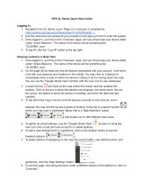
Tracking Your Device
To track your Trackport 4.0, open a browser window and go to
www.BrickhouseSecurity.com. Hover your cursor over the Login tab on the
top right of the website and click on GPS Tracking. Enter your login
information and press the Submit button. The tracking page will appear and
the device’s last reported location will be centered on the map. If you have
multiple devices on your account, the first 3 that were registered will be
automatically selected and appear on the map. Along the bottom of your
screen will be your dashboard.
Tracking information is displayed using Google Earth Maps, so navigation is
similar to what most people have grown used to in using internet-based
mapping solutions. You can use the Navigation arrows and Zoom Bar to move
around the map, or drag the map using your mouse and zoom using a click-
wheel mouse.


At the bottom of the pop-up window are the Zoom, Street View, and
Live Tracker buttons.
• Zoom will perform the same task as using the Zoom bar on the left side
of the map; zooming in on the icon you have selected.
• Street
View will open up a separate window displaying Google’s Street
View, if available.
The BrickHouse shield icon will appear where a tracker transmitted most
recently. Click on an icon to bring up a pop-up box. This will show your
tracker’s name, the distance it has traveled on this trip, what direction it was
moving in, speed, battery information, and start and stop locations. Start will
display the beginning location of the current trip, and the time it was
recorded. Stop will display the most recent location from the device, as well
as the time it was reported.
The More tab is not currently active. Future updates to the platform will
utilize this tab.
The GeoFence tab allows you to create quick geofences based on the
location you are currently viewing and the route the device was following.
Use

the Circular GeoFence selection to create a perimeter around the location
you are clicked on. Use the Circular Geofence radio button to create a
perimeter around the location you have selected. Use the Route Geofence
radio button to create a boundary that will follow your device’s entire trip.
Give the Geofence a name in the Geofence Name window, and add a short
description in the Description box (optional).
Use the Action drop down box to choose if you would like an alert created
when the device enters the chosen area, exits the area, or both. Use the
Radius box to choose how large the area will be. You can enter values
below a mile as decimals. For example: A half-mile radius geofence would
be entered as .5.
When you are done, press the Create Geofence button to save.
The Video Links tab is not currently active. Future updates will take
advantage of this tab.
The Alerts tab will display current Geofence, Speed, Panic, or Motion alerts
that have been triggered.


Live Tracker will open up a separate window displaying your devices’
locations, and allows you to see past locations. Using the drop-down
boxes on the bottom right of the window, you can adjust how often your
screen refreshes and how many locations will appear on the screen. The
counter on the bottom left displays how long it will be until your screen
refreshes.
Us
ing the Dashboard
The Calendar allows a user to choose from which dates information can
display. Any date that has tracking information will be highlighted. Simply
click on that date to display information. To choose multiple days, click on
the Date Range button, input a start and end date, and press Search.
Press the

Current Date button to return to viewing the current day’s information.
When searching by date, all locations generated in the chosen time-
frame will dis-play as breadcrumbs.
Under the Display section you can see a list of all devices currently
displaying information on the map. Click on the View/Change Device
button to choose which of your devices will display on the map. This button
only serves a purpose if there are multiple devices on your account.
Breadcrumb Trail will display all locations, or breadcrumbs, generated on
the date you currently have displayed, connected by a line. Click on any
individual breadcrumb to see detailed information. The BrickHouse shield
icon represents the start and stop of a trip, green circles mean the device
was moving with the arrow indicating direction, and red octagons indicate
stops.

Click on the Street View button to open a Google Street View window
from the most recent location of the device. This function will only work if
Google Street View is available in that location. (Please note: Google Street
View is a not a current live view.)
The Alerts section lets you manage what kinds of alerts your device will
create and how you will be notified.
Click the Geofence button to manage your geofences. The Geofence Alert
Configuration tab lets you choose when and where alerts will be sent.
Select the device you would like to edit by checking the box next to it.
• Highlight which days you would like to configure by clicking on each.
You may choose to enter certain hours during which alerts will be
active, or leave these fields blank to have them sent all the time.
• Choose if duplicate alerts will not be created if the device stays inside
or outside a geofence for a certain period of time using the slider bar.
• Choose what icon will appear where a geofence alert was created
using the Alert Image dropdown box.
• Enter Email Address allows you to choose where alert notifications will
be sent. Click on the + icon to add phone numbers you want to have
texted.

In the Create New Geofence tab you can create geofences around any
area in different shapes. Navigate to the area on the map where you would
like to create a geofence. Click on the Circle, Polygon, or Route button. It is
suggested that all geofences be in at least a .2 mile radius, or at least 1 city
block around an area to allow for GPS drift.
To create a circular geofence around an area, click on Circle and then click
on the spot on the map you want to create your geofence around. Hold
down the left mouse button and drag the cursor until your geofence is the
size you want, then release the mouse button.
The Polygon button allows you to create geofences in different shapes.
Each point you click on will be a corner of your perimeter.
A Route geofence will be straight lines. You must choose how far a device
will need to be away from the route before a report is generated.
Once you have created a geofence, assign it a name in the Geofence field
and hit Save. You may also choose to enter a short description for your
geofence.

The Assign Geofence tab allows you to activate and deactivate geofences.
Select a device from the dropdown menu to see what geofences are
currently active. Click on an Assigned Geofence to view and edit its
configuration. Click the Remove link to deactivate a geofence. Hit Save
once you have finished making changes.
Click on the check box for any available geofence to edit its configuration
and press the Save button to implement it.
The View Geofence tab allows you to view your geofences.
Click the Speed button on the dashboard to set up speed alerts. Simply
select your device and enter a speed which, when exceeded, will generate
an alert. Choose the days and times you would like the alert to be active,
select if you would like duplicate alerts to be ignored, and enter an email
address where you wish to receive your notifications. If you would prefer to
receive alert notifications via text message, click on the + button and enter
your phone information. Hit Save once you have finished configuring your
alerts.

The TrackPort 4.0 does not take advantage of the BrickHouse Tracking
platform’s Panic alert function.
The Power Alert button is used for GPS devices with a battery. This device
is hardwired and runs on your vehicle’s power, so disregard this button.
You can run four different types of reports, listed below. To run one, select a
report type, choose the device on which you would like to run a report from
the dropdown box, choose the dates you would like to run your report on in
the upper right corner, and press the magnifying glass search icon. You can
export any generated reports to Microsoft Excel by clicking on the export
button in the upper right corner of the window.
Start/Stop reports will list trips between stopping points, with starting and
ending locations, as well as speed information, trip duration, stop time, and
the distance traveled.
The Alert History button will show you all alerts generated during the
specified time and where they occurred.

The Full History button includes individual locate information such as:
location, time of transmission, battery life, speed, and distance from its
previous locate.
The Frequent Visits button will create a list of addresses that the device has
reported from and show how many times the device reported from that spot.
Changing Your Password
To change your password, click on the account name, which should appear
in the upper right corner of the browser window. Once complete, click on
Quick View to return to your tracking page.
Support
To access FAQs, as well as other support materials for your device, visit
help.brickhousesecurity.com

Live support is available.
Monday - Friday: 9 am and 8 pm ET
Saturday - Sunday: 9 am and 6 pm ET
at 1-800-654-7966
Or, e-mail: [email protected]
If you are having trouble with your device, please have access to it
before calling the support team. We will need to refer to the indicator
lights to provide support.
/