Apollo SL50 User manual

Category
Navigators
Type
User manual

This manual is also suitable for

© 2003 Garmin Ltd. or its subsidiaries. All rights reserved. Printed in the U.S.A.
Garmin International, Inc., 1200 East 151st Street, Olathe Kansas 66062, U.S.A.
Tel: 913/397.8200 Fax: 913/397.8282
Garmin (Europe) Ltd., Unit 5, The Quadrangle, Abbey Park Industrial Estate,
Romsey, Hampshire S051 9DL, U.K.
Tel: 44/1794.519944 Fax: 44/1794.519222
Garmin Corporation, No. 68, Jangshu 2nd Road, Shijr, Taipei County, Taiwan
Tel: 886/02.2642.9199 Fax: 886/02.2642.9099
Garmin AT, Inc., 2345 Turner Road, S.E., Salem, OR 97302, U.S.A.
Tel: 800/525.6726 Fax: 503/364.2138
Canada Tel: 800/654.3415
International Tel: 503/391.3411
Visit our web pages at http://www.garminat.com and http://www.garmin.com
Send comments about this manual by email to: [email protected]
Except as expressly provided herein, no part of this manual may be reproduced,
copied, transmitted, disseminated, downloaded or stored in any storage medium, for
any purpose without the express written permission of Garmin. Garmin hereby grants
permission to download a single copy of this manual and of any revision to this
manual onto a hard drive or other electronic storage medium to be viewed for
personal use, provided that such electronic or printed copy of this manual or revision
must contain the complete text of this copyright notice and provided further that any
unauthorized commercial distribution of this manual or any revision hereto is strictly
prohibited.
Information in this document is subject to change without notice. Garmin reserves the
right to change or improve their products and to make changes in the content of this
material without obligation to notify any person or organization of such changes or
improvements.
Garmin®, Garmin AT™, II Morrow, Apollo, and GNS are trademarks of Garmin Ltd.
or its subsidiaries. These trademarks may not be used without the express
permission of Garmin.
Welcome ...
Welcome to a new era of aviation navigation
communication. Once again, Garmin AT, Inc. has
set new standards in features and ease of use for the
general aviation public. The Apollo SL50 and SL60
are unequaled in providing the features, level of
performance, and reliability that aviation users
require. The Apollo slim line series of avionics sets
a precedent that will be the standard that all other
avionics will be compared to. The Apollo SL50 is a
full-featured slim line GPS receiver. The Apollo
SL60 combines the capabilities of our outstanding
GPS receiver with a state-of-the-art VHF
communications transceiver in the same small
package. You can be confident in knowing that you
are the owner of the state-of-the-art in aviation
navigation and communication. Our products are
built to last and to satisfy your navigation needs.
i
Welcome ...
History of Revisions
March 1997 Original Release
April 1997 Rev -01
September 1998 Rev -01a -Comm changes
February 2002 Rev-01b - User Comm Controls
September 2003 Rev 01c - Company name
change
Ordering Information
To receive additional copies of the Apollo SL50/60
manuals order the following part numbers:
User’s Guide 560-0955-xx
User’s Guide Binder (3/4”) 560-9002-xx
Installation Manual 560-0957-xx
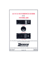
SL50 Quick Reference 561-0235-xx
SL60 Quick Reference 561-0239-xx
ii
History of Revisions
Important Notice
The Global Positioning System (GPS) is operated by the United States Department of Defense which is solely
responsible for the accuracy, daily operation, and maintenance of the satellite constellation. System accuracy
is affected by the Department of Defense’s Selective Availability (SA) and the Dilution of Precision (DOP)
attributed to poor satellite geometry.
Due to implementation of Selective Availability by the United States Department of Defense (DoD), all GPS
receivers may suffer degradation of position accuracy. The DoD has stated that 95% of the time horizontal
accuracy will not be degraded more than 100 m and 99.9% of the time accuracy will not be degraded more
than 300 m.
Installations of TSO C-129 authorized Apollo SL50/60’s may be approved for supplemental navigation only.
The Apollo SL50/60 may be used as the primary navigation data display, however, other means of navigation
appropriate to the intended route of flight must be installed and operational. It is not required that these other
systems be monitored.
FCC Notice
This equipment has been tested and found to comply with the limits for a Class B digital device, pursuant to
part 15 of the FCC Rules. These limits are designed to provide reasonable protection against harmful
interference during residential use. Operation is subject to the following two conditions: (1) this device may not
cause harmful interference, and (2) this device must accept any interference received, including interference
that may cause undesired operation. This equipment generates, uses and can radiate radio frequency energy
and, if not installed and used in accordance with the instructions, may cause harmful interference to radio
communications. However, there is no guarantee that interference will not occur in a particular installation. If
this equipment does cause harmful interference to radio or television reception, which can be determined by
turning the equipment off and on, the user is encouraged to try to correct the interference by one or more of
the following measures:
Reorient or relocate the receiving antenna.
Increase the separation between the equipment and receiver.
Connect the equipment into an outlet on a circuit different from the one the receiver is connected.
Consult the dealer or an experienced radio/TV technician for help.
Changes or modifications to this equipment not expressly approved by Garmin AT, Inc. could void the user’s
authority to operate this equipment.
DOC Notice
This digital apparatus does not exceed the Class B limits for radio noise emissions from digital apparatus as
set out in the radio interference regulations of the Canadian Department of Communications.
TABLE OF CONTENTS
Welcome ... .........................................i
History of Revisions..................................ii
Ordering Information ................................ii
Introduction ........................................1
SL50 ............................................1
SL60 ............................................2
Display ..........................................3
Annunciators .....................................3
Relative Bearing Indicator ................3
Controls .........................................4
Keys ............................................4
Apollo SL50/60 Features ..............................6
Getting Started the First Time .........................9
Power Up ........................................9
Seed Position .....................................9
Entering a Seed Position............................10
Change Reference Waypoint ..............10
Change Lat/Lon Reference Position ..........11
Checking GPS Signal Strength.......................13
Entering a Destination Waypoint .....................14
Using the Nearest Waypoint Function .........14
Using the Direct-To Function ..............15
Navigation Basics...................................17
About the Navigation Function ......................17
About the Navigation Function Displays ...............17
Nav Home Page ..................................17
Autonav ........................................18
Nav Pages .......................................19
Nav Display Choices ..................19
iii
Emergency Search ................................25
Starting Emergency Search ...............25
Searching Around a Reference Waypoint........26
Setting Runway Limits .................27
Special Use Airspace ..............................28
Parallel Track Offset ..............................29
GPS Position.....................................30
Countdown Timer.................................30
From/To/Next Waypoint ...........................32
Creating From/To/Next Waypoints ...........32
Placing the To Waypoint on Hold............35
Using Direct-To ..................................36
Direct-To OBS ...................................36
Waypoint Functions ................................37
Waypoint Information .............................37
Available Waypoint Information .....................37
ARPT Waypoint Information ..............37
Getting Information about a Waypoint ................39
Database Update..................................40
Nearest (Emergency Search) Waypoint ................41
Starting Emergency Search ...............41
Create User Waypoint by Lat/Lon ....................42
Create User Waypoint by Radial/Distance..............44
Delete User Waypoint .............................45
Modify User Waypoint.............................46
Waypoint Comments ..............................46
Flight Plan Functions ...............................47
Flight Plan Pages .................................47
Reaching the Flight Plan Function ...........47
Active Flight Plan ....................48
iv
Creating a Flight Plan..............................48
Flight Plan Leg Information .........................50
Manual Leg Activation.............................53
Flight Plan Editing ................................53
Changing Existing Flight Plan Legs ..........54
Inserting a New Waypoint ...............54
Deleting a Waypoint ..................55
Flight Plan Options................................56
Activate .........................56
Rev Activate.......................56
Reactivate ........................56
Rename .........................56
Copy Plan ........................57
Estimate Ground Speed .................57
Clear Waypoints.....................57
Reverse Flight Plan ...................57
Estimated Fuel Flow ..................57
Delete Plan .......................58
Hold ...........................58
Continue .........................59
Destination Waypoint Information....................59
Flight Plan Comments .............................59
Copying the Active Flight Plan ......................60
System Functions ...................................61
Flight Plans......................................61
Waypoint Database................................61
Com Radio Information (SL60 Only) .................62
RF Signal Strength ...................62
Com Noise Level ....................63
Mic 1 and Mic 2 Squelch Level Adjustment ......63
v
Transmit Using .....................63
Intercom Level .....................64
Sidetone Level Adjustment ...............64
Headphone Level ....................65
Navigation Information ............................65
Airspace Setup .....................65
Airspace Buffers.....................66
Airspace Selections ...................66
Autonav Time ......................67
Navigation Mode Programmable Pages and Autonav Pages
..............................68
Creating a New Custom Nav Page ...........70
Setting Units.......................71
Magnetic Variation ...................72
Flight Timer Trigger ..................73
Direct-To Entry Options ................73
CDI Scaling .......................75
System Information ...............................76
Date and Time ......................76
Software Version ....................77
Fuel Measure Units ...................78
Test Display .......................78
Owner Information ...................78
GPS Sensor......................................80
Satellite Search Status ..................81
GPS Date and Time Page ................81
GPS Normal Reset Page.................81
Comm Radio Operation .............................83
Power On/Off ....................................83
Volume .........................................83
vi
Small and Large Knobs .................83
Selecting Frequencies ..............................83
Frequency Monitoring .............................84
Recalling a Frequency .............................85
TO, FROM, and INFO Frequency Database ......85
Auto Stored Frequencies (Auto) ............87
User Stored Frequencies ................88
Weather Channels ....................89
Emergency Channel ...................89
Intercom Function ................................90
Introduction to GPS Navigation.......................91
GPS Overview ...................................91
GPS System Accuracy .............................92
Summary .......................................92
Start Up Displays ...................................93
Owner Message ..................................93
Memory Tests....................................93
Software Memory Test .................94
Non-Volatile RAM Tests ................94
User Database Memory Failure .............94
Miscellaneous NVRAM Memory Failure........95
Database Test ......................95
Special Use Airspace Displays.......................96
Database Message ................................96
IFR Output Tests .................................96
Message Function ..................................97
New Messages ...................................98
Old Messages ....................................98
Messages .......................................98
Special Use Airspace Messages .............98
vii
Soon ...........................98
Close...........................99
Inside ..........................99
Empty To Waypoint: Cannot Compute Nav ......99
GPS Communications Failure..............99
GPS Command Failure .................99
GPS Self Test Failure .................100
GPS Sensor Lat/Lon Failure ..............100
GPS RAIM Not Available ...............100
GPS RAIM Position Error ...............100
GPS HDOP Position Error ...............100
Arrival At the To Waypoint ..............101
Holding at the To Waypoint ..............101
To Waypoint Sequence ................101
Auto OBS Crossing Holding Waypoint ........101
User Database Memory Loss .............102
Comm Radio Failure (SL60 only) ...........102
Flight Plan Memory Loss ...............103
User Memory Failure .................103
Database Expired ...................103
Database Invalid ....................103
Manual Magnetic Variation ..............103
Low Internal Battery Voltage .............104
High Battery Voltage .................104
Countdown Timer Expired...............104
Flight Simulator...................................105
Troubleshooting ...................................109
Contacting the Factory ............................109
Glossary of Navigation Terms .......................111
viii
Introduction
This guide describes the operation of the Apollo
SL50 GPS Receiver and the Apollo SL60 GPS
Receiver and VHF Communication Transceiver.
SL50 The Apollo SL50 is a high performance GPS
receiver with a high intensity LED display packed
into a 1.3 inch high by 6.25 inch wide package that
conserves panel space. The SL50 uses the same
8-channel GPS engine that is used in Garmin AT’s
high end TSO C129 terminal and enroute certified
products. The 32 character alphanumeric LED
display uses an automatic intensity control to keep
it easily readable in all conditions from direct
sunlight to the dark of night.
The Apollo SL50 has a wealth of easy to use
features that every pilot needs. The large waypoint
database has information about airports, VORs,
NDBs, intersections, and special use airspaces that
makes the Apollo SL50 an encyclopedia of
aviation. The database can be updated by
connecting the SL50 serial port to a computer with
Garmin AT’s innovative Waypoint Manager
software. The database can also include 200 custom
1
Introduction
Power
Photocell
Nearest
Waypoint
Navigation
Mode
Direct To
Message
Mode
System
Mode
GPS
OFF/ON
Ete SLE 00:22 Brg 082 74 nm
POLLO
A
SL50
SEL
INFO ENT
D
Information
Display
Large, Outer
Knob
Small, Inner
Knob
Waypoint
Mode
Info
Mode
Select
Enter
WPT SYSNAV MSGNRST
Message
Annunciator
Apollo SL50 Front Panel Description
waypoints created by the user. Ten flight plans can
be saved with up to twenty legs for setting up
custom tailored routes. The detailed Navigation
information displays are also customizable and can
be set to automatically scroll through the desired
information. The Emergency Search feature,
invented by Garmin AT, when used with the
Direct-To feature makes it easy to quickly select an
airport as a new destination whether because of a
change in plans, or to react to an emergency.
SL60 The Apollo SL60 combines all of the features of the
SL50 with a state-of-the-art VHF communications
transceiver in the same compact package. The VHF
comm radio covers all 760 channels with 8+ watts
(10 W typical for most frequencies) without any
external cooling devices required. A built-in
intercom capability works either with or replaces an
audio panel. The features and packaging of the
SL60 keeps your power requirements and
installation costs low. You can easily switch
between active and standby frequencies, select a
weather channel, activate the emergency channel, or
choose from one of ten customized frequencies or
one of the last ten used.
2
Introduction
Apollo SL60 Front Panel Description
Display The display is a 1-line by 32-character 5x7 dot
matrix alphanumeric display. A photocell is located
in the top left corner of the front panel display. The
photocell automatically controls the light intensity
of the display LEDs from low brightness at night to
high brightness during daylight operation.
Annunciators Several annunciators are used to help indicate the
operating modes of your SL60. The TX (Transmit)
annunciator is lighted whenever you are
transmitting. If the avionics bus drops below 9
VDC, the SL60 will not transmit. An LED will be
lighted above the WPT/COM, NAV, SYS, or MSG
keys when they are pressed. An “s” normally
appears to the left of the Standby frequency. An
“m” will appear to the left of the Standby frequency
when you are using the Monitor function.
TX - Transmit (SL60)
s - Standby Frequency (SL60)
m - Monitor Mode (SL60)
Relative Bearing Indicator
The Relative Bearing Indicator indicates an
approximate bearing to a waypoint or airspace
relative to the aircraft’s current Track when your
current ground speed is more than 5 knots. The
following illustration describes the bearing range
for each arrow.
MNOPQR\T
23º to
67º
68º to
112º
113º
to
157º
158º
to
202º
203º
to
247º
248º
to
292º
293º
to
337º
338º
to
22º
3
Introduction
Controls Power/Volume/Squelch Knob(SL60)
The knob on the left side of the SL60 controls power
on/off, volume, and squelch test. Rotate the knob
clockwise (CW) past the detent to turn the power on.
Continue rotating the knob to the right to increase
speaker and headphone amplifier volume level.
Rotate the knob to the left to reduce the volume
level. Pull the knob out to disable automatic squelch.
Power Knob (SL50)
The knob on the left side of the SL50 controls
power on/off. Rotate the knob clockwise (CW) past
the detent to turn the power on. Rotate the knob
fully counterclockwise to turn the power off.
Small and Large Knobs
The dual concentric knobs on the right side of the
front panel are used to select pages, edit characters
and values, or other options.
Keys Nine backlighted keys allow you access the
functions in your Apollo SL50/60.
Flip/Flop (Arrows) - SL60
Press the Flip/Flop key to switch between the
active (left-most) and standby (right-most)
frequency while in the Nav or Com functions. You
may use an optional external Flip/Flop key for the
same operation as the front panel control. Switching
between frequencies is disabled while you are
transmitting or editing in any function.
NRST (Nearest Waypoint) - SL50
The Nearest Waypoint (Emergency) mode displays
the closest waypoints to your position.
COM (Communications Radio Mode) - SL60
Press the COM key to operate the Communications
radio functions.
4
Introduction
COM
NRST
WPT (Waypoint) - SL50
The Waypoint key allows access to the waypoint
database. (SL60 accesses the database from within
the System function - see page 39.)
NAV (Navigation)
Press the NAV key to reach the navigation
functions.
SYS (System Mode)
Press the SYS key to reach the System mode
functions. System mode is used to make system
level adjustments, setup flight plans, access the
database, and modify Nav function displays.
MSG (Message)
Press the MSG key to reach the Message functions.
The MSG annunciator will flash when a new
message is provided. In the SL60, pressing MSG
twice will start the Nearest Waypoint mode just as
pressing NRST will on the SL50.
DIRECT-TO
The DIRECT-TO key is used to define a direct
course from your present position to a waypoint.
INFO (Information)
The Info function accesses supplementary
information about a waypoint.
SEL (Select)
The SELECT key activates editing or the selection
of options. Editing is active on the items that flash
on the display.
In the SL60 when the COM function is active,
pressing the SEL key will recall stored frequencies.
ENT (Enter)
The ENT key enters and saves the information
flashing on the display. If the ENT key is not
pressed after editing, any changes made are not
saved.
In the SL60 when the COM function is active,
pressing the ENT key will save the standby
frequency into the Auto Stack list.
5
Introduction
SEL
ENT
INFO
D
NAV
SYS
MSG
WPT
Apollo SL50/60 Features
SL50/60 GPS Navigation Features
10 Reversible Flight Plans with 20 Legs
Automatic Waypoint Sequencing
200 User-Defined Waypoints
Nav Displays
Lat/Lon
Bearing and Distance
Ground Speed and Track Angle
Desired Track and Distance
Internal CDI Display
32-Character High-Intensity Alphanumeric LED Display
Automatic Display Intensity Control
User-Selectable Nav Displays
User-Defineable Distance and Speed Settings:
nm, km (distance)
knots, kph (speed)
Clock and Countdown Timer
Auto/Manual Magnetic Variation Settings
Direct-To Nav Function
Parallel Track
Nearest Waypoint Search
Internal Database of Airports, VORs, NDBs, Intersections,
Frequencies, and Airport Info
Update the database through the serial port
SL50/60 GPS Receiver Performance Specifications
8-Channel Parallel GPS Receiver
Certified TSO C129 Class A2 for En Route and Terminal
Operation
6
Apollo SL50/60 Features
SL60 Comm Radio Features
760 Communication Channels
Frequency Range: 118 to 136.975 MHz
Weather Channels: Receive only
Active and Standby Flip/Flop Frequencies
Volume Control
32-Character High-Intensity Alphanumeric LED Display
Transmit Status Indicator
Backlit Keypad Controls
Automatic Display Intensity Control
2x10 Frequency Memory and Recall
Stores/Recalls Ten User-Defined Frequencies
Stores/Recalls Previous Ten Frequencies
Frequency Monitor Function (listens to standby while
monitoring the active)
Squelch Test Function
Stuck Mic Time-Out - 35 seconds
SL60 Comm Radio Performance
Transmit Power: 8 watts Carrier Power (35 watts Input Power)
Input Voltage Range: 10 to 40 VDC
Operating Temperature Range: -20° to +55° C
Certified TSO C37d (transmitting)
Certified TSO C38d (receiving)
Certified TSO C128 (microphone)
Physical Specifications
Height: 1.3 inches
Width: 6.25 inches
Depth: 11.45 inches
Weight:
SL50: 2.3 pounds
SL60: 2.8 pounds
Interfaces
External:
CDI Left/Right
TO/FROM Flag
Nav Valid Flag
Nav Superflag
Three External Annunciators
RS-232 Bi-Directional Serial Ports
Optional External:
Flip/Flop Switch
OBS/Hold
7
Apollo SL50/60 Features
Notes
8
Apollo SL50/60 Features
Getting Started the First Time
This section explains how to get started using your
Apollo SL50/60. Information in this section
explains how to startup the unit, check signals from
the GPS satellites, enter a seed position, and GOTO
a destination waypoint.
It is necessary to enter a seed position and the
current time the first time you turn the unit on.
Power on
Enter a seed position (your dealer may have already
completed this step for you), if necessary
Enter the current time
Check satellite signal strength
Enter a “GOTO” waypoint
Begin navigating
Power Up Turn the Power knob clockwise to switch the unit
on. The startup screen, testing, position, and
database information shows on the display for
several seconds and then will go into the Navigation
function.
Seed
Position
Each time the Apollo SL50/60 is switched on, it must
locate satellites in the sky to acquire signals before
determining a position fix in a complex process
involving lengthy mathematical operations. Without a
seed position and the current UTC time and date, this
process can take 10 minutes or more to complete.
Enter a Seed Position to allow the receiver to quickly
locate and track available satellites.
Note
The seed position and current time only
need to be entered the first time the receiver
is switched on. This information is stored in
memory and need not be entered again. If
you move about three hundred miles
without the Apollo SL50/60 turned on and
tracking its position, reenter the seed
position.
9
Getting Started the First Time
Entering a
Seed
Position
After the start up tests, you will always have the
choice of entering a Seed Position. The Seed
Position is a starting reference point so the GPS
receiver knows what satellites it is looking for. If a
Seed Position has been previously entered, you do
not need to select a new Present Position or a
Reference Waypoint. If you do not make any
selections, the Apollo SL50/60 will automatically
progress into the Navigation function.
1. The previous Seed Position will display with the
choice of SEL/ENT for a few seconds. If you don’t
do anything, the Apollo SL50/60 will continue
normally. You can also press ENT to accept the
current position, though this is not required.
0.3nm 2770 To SLE SEL/ENT
2. Press SEL to change the Seed Position.
3. The current Reference Position will be displayed
and the Chg? prompt will flash.
44054.46N 122059.69W Ref: Chg?
Press ENT to change the Reference Waypoint or
turn the Large knob to change to Lat/Lon
Reference Position. Use the appropriate following
description: Change Reference Waypoint or Change
Lat/Lon Reference Position.
Change Reference Waypoint
1. After pressing ENT, the first character of the
Reference Waypoint name will flash. You can
change the waypoint type by turning the Large
knob ccw one click and the turning the Small
knob.
aPDX c PORTLAND OR USA
10
Getting Started the First Time
SEL
ENT
ENT
  • Page 1 1
  • Page 2 2
  • Page 3 3
  • Page 4 4
  • Page 5 5
  • Page 6 6
  • Page 7 7
  • Page 8 8
  • Page 9 9
  • Page 10 10
  • Page 11 11
  • Page 12 12
  • Page 13 13
  • Page 14 14
  • Page 15 15
  • Page 16 16
  • Page 17 17
  • Page 18 18
  • Page 19 19
  • Page 20 20
  • Page 21 21
  • Page 22 22
  • Page 23 23
  • Page 24 24
  • Page 25 25
  • Page 26 26
  • Page 27 27
  • Page 28 28
  • Page 29 29
  • Page 30 30
  • Page 31 31
  • Page 32 32
  • Page 33 33
  • Page 34 34
  • Page 35 35
  • Page 36 36
  • Page 37 37
  • Page 38 38
  • Page 39 39
  • Page 40 40
  • Page 41 41
  • Page 42 42
  • Page 43 43
  • Page 44 44
  • Page 45 45
  • Page 46 46
  • Page 47 47
  • Page 48 48
  • Page 49 49
  • Page 50 50
  • Page 51 51
  • Page 52 52
  • Page 53 53
  • Page 54 54
  • Page 55 55
  • Page 56 56
  • Page 57 57
  • Page 58 58
  • Page 59 59
  • Page 60 60
  • Page 61 61
  • Page 62 62
  • Page 63 63
  • Page 64 64
  • Page 65 65
  • Page 66 66
  • Page 67 67
  • Page 68 68
  • Page 69 69
  • Page 70 70
  • Page 71 71
  • Page 72 72
  • Page 73 73
  • Page 74 74
  • Page 75 75
  • Page 76 76
  • Page 77 77
  • Page 78 78
  • Page 79 79
  • Page 80 80
  • Page 81 81
  • Page 82 82
  • Page 83 83
  • Page 84 84
  • Page 85 85
  • Page 86 86
  • Page 87 87
  • Page 88 88
  • Page 89 89
  • Page 90 90
  • Page 91 91
  • Page 92 92
  • Page 93 93
  • Page 94 94
  • Page 95 95
  • Page 96 96
  • Page 97 97
  • Page 98 98
  • Page 99 99
  • Page 100 100
  • Page 101 101
  • Page 102 102
  • Page 103 103
  • Page 104 104
  • Page 105 105
  • Page 106 106
  • Page 107 107
  • Page 108 108
  • Page 109 109
  • Page 110 110
  • Page 111 111
  • Page 112 112
  • Page 113 113
  • Page 114 114
  • Page 115 115
  • Page 116 116
  • Page 117 117
  • Page 118 118
  • Page 119 119
  • Page 120 120
  • Page 121 121
  • Page 122 122
  • Page 123 123
  • Page 124 124
  • Page 125 125
  • Page 126 126
  • Page 127 127
  • Page 128 128
  • Page 129 129
  • Page 130 130
  • Page 131 131
  • Page 132 132
  • Page 133 133
  • Page 134 134

Apollo SL50 User manual

Category
Navigators
Type
User manual
This manual is also suitable for

Ask a question and I''ll find the answer in the document

Finding information in a document is now easier with AI