Page is loading ...

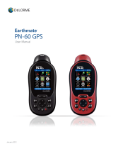
Earthmate
PN-Series
DELORME
Quick Start Guide
Map Library Subscription
Using Topo USA with your PN-Series GPS
Install Topo USA on your computer
Use Topo USA to quickly create projects containing waypoints, tracks, routes, and maps that
you can send to your PN-Series GPS. After you gather info in the field, send it to Topo USA and
manage everything in one location. For detailed information, see your device’s User Manual and
the Help in Topo USA.
Add a map from the Map Library
Layer additional maps and data from the Map Library over your Topo USA maps. See the
Map Library Subscription box below for more information. For detailed help, click the blue
NetLink Help button on the Map Library subtab.
1. Use the Find tab to locate the area.
2. On the NetLink tab, click Map Library and enter your download certificate or Map Library
validation key.
3. Select the map data type from the drop-down list.
4. Click the Select button and click each grid on the map, or click and hold the left mouse
button and drag the cursor on the map to select multiple grids.
5. Click the Add to List button and then name your selection.
6. Make sure the PN-Series map package check box is selected and click Checkout.
• An email notifies you when your order is ready
• Click Downloads on the NetLink tab to check order status
7. Once you download your map file, the Exchange dialog opens and your PN map package
is highlighted in the Saved Map Packages list on the left.
8. In the Exchange dialog, select the destination from the drop-down list.
• Fastest transfer—send to an SD card in an SD card reader.
Subscribe and SAVE!
Now you can purchase an annual $29.95 NetLink subscription to access the complete collection
of supplementary datasets offered by DeLorme.
These additional map and imagery types can be layered for PN-Series GPS use along with Topo
USA street and topographic maps. Sample these datasets for free using the included certificate
found in your Topo USA software case.
After you’ve used your sample data, if you want more you can download USGS 7.5-minute
QUADS, high-resolution color imagery, NOAA nautical charts, plus other datasets ideal for use
with your PN-Series GPS. No more paying as you go — instead, enjoy remarkable savings over
buying a la carte and experience the ease of mind provided by a subscription plan.
To purchase your subscription, click the NetLink tab in the Topo USA software and follow the
instructions.
• Best use of memory—send to the device’s internal memory. Connect the device to the
computer with the USB cable and power it on. From the Connect to Computer page,
select Map Transfer > Transfer to Internal. You can also press MENU and go to
Device Setup > Connect to Computer.
Exchange maps, waypoints, tracks, and routes
The Exchange dialog sends and receives maps waypoints, tracks, and routes between Topo
USA and your PN-Series GPS. You can also send maps to an SD card in an SD card reader.
Draw tab—waypoints and tracks
Use the Draw tab to add waypoints and tracks to your map.
Route tab
Use the Route tab to create a driving, biking, or hiking route.

What’s in the box
Set up your PN-Series GPS
Take your PN-Series GPS outside
➤ Earthmate PN-40 or PN-30 GPS
➤
Quick Start Guide
➤
User Manual
➤
DeLorme Topo USA
®
software DVD
➤
PN-formatted maps on 4 DVDs
➤
SD card
➤
USB cable
➤
2 AA batteries
Add Maps
Insert the PN-formatted map DVD for your region in your computer and follow the simple
on-screen instructions to copy the maps you want:
• To an SD card using your SD card reader (fastest setup)
• To the device’s internal memory (best memory use)
Connect the device to the computer with the USB cable and power it on. From the Connect to Computer page, select
the transfer method. You can also press MENU and go to Device Setup > Connect to Computer.
Insert SD Card and Batteries
Unscrew the D-rings on the battery cover to remove it. To insert
an SD card, gently press the SD card latch, insert the card in the slot,
and press the slot down to close it. Insert 2 AA batteries and replace the cover.
To change the battery type if you are using other than regular AA batteries, press MENU and go to
Device Setup > System > Battery Type.
Go outside to a place where you have a clear
view of the sky.
Press and hold the Power button until you see
the Welcome screen.
Wait while the PN-Series GPS determines
your location. It may take up to 10 minutes to
determine your location the first time you use
your PN-Series GPS.
Earthmate GPS PN-Series GPS Interface
IN/OUT—Zoom the
map in or out.
ARROW KEYPAD—Move the
cursor, pan maps, and navigate
the keyboard, menus, and lists.
PAGE—Move forward
through pages.
MENU—Upper section
options for active page.
Lower section shows
pages not in PAGE
button sequence.
ENTER—Choose a
menu, option, or field.
Get info about a place
on the map.
POWER—Press and hold
to turn on. To turn off, press
POWER and ENTER.
QUIT—Cancel an action
or move backward
through pages.
FIND—Search for 4 million
points of interest, waypoints,
addresses, and more.
MARK—Mark a waypoint at your
GPS location or the cursor location
when panning.
SD
Card
Fastest Setup—SD Card Reader
Best Use of Memory—Internal

WARNING:
Messaging, tracking and SOS functions require an active Iridium satellite subscription. Always test your device before you go.
This manual is provided as a convenience.
GARMIN IS NOT RESPONSIBLE FOR THE ACCURACY OF THIS MANUAL AND DISCLAIMS ANY LIABILITY ARISING FROM THE RELIANCE
THEREON.
/