Page is loading ...

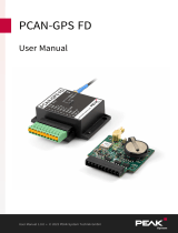
Programmable Position Sensor Module
with CAN Connection
User Manual
PCAN-GPS
Document version 1.1.0 (2014-11-13)

PCAN-GPS – User Manual
2
Products taken into account
Product Name Model Part number
PCAN-GPS IPEH-002110
microSD™ is a trademark or registered trademark of SD-3C, LLC in the United States
of America, other countries, or both.
Other product names mentioned in this document may be the trademarks or regis-
tered trademarks of their respective companies. They are not explicitly marked by
“™” and “®”.
© 2014 PEAK-System Technik GmbH
PEAK-System Technik GmbH
Otto-Roehm-Strasse 69
64293 Darmstadt
Germany
Phone: +49 (0)6151 8173-20
Fax: +49 (0)6151 8173-29
www.peak-system.com
info@peak-system.com
Documen
t version 1.1.0 (2014-11-13)

PCAN-GPS – User Manual
3
Contents
1 Introduction 5
1.1 Properties at a Glance 5
1.2 Scope of Supply 6
1.3 Prerequisites for Operation 7
2 Description of the Sensors 8
2.1 Receiver for Navigation Satellites (GNSS) 8
2.2 Gyroscope 9
2.3 Acceleration and Magnetic Field Sensor 10
3 Hardware Configuration 13
3.1 Coding Solder Jumpers 14
3.2 Buffer Battery for GNSS 15
4 Connectors 16
4.1 Screw Terminal Strip 16
4.2 SMA Antenna Connector 17
4.3 microSD™ Slot (internal) 17
5 Operation 18
5.1 Starting PCAN-GPS 18
5.2 Status LEDs 18
6 Software 19
6.1 Installing the GNU ARM Toolchain 19
6.2 Library 20
6.3 Firmware Examples (Compiling) 20

PCAN-GPS – User Manual
4
7 Firmware Update 22
7.1 System Requirements 22
7.2 Preparing Hardware and Software 22
7.3 Sending the Firmware 23
8 Technical Specifications 27
Appendix A CE Certificate 31
Appendix B Dimension Drawing 32
Appendix C CAN-Messages of the Demo Firmware 33
C.1 CAN Messages from the PCAN-GPS 33
C.2 CAN Messages to the PCAN-GPS 36
Appendix D Data Sheets 38

PCAN-GPS – User Manual
5
1 Introduction
The PCAN-GPS is a programmable sensor module for position and
orientation determination. It has a satellite receiver, a magnetic field
sensor, an accelerometer, and a gyroscope. The sampled data can
be transmitted on a CAN bus and logged on the internal memory
card. The data processing is performed by a microcontroller of the
NXP LPC4000 series.
Using the supplied library and the Yagarto GNU ARM toolchain
(contains the GNU Compiler Collection GCC for C and C++), custom
firmware can be created and then transferred to the module via
CAN. This gives a whole range of options for processing and
routing of the arising sensor data.
On delivery, the PCAN-GPS is provided with a demo firmware that
transmits the raw data of the sensors periodically on the CAN bus.
The source code of the demo firmware as well as further program-
ming examples that cover different tasks are in the scope of supply.
1.1 Properties at a Glance
NXP LPC4000 series microcontroller (ARM Cortex-M4)
Receiver for navigation satellites u-blox MAX-7W (GPS, Galileo,
GLONASS, QZSS, and SBAS)
Bosch BMC050 electronic three-axis magnetic field sensor and
three-axis accelerometer
Gyroscope STMicroelectronics L3GD20
High-speed CAN channel (ISO 11898-2) with bit rates from
40 kbit/s to 1 Mbit/s
2-KByte EEPROM in the microcontroller

PCAN-GPS – User Manual
6
Internal microSD™ memory card slot, e.g. for logging position
data (microSD™ memory card not in the scope of supply)
Wake-up via CAN bus or a separate input
2 digital inputs (High-active)
1 digital output (Low-side switch)
LEDs for status signaling
Connection via a 10-pole screw terminal strip (Phoenix)
Supply voltage from 8 to 30 V
Extended operating temperature range from -40 to +85 °C (-40 to
+185 °F) (with exception of the button cell)
New firmware can be loaded via CAN interface
1.2 Scope of Supply
PCAN-GPS in a plastic casing
10-pin screw terminal strip
External antenna for satellite reception
Windows development software (Yagarto GNU ARM toolchain,
flash program)
DVD with library, programming examples, and manual in PDF
format

PCAN-GPS – User Manual
7
1.3 Prerequisites for Operation
Power supply in the range of 8 to 30 V DC
For updating the firmware via CAN:
• CAN interface of the PCAN series for the computer (e.g.
PCAN-USB)
• Operating system Windows 8.1, 7, Vista (32/64-bit)

PCAN-GPS – User Manual
8
2 Description of the Sensors
This chapter describes the characteristics of the sensors that are
used in the PCAN-GPS in short form and gives instructions for use.
For additional information about the sensors, see the technical
specifications (on page 27) and the data sheets of the respective
manu
facturers (Appendix D on page 38).
2.1 Receiver for Navigation Satellites
(GNSS)
The u-blox MAX-7W receiver is designed for the following global
navigation satellite systems (GNSS):
GPS (USA)
GLONASS (Russia)
Galileo (Europe)
QZSS (Japan)
SBAS (supplementary)
To receive a satellite signal, an external antenna must be connected
to the SMA socket
. Both passive and active antennas are suitable.
An active antenna is included.
The use of GPS and GLONASS cannot
happen simultaneously. On
the one hand, the external antenna must match the respective
system (the supplied one can receive both), on the other hand, the
GNSS receiver must be switched.
For a faster position fix after turning on the PCAN-GPS, the internal
RTC and the internal backup RAM can be supplied by the button

PCAN-GPS – User Manual
9
cell. This requires a hardware modification (see section 3.2 on page
15).
2.2 Gyroscope
The STMicroelectronics L3GD20 gyroscope is a three-axis angular
rate sensor. It returns the rotational speed around X, Y, and Z axis.
X: roll
Y: pitch
Z: yaw
Gyroscope axes in relation to the PCAN-GPS casing
The covered rotation angle can be determined by integration over
time.
There are two sensor-internal filters for limitation and damping of
output values. They are implemented by configurable high-pass and
low-pass.
With its cut-off frequency (3 dB level), the high-pass defines the
minimum angular velocity needed for transmission. With the low-
pass in contrast, it is possible to affect the transmission of faster
rotation angles. Typical values for output can be distinguished from
intermittent fast movements. The selected filter characteristic is
always to be considered together with the output data rate (ODR).

PCAN-GPS – User Manual
10
Filter curve of high-pass and low-pass
2.3 Acceleration and Magnetic Field Sensor
The acceleration and magnetic field sensor Bosch Sensortec
BMC050 is used to determine the position in a magnetic field (such
as the earth's magnetic field) and the acceleration along three axes.
Axes of the acceleration and magnetic field sensor
in relation to the PCAN-GPS casing
There are three configurable control lines to adjust the function to
the respective application: Data Ready MAG, Interrupt_MAG, and

PCAN-GPS – User Manual
11
Interrupt_ACC1. Interrupt_ACC2 is not connected to the microcon-
troller. All connected interrupt lines of the sensor are provided with
pull-up resistors. Since both functions of the sensor are indepen-
dent of each other, also the corresponding interrupt functions are
not linked. The interrupt for the acceleration sensor can be confi-
gured from seven functionalities, its timing validity can be adjusted.
The functional scope of the magnetic field sensor interrupt
comprises four sources.
The offset compensation of the acceleration sensor is done via the
addition of a correction value which is copied from the EEPROM.
This requires a conversion of an 8-bit value (Public Register) to a 10-
bit value (Internal Register) (see table). With one of the four
compensation methods, the correction value can be checked and
readjusted.
Compensation value for measuring range
Bit in Public register
±2 G ±4 G ±8 G ±16 G
8 (msb): sign ± ± ± ±
7 500 mG 500 mG 500 mG 500 mG
6 250 mG 250 mG 250 mG 250 mG
5 125 mG 125 mG 125 mG 125 mG
4 62.5 mG 62.5 mG 62.5 mG 62.5 mG
3 31.3 mG 31.3 mG 31.3 mG 31.3 mG
2 15.6 mG 15.6 mG 15.6 mG -
1 (lsb) 7.8 mG 7.8 mG - -
The correction value can be determined with four methods. A target
value (± 1 G in X/Y/Z) is given in this process. The methods deter-
mine the necessary offset of the measured value until it reaches the
target value. The offset appears in the Public Register and may be
transferred to EEPROM.
Slow compensation: Over several steps (8 or 16), the correction
value is gradually adjusted (4 lsb) to reach the target value.

PCAN-GPS – User Manual
12
Fast compensation: The correction value is calculated from the
average of 16 measurements and the target value.
Manual compensation: The user specifies a correction value.
Inline calibration: The calculated correction value is stored in the
EEPROM.

PCAN-GPS – User Manual
13
3 Hardware Configuration
Basic settings can be made on the circuit board of the PCAN-GPS
module by using solder jumpers. On delivery, there are the
following presets:
3 coding solder jumpers: all open
Buffer battery for satellite reception: not connected
These settings need to be adjusted only if necessary. On delivery,
you can operate the PCAN-GPS module without changing the
hardware configuration.
Attention! Electrostatic discharge (ESD) can damage or destroy
components on the PCAN-GPS circuit board. Take precautions
to avoid ESD when handling the circuit board.

PCAN-GPS – User Manual
14
3.1 Coding Solder Jumpers
The three solder fields for coding solder jumpers (ID0, ID1, ID2) are
each assigned to one port of the LPC4074 microcontroller (μC).
Solder fields for coding solder jumpers on the circuit board
Solder field is … Status at the port
bridged Low
open High
The status of the ports is relevant in the following cases:
The loaded firmware is programmed so that it reads the status
at the corresponding ports of the microcontroller. For example,
the activation of certain functions of the firmware or the coding
of an ID is conceivable here.
For a firmware update via CAN, the PCAN-GPS module is identi-
fied by a 3-bit ID which is determined by solder jumpers. A bit is
set (1) when the corresponding solder field is open (default
setting: ID 7, all solder fields open).

PCAN-GPS – User Manual
15
Solder field
ID0 ID1 ID2
Binary digit
001 010 100
Decimal equivalent
1 2 4
See also chapter 7
Firmware Update
on page 22.
3.2 Buffer Battery for GNSS
The receiver for navigation satellites (GNSS) needs about half a
minute until the first position fix after switching on the PCAN-GPS
module. To shorten this period, the button cell can be used as a
buffer battery for a quick start of the GNSS Receiver. However, this
will shorten the life of the button cell.
On solder field JP6, a solder bridge must be set that connects the
button cell with the GNSS receiver.
Solder field JP6 on the circuit board

PCAN-GPS – User Manual
16
4 Connectors
4.1 Screw Terminal Strip
Screw terminal strip with 3.5 mm pitch
(Phoenix Contact MC 1,5/10-ST-3,5 - 1840447)
Terminal Identifier Function
1 U
b
Power supply 8 - 30 V DC,
e.g. car terminal 30, reverse-polarity
protection
2 GND Ground
3 CAN_L
4 CAN_H
Differential CAN signal
5 DOut Digital output, Low-side switch
6 DIn1 Digital input, High-active (internal pull-
down), inverting
7 Boot CAN CAN bootloader activation, High-active
8 GND Ground
9 Wake-up External wake-up signal, High-active, e.g.
car terminal 15
10 DIn2 Digital input, High-active (internal pull-
down), inverting

PCAN-GPS – User Manual
17
4.2 SMA Antenna Connector
An external antenna must be connected to the SMA socket for the
reception of satellite signals. Both passive and active antennas are
suitable. For an active antenna, a supply of 3.3 V with at most
50 mA can be switched through the GNSS receiver.
The scope of supply of the PCAN-GPS provides an active antenna
that is suitable for the navigation satellite systems GPS and
GLONASS.
4.3 microSD™ Slot (internal)
For the recording of, for example, status and location information, a
microSD™ memory card of the types SD and SDHC can be used
(not included). The maximum capacity is 32 GByte.
Freely available source code exists for the implementation of the
FAT32 file system in custom firmware.
Note: The microSD™ connectivity in the PCAN-GPS module is
not suitable for recording large data flows, such as the CAN
traffic.
In order to insert a memory card, open the casing of the PCAN-GPS
module by loosening the two fixing screws.

PCAN-GPS – User Manual
18
5 Operation
5.1 Starting PCAN-GPS
The PCAN-GPS is activated by applying the supply voltage to the
respective ports (see chapter 4.1
Screw Terminal Strip
on page 16).
The firmware in the flash memory is subsequently run.
At delivery, the PCAN-GPS is provided with a demo firmware. At a
CAN bit rate of 500 kbit/s, it periodically transmits the raw values
determined by the sensors. In Appendix C on page 33, there is a list
of the u
sed CAN messages.
5.2 Status LEDs
The PCAN-GPS has two status LEDs that can be green, red, or
orange. The status LEDs are controlled by the running firmware.
If the PCAN-GPS module is in CAN bootloader mode which is used
for a firmware update (see chapter 7 on page 22), the two LEDs are
in the following s
tate:
Status 1 (left): orange, quickly blinking
Status 2 (right): orange

PCAN-GPS – User Manual
19
6 Software
This chapter covers the installation of the Yagarto GNU ARM
toolchain and gives notes about the software library and the
firmware examples.
Software, source code, and additional information are included on
the supplied DVD in the following directory branch:
/Develop/Microcontroller hardware/PCAN-GPS/
6.1 Installing the GNU ARM Toolchain
To compile the code examples and the custom firmware code under
Windows, install Yagarto on your computer. Yagarto is a collection
of tools to develop applications for ARM processors and microcon-
trollers on Windows platforms. The collection includes the GNU
GCC compiler for C and C++, Make, and further tools. Further
information about Yagarto: www.yagarto.de
System r
equirement: operating system Windows 8.1, 7, Vista
(32/64-bit)
Do the following to install Yagarto:
1. From the directory branch on the provided DVD mentioned
above, change to the Compiler subdirectory.
The directory contains the two installation programs
yagarto-*.exe and yagarto-tools-*.exe.
2. Execute the first installation program and follow its
instructions.

PCAN-GPS – User Manual
20
If you don't want to use the default destination folder, make
sure that your customized path doesn't contain any spaces.
Otherwise compile operations will not work later.
3. Afterwards, execute the second installation program and
follow its instructions.
In the system environment, the installation programs create search
paths for the executable files. These new search paths are effective
only for programs and command prompts that are started
afterwards.
6.2 Library
The development of applications for the PCAN-GPS module is
supported by the library libPCAN-GPS-GNU*.a (* stands for
version number), a binary file. You can access the resources of the
module by means of this library. The library is documented in the
header files (*.h). The files are located in each example directory.
6.3 Firmware Examples (Compiling)
On the DVD, the Examples subdirectory contains source code for
several firmware examples that you can use and test directly and
that you can reuse for custom firmware.
At delivery, the PCAN-GPS module is provided with the
DeliveryFirmware. At a CAN bit rate of 500 kbit/s, it periodically
transmits the raw values determined by the sensors. In Appendix C
on page 33, there is a list of the u
sed CAN messages.
Freely available source code exists for the implementation of the
FAT32 file system in custom firmware.
/