Page is loading ...

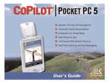
SPiN 100
Pocket PC Navigation Software
English
USER MANUAL
Pocket PC


3
SPiN 100 | User Manual
Contents
1. Introduction ............................................................................ 5
2. Pocket PC Features ...............................................................
7
3. Installing SPiN 100
................................................................ 8
4. Starting SPiN 100 ..................................................................
9
5. GPS Setup .......................................................................... 11
6. Setting your Destination ...................................................... 14
7. Using the 2D Map Screen to Plan a Route ..........................
22
8. Trip Planner .......................................................................... 23
9. Viewing your Route ............................................................. 26
10. Map Screen Pop-up Menu .................................................
32
11. Avoiding an Area ................................................................ 33
12. Route Demonstrator ............................................................ 34
13. Trip Meter ............................................................................ 35
14. Favourites and Quick Navs ................................................. 36
15. Settings ............................................................................... 38
16. Improving Performance ....................................................... 45
17. Accessories ........................................................................
46
Appendix: Street Types ............................................................ 47
Support Information ................................................................. 50
Compliance ............................................................................... 50
Copyright ................................................................................... 50

4
SPiN 100 | User Manual

5
SPiN 100 | User Manual
Getting started
1. Introduction
Thank you for purchasing SPiN 100 Pocket PC navigation software. We hope you enjoy using your new
GPS navigation software.
Whether you travel in your own country or elsewhere, SPiN 100 will direct you to your destination
without the need for map books and second-hand instructions. The Global Positioning System (GPS)
is available free of charge, at any time, and is accurate to within 5 m (15 ft). Your SPiN 100 map
provides street-level detail for door-to-door navigation, including Points Of Interest (POIs) such as
accommodation, railway stations and airports.
Use this manual to help you install SPiN 100, learn how to operate it effectively and safely, and discover
the range of features available to you.
Navman welcomes your feedback. To contact us or visit our website, see Support Information on page 50.
Compatibility
SPiN 100 is compatible with both Bluetooth and serial-port connected GPS receivers, and with
Pocket PCs manufactured by:
• Acer
• Dell
• HP
• i-mate
• Qtek
• T-Mobile
Note: Depending on your model of Pocket PC, you may not be able to connect to both a Bluetooth
GPS receiver and another Bluetooth device (such as a headset) simultaneously.
Operation
Like many software programs, SPiN 100 requires the software media (in this case, the SPiN 100
SD Memory Card) to be present for the software to operate. This enables the software to be used
on multiple devices but prevents it being used by two persons at the same time (as that would
require a second software licence).
Important Note: Because the SPiN 100 program and map data files are stored on the SD Memory
Card, it is important not to modify or overwrite those files. Accordingly, it is recommended that
before installation you save a copy of all
files onto your personal computer or other storage device.

6
SPiN 100 | User Manual
Getting started
GPS and GPS Signals
The Global Positioning System is a network of satellites that transmit accurate time and position
information worldwide. GPS receivers receive signals from these satellites and use the information to
determine an exact location.
Satellites orbit the earth at around 12,000 miles above the surface. While a GPS receiver can
detect signals from up to 12 satellites at any time, only three signals are needed to provide a
position or GPS “fix” (latitude and longitude) for vehicle navigation systems.
SPiN 100 is designed to use GPS information to find your current position, and calculate the best
route to your desired destination using the available road maps. SPiN 100 will then guide you with
voice and visual commands to your destination using the continuous stream of GPS data to track
your position.
To receive GPS signals, ensure that the receiver is outdoors, or in a vehicle outdoors, and has an
unobstructed view of the sky. The reciever can operate in all weather types except snowfall.
For details about reading the SPiN 100 GPS Status screen, see page 12.
Safety Notice
WARNING: In a vehicle, it is your sole responsibility to place, secure and use the Pocket PC
in a manner that will not cause accidents, personal injury or property damage. The user of this
product is solely responsible for observing safe driving practices. It is your responsibility to read
and follow the vehicle mount installation instructions and to use the product consistent with your
government’s laws/regulations. Consult the vehicle manual to ensure the mounting location is safe.
It is your sole responsibility to adhere to the following safety instructions at all times:
• Do not operate the Pocket PC while driving or place the Pocket PC in a position that
obstructs the driver’s view.
• Do not mount the Pocket PC in a way that may be distracting or interfere with the safe
operation of the vehicle, the deployment of airbags or other safety equipment.
• Do not leave the Pocket PC in view while your vehicle is unattended, especially in strong or
direct sunlight.
• Do not use or handle the Pocket PC when it is hot; leave it to cool, out of direct sunlight.
Failure to adhere to these instructions may lead to serious personal injury, including death,
or property damage. Navman disclaims all liability for use of the Pocket PC that contributes
to injuries, death, property damage or violates law.

7
SPiN 100 | User Manual
Getting started
2. Pocket PC Features
4-Way Toggle
The style of the 4-way toggle differs between models of Pocket PC. It may be referred to as a
navigation button or navigation stick; it may be a 5-way toggle. See your Pocket PC manual to
identify the 4-way toggle.
Note: If your Pocket PC does not have a toggle you must first assign Button 1 to <Scroll
Right
and Button 4 to <Scroll Left.
See your Pocket PC manual for information on how to assign buttons.
Touch-Screen
Use the stylus with the Pocket PC touch-screen to navigate and use the Main Menu options, set
destination addresses and configure the GPS status. See your Pocket PC manual for information
on using the stylus with the touch-screen.
Tap and hold the stylus on the 2D Map and 3D Map screens to activate the Pop-up menu.
See page 32 for information on the Pop-up menu.
Portrait vs. Landscape Screens
Microsoft Windows Mobile™ 2003 SE (standard and phone editions) can display SPiN 100 in
portrait or landscape mode.
This manual shows most SPiN 100 screens primarily in portrait mode; however, where landscape
mode significantly differs from portrait mode, both are shown.
Toggle Description
Left
Opens the Main Menu screen.
Right
Cycles through the navigation screens once a route has been calculated:
• 2D Map screen
• 3D Map screen
• Next Instruction screen
• Instruction List screen.
Up
From the 2D Map screen, enables you to zoom in to view less of the street
map, but with more detail.
From the
3D Map screen, with the Information button set to Angle,
enables you to increase the viewing angle.
Down
From the 2D Map screen, enables you to zoom out to view more of the
street map, but with less detail.
From the
3D Map screen, with the Information button set to Angle,
enables you to decrease the viewing angle.

8
SPiN 100 | User Manual
Getting started
3. Installing SPiN 100
Installing SPiN 100 is as simple as inserting the SPiN 100 SD Memory Card into your Pocket PC and
following the simple on-screen instructions.
1. Close all open programs on your Pocket PC.
2. Insert the SPiN 100 SD Memory Card into your Pocket PC. The SPiN 100 Installer will start
automatically.
3. Follow the screen prompts to install the software
.
• Select your preferred language.
• Tap Install.
A warning dialog box will display reminding you not to remove the SD Memory Card during
installation or operation. Tap
.
The Installing NAVMAN SPiN 100 window will display.
4. When installation is complete a dialog box will display confirming that installation was successful.
Tap
to automatically start SPiN 100.

9
SPiN 100 | User Manual
Getting started
4. Starting SPiN 100
By now, you have installed SPiN 100 on your Pocket PC and, if required, mounted your GPS receiver
in your vehicle. You are now ready to start SPiN 100 and ensure that your Pocket PC and GPS receiver
are communicating successfully.
1. Close all open programs on your Pocket PC to provide memory resources for SPiN 100.
Note: Tapping or in the top right corner of an application does not usually close the
application, but leaves it running in the background. To close SPiN 100 tap and hold a point on the
screen to display the Pop-up Menu, then select Exit Application. To close all applications, see your
Pocket PC manual.
2. Tap Start (a) to display the Start menu (see Figure 1).
3. Tap Programs (b) on the Start menu.
4. Tap
(c) on the Programs screen (see Figure 2).
SPiN 100 will open.
5. The Legal Notice screen will display. Read the legal notice and tap I Agree to confirm you understand.
6. The Tutorial will display. Tap
to move through the screens.
Note: To switch off the Tutorial, from the Main Menu tap , then Setup, then the General tab. In
the Tutorial section of the General screen, tap the Show at Startup checkbox to deselect it
.
The 2D Map screen will open and the status bar at the bottom of the screen will either display
your present location (if a GPS fix has already been obtained) or the current GPS status. Tapping
the status bar will open the GPS Status screen.
You are now ready to obtain a GPS fix. See GPS Setup on page 11.
a
b
c
Figure 1. Start Menu
Figure 2. Programs Screen

10
SPiN 100 | User Manual
Getting started
Main Menu Screen
The Main Menu screen provides access to all SPiN 100 functions, including navigating to a
destination.
1. From the 2D Map screen, open the Main Menu screen by pushing the 4-way toggle
.
2. Tap
, to display more Main Menu options.

11
SPiN 100 | User Manual
Getting started
5. GPS Setup
The Global Positioning System (GPS) comprises a collection of satellites orbiting Earth that transmit
signals to a GPS receiver (antenna) connected to your Pocket PC.
Before your GPS receiver (antenna) can attempt to obtain a GPS fix, your Pocket PC must be first be
setup to connect (‘pair’) with the GPS receiver
.
GPS receiver setup
GPS receivers can connect to a Pocket PC via two mediums: wireless Bluetooth or a serial cable.
In either case, once the Pocket PC has successfully paired the pairing information is remembered
by the software and the following steps are bypassed.
Automatic Bluetooth pairing
The first time it is used, SPiN 100 assumes you are using a Navman Bluetooth GPS
receiver and displays a dialog box asking if you want to connect to it. If you have a Navman
Bluetooth GPS receiver tap Yes to automatically pair the Pocket PC with the receiver and
attempt to obtain a GPS fix. If you do not have a Navman Bluetooth GPS receiver tap No.
Manual setup
Whether you have a third-party Bluetooth GPS receiver or a GPS receiver connected via a
serial cable, you need to manually pair the receiver with the Pocket PC.
1. Either tap the GPS status message at the bottom of the 2D Map or 3D Map screens or,
from the Main Menu, tap , then GPS Status.
The GPS Status screen will open
:
2. Tap the first drop-down box and select the COM port for your GPS receiver from the list
that appears. See your Pocket PC manual for the correct COM port.
3. Tap the second drop-down box and select the baud rate (speed) for your GPS receiver
from the list that appears. See your GPS receiver manual for the correct baud rate
.
4.
Tap the GPS checkbox to open the COM port. Your Pocket PC will now attempt to obtain
a GPS fix.

12
SPiN 100 | User Manual
Getting started
Latitude and longitude of current position;
tap to toggle displayed units between
degrees, minutes and decimal seconds;
decimal degrees; degrees and decimal
minutes.
Each segment represents a satellite
North-pointing compass and current
heading in degrees
GPS fix
Coordinated Universal Time (UTC)
and date
Number of satellites used in GPS fix
COM Port drop-down box, displays
selected GPS receiver or COM port
Ground speed
Manually opens and closes the COM Port*
Baud rate drop-down box which
displays the selected baud rate for
the GPS receiver COM port
GPS Satellite Segment Key
Getting a GPS Fix
Once your GPS receiver is setup (‘paired’) with your Pocket PC, it will attempt to obtain a GPS fix.
To do this, the receiver’s antenna must have a clear view of the sky.
To ascertain the GPS status, check the GPS status message at the bottom of the 2D Map, 3D
Map, or Next Instruction screens, or check the GPS Status screen.
GPS Status Screen
The GPS Status screen provides a visual representation of the information being received. Latitude
and longitude are displayed, along with a north-pointing compass, ground speed and the heading
in degrees. Available
satellites are shown as segments.
The GPS Status screen can be accessed by tapping the GPS status message at the bottom of the
2D Map or
3D Map screens or, from the Main Menu, by tapping , then GPS Status.
To close the GPS Status screen, tap .
* Once the COM port has been selected and the COM port opened, manually opening the port is not required
during regular usage.
Colour Description
Red No signal is being received.
Yellow A valid signal is being received but not being used to fix your position.
Green A valid signal is being used to fix your position.

13
SPiN 100 | User Manual
Getting started
GPS Status Messages
The GPS status messages are displayed on the 2D Map, 3D Map, Next Instruction and GPS
Status screens. These messages provide feedback on the status of the GPS receiver connection.
The following table explains the meaning of these messages and includes suggested actions.
Status Message Meaning Suggested Action
GPS PORT CLOSED A GPS COM port has not
been opened.
On the GPS Status screen, tap the GPS
checkbox to open the COM port selected
in the first drop-down box.
NO GPS DATA
A GPS COM Port has
been opened but no GPS
data is being received.
Ensure the GPS receiver is turned on
and connected.
WAITING FOR GPS
A GPS COM Port has
been opened, GPS data
is being received, but a
GPS position fix has not
yet been established.
Ensure the GPS receiver has an
unobscured view of the sky.
If you are in a vehicle with athermic (heat
reflecting) windows, you will require an
external GPS antenna (sold separately).
BLUETOOTH
SEARCH
A GPS Bluetooth receiver
is being searched for.
Ensure the Bluetooth GPS receiver is
turned on.
GPS LOST Your GPS fix has been lost. Ensure the GPS receiver has an
unobscured view of the sky.
(no GPS message;
date displayed on
GPS Status screen)
You have a valid GPS
position fix and
GPS data
is being received.
No action required. You can navigate to
your destination.

14
SPiN 100 | User Manual
Getting started
6. Setting your Destination
Before you travel, specify a destination and SPiN 100 will plan your route. You may select a destination
using any of the Destination menu options.
Note: Depending on the destination country, some fields may be unavailable when selecting a destination.
Entering Destination Text
Use the keyboard to enter text into the appropriate boxes on the Destination screens.
Note: If the text you enter does not match any address or Point of Interest (or any name in Pocket PC
Contacts), the text will turn red. In this case, check your spelling and try again.
Destination Icons
Each Destination screen displays a variable selection of icons:
Tap To...
Return to the previous screen.
Display the Route Options screen.
Add current location to Favourites.
Show the current location on the 2D Map.
Calculate route and display the 3D Map.
Confirm selection.
Edit current Favourite.
Delete current Favourite.
View the Help screen for Destination icons.
Display information about the current item.

15
SPiN 100 | User Manual
Getting started
Address Search Rules
The following rules apply when searching for a destination in Europe:
Street Names with Dates
If a street name contains a date or a number, search by the first number:
Example 1: If searching for
“Faubourg du 13 Juillet 1920”, search by “13”.
Example 2: If searching for
“Avenue du 14 Avril 1914”, search by “14”.
Example 3: If searching for
“Rue de la 1 ere Armée”, search by “1”.
Streets Named After People (excluding Italy)
If a street name is a person’s name (including at least a first and last name), search by the first name:
Example 1: If searching for “Rue Albert Mathieu”, search by
“Albert”.
Example 2: If searching for “Fred Archer Way”, search by “Fred”.
Example 3: If searching for “Franz-Grillparzer-Strasse”, search by “Franz
”.
Streets Named After People - Italy
In Italy, if a street name is a person’s name (including at least a first and last name), search by the last name:
Example 1: If searching for “Via de Angelo de Thomasis”, search by
“Thomasis”.
Example 2: If searching for “Via Placido Giovanella”, search by “Giovanella”.
Example 3: If searching for “Via della Giacomo Marca”, search by “Marca”.
Postcodes in United Kingdom and Netherlands
When searching by postcode in United Kingdom or Netherlands, type the postcode with spaces and
without the last two letters.
Example 1: If searching for “RH6 9ST”, search by
“RH6 9”.
Example 2: If searching for “3514 BN”, search by “3514”.
For exact European street type abbreviations, see Appendix: Street Types on page 47.

16
SPiN 100 | User Manual
Getting started
Navigating to a Street Address
1. From the Main Menu, tap Destination, then Address.
The Destination Address screen will open.
Note: If you have previously selected a destination and not subsequently exited SPiN 100, the
last address will display.
2. Select a country from the Country drop-down box.
3. Type and select the destination address starting in any box, as follows:
Box Action
Postcode • Tap the Postcode box.
The Destination Address - Postcode screen will display.
• Type up to five characters of the postcode in the Postcode box.
Note: When navigating in United Kingdom or Netherlands, type the
postcode with spaces and without the last two letters.
• Select the postcode from the list that displays.
• Tap
.
The Destination Address screen will reopen.
Area • Tap the Area box.
The Destination Address - Area screen will display.
• Type the name of a geographical location such as a town, city, state
or county in the Area box.
• Select the area from the list that displays.
• Tap
.
The Destination Address screen will reopen.
Road • Tap the Road box.
The Destination Address - Road screen will display.
• Type the name of a road in the Road box.
• Select the road from the list that displays.
• Tap
.
The Destination Address screen will reopen.
House number • Tap the House No. box.
The Destination Address - House No.
screen will display.
• Type the house number in the House No. box.
• Select the number from the list that displays.
• Tap
.
The Destination Address screen will reopen.

17
SPiN 100 | User Manual
Getting started
4. Complete one of the following:
• To calculate and display your route, tap
.
The 3D Map screen will open.
• To display the address without calculating the route, tap
.
The 2D Map screen will open.
• To add the address as a Favourite, t
ap .
The Favourite will be saved with the name of the road.
Navigating to the Intersection of Two Streets
1. From the Main Menu, tap Destination, then Intersection.
The Destination Intersection screen will open.
Note: If you have previously selected a destination and not subsequently exited SPiN 100, the
last address will display.
2. Select a country from the Country drop-down box.

18
SPiN 100 | User Manual
Getting started
3. Type and select the destination address:
4. Complete one of the following:
• To calculate and display the route to the intersection, tap
.
The 3D Map screen will open.
• To display the address without calculating the route, tap
.
The 2D Map screen will open.
• To add the intersection as a Favourite, t
ap .
The Favourite will be saved with the name of the road.
Box Action
Area • Tap the Area box.
The Destination Intersection - Area screen will display.
• Type the name of a geographical location such as a town, city, state
or county in the Area box.
• Select the area from the list that displays.
• Tap
.
The Destination Address screen will reopen.
Road 1 • Tap the Road 1 box.
The Destination Intersection - Road 1 screen will display.
• Type the name of a road in the Road 1 box.
• Select the road from the list that displays.
• Tap
.
The Destination Address screen will reopen.
Road 2 • Tap the Road 2 box.
The Destination Intersection - Road 2 screen will display.
• Type the name of a road in the Road 2 box.
A list of roads that intersect with the road specified in the Road 1 box
will display.
• Select a road from the list that displays.
• Tap
.
The Destination Address screen will reopen.

19
SPiN 100 | User Manual
Getting started
Navigating to a Point of Interest (POI)
A POI is a named site, feature, landmark or public venue which can be displayed as an icon on the
map. POIs are stored in
types, such as parks and museums.
Note: You can also navigate to a POI via the Pop-up menu. See page 32.
1. From the Main Menu, tap Destination, then Points of Interest.
The Points of Interest screen will open.
2. Select a country from the Country drop-down box.
3. Select a POI category from the Category drop-down box.
4. Select a type of POI from the Type drop-down box.
5. Select an Area by tapping the Area box.
The Destination Intersection - Area screen will display.
• Type the name of a geographical location such as a town, city, state
or county in the Area box.
• Select the area from the list that displays.
• Tap
.
The Points of Interest screen will reopen.
6. Tap
.
The Points of Interest screen will reopen.
7. Tap
.
The Points of Interest Results screen will display, with a list of your search results. Only the first
40 search results will display.
8. Select a POI from the list of search results.
• If the list is long, begin typing the name of the POI in the Name box. The list of POIs will
reduce to match your search.
9. Complete one of the following:
• To calculate and display the route to the POI, tap
.
The 3D Map screen will open.
• To display the address without calculating the route, tap
.
The 2D Map screen will open.
• To add the POI as a Favourite, tap
.
The Favourite will be saved with the name of the POI.

20
SPiN 100 | User Manual
Getting started
Navigating to a Favourite
To navigate to a Favourite, see Using Favourites, page 37.
Navigating to a Contact Address
Addresses stored in your Pocket Outlook Contacts database can be used to set a destination.
The contact address must be contained on an installed map.
1. From the Main Menu, tap Destination, then Contact.
The Find Contact screen will open.
2. Type the name of your contact in the Name box. Select the contact name from the list that displays.
3. Tap the Business, Home or Other option to display your contact’s correct address details.
4.
Tap .
The Destination Address screen will open.
5. Confirm that the correct details are displayed.
• If the details of the contact address are incorrect they will display in red. Type and select
the correct details and tap
. Your Pocket Outlook Contacts database will be updated.
6.
Complete one of the following:
• To calculate and display the route, tap
.
The 3D Map screen will open.
• To display the address without calculating the route, tap
.
The
2D Map screen will open.
/