Page is loading ...

User’s manual
MN7 PDA
English (United Kingdom)
November 2008

Imprint
NAVIGON AG
Schottmüllerstraße 20A
D-20251 Hamburg
The information contained herein may be changed at any time without prior
notification. Neither this manual nor any parts thereof may be reproduced for any
purpose whatsoever without the express written consent of NAVIGON AG, nor may
they be transmitted in any form either electronically or mechanically, including
photocopying and recording. All technical specifications, drawings etc are subject to
copyright law.
© 2008, NAVIGON AG
All rights reserved.

User’s manual MN7 PDA
User’s manual Table of contents III
Table of contents
1 Introduction.......................................................................................6
1.1 About this manual.....................................................................................6
1.1.1 Conventions.................................................................................6
1.1.2 Symbols.......................................................................................6
1.2 Legal notice ..............................................................................................6
1.2.1 Liability.........................................................................................6
1.2.2 Trademarks .................................................................................7
1.3 Questions about the product ....................................................................7
2 Before you begin...............................................................................7
2.1 Installing the software...............................................................................7
2.1.1 Preconditions...............................................................................7
2.1.2 Installation ...................................................................................7
2.2 Two modes of operation...........................................................................9
2.2.1 Test mode....................................................................................9
2.2.2 Full version ..................................................................................9
2.3 Working with the test version ...................................................................9
2.4 Registering and activating the full version................................................9
2.5 Upgrading the test version to a full version ............................................10
2.6 Activation................................................................................................11
2.7 Connecting the GPS receiver.................................................................11
2.8 Installing the hardware in a vehicle ........................................................12
2.9 Power supply for the PDA and GPS receiver.........................................12
2.10 Navigating with GPS ..............................................................................12
2.11 Important safety information...................................................................13
2.11.1 Navigation safety information ....................................................13
2.11.2 Safety information for external GPS receivers ..........................14
2.11.3 Safety guidelines when installing the device in your car ...........14
3 Operating the navigation software ................................................15
3.1 Volume ...................................................................................................15
3.2 Information .............................................................................................15
3.3 Software keyboard .................................................................................16
3.3.1 Special keys ..............................................................................17
3.3.2 Entering data .............................................................................18
3.4 Options ...................................................................................................18
3.5 Menus.....................................................................................................18

User’s manual MN7 PDA
IV Table of contents User’s manual
4 Navigation .......................................................................................19
4.1 Starting MN7 PDA ..................................................................................19
4.1.1 Initialising the GPS receiver ......................................................20
4.2 Specifying a destination .........................................................................21
4.2.1 Specifying the country in which the destination is situated........21
4.2.2 Entering an address ..................................................................21
4.2.3 Points of interest........................................................................22
4.2.4 Information about the destination ..............................................26
4.2.5 Last Destinations .......................................................................26
4.2.6 Favourites..................................................................................26
4.2.7 Navigating home........................................................................27
4.2.8 Imported addresses...................................................................27
4.2.9 Selecting destinations on the map.............................................28
4.2.10 Starting navigation.....................................................................28
4.3 Managing destinations ...........................................................................29
4.3.1 Saving destinations ...................................................................29
4.3.2 Defining a destination as home address ...................................30
4.4 Multi-leg routes.......................................................................................30
4.4.1 Entering the starting point..........................................................30
4.4.2 Entering route points .................................................................31
4.4.3 Editing route points....................................................................32
4.4.4 Managing routes........................................................................32
4.4.5 Calculating and displaying routes..............................................33
4.4.6 Simulating routes.......................................................................33
4.4.7 Starting navigation.....................................................................33
4.5 Options in the navigation application......................................................34
4.6 Working with the map.............................................................................36
4.6.1 Maps..........................................................................................36
4.6.2 Selecting a map.........................................................................36
4.6.3 Activating an additional map......................................................37
4.6.4 Map in Preview mode ................................................................37
4.6.5 Map in Navigation mode............................................................39
4.6.6 Reality View...............................................................................41
4.6.7 Map in Destination search mode ...............................................42
4.7 Useful functions......................................................................................44
4.7.1 Emergency Services..................................................................44
4.7.2 GPS Status, saving the current location....................................45
4.7.3 Block..........................................................................................45
4.7.4 Turn-by-Turn List .......................................................................46
4.7.5 TMC (Traffic Information) ..........................................................47
4.7.6 Logbook.....................................................................................48

User’s manual MN7 PDA
User’s manual Table of contents V
5 Services ...........................................................................................49
5.1 Weather Service.....................................................................................50
5.2 HRS Hotel Reservation Service .............................................................50
6 Configuring the MN7 PDA ..............................................................50
7 Index ................................................................................................52

User’s manual MN7 PDA
- 6 - Introduction
1 Introduction
1.1 About this manual
1.1.1 Conventions
For better legibility and clarification, the following styles are used in this
manual:
Bold and italics: Product names.
S
MALL CAPITALS: Window and dialogue box titles.
Bold: Highlighting of important parts in the text.
Underlined
: Names of buttons, input boxes and other elements
on the user interface.
Underlined and italics
: Names of control elements on the navigation
device.
1.1.2 Symbols
The following symbols refer to specific passages of text:
Instructions and tips for operating the software
More detailed information and explanations
Warnings
1.2 Legal notice
1.2.1 Liability
The software and manual are subject to change without notice.
NAVIGON AG is not liable for the accuracy of the information contained
in this manual or for damages resulting from the use of this manual.
Suggestions for improvements and information regarding errors are
always welcome so that we can supply you with even better products in
the future.

User’s manual MN7 PDA
Before you begin - 7 -
1.2.2 Trademarks
All brand and trade marks mentioned in this document and registered
by third parties are subject without reservation to copyright law and the
proprietary rights of their respective owners. All trade marks, trade
names and company names used in this document are or may be trade
marks or registered trademarks of their respective owners. All rights
reserved except those explicitly granted.
The absence of an explicit labelling of registered trademarks does not
allow the conclusion that this brand was not subject to the rights of third
party.
► Microsoft, Outlook, Excel, Windows and ActiveSync are registered
trade marks of the Microsoft Corporation.
► NAVIGON is a registered trade mark of NAVIGON AG.
1.3 Questions about the product
You have a question concerning your product? Then visit our webseite
www.navigon.com and click on "Support". There you will find an area
with frequently asked questions (FAQ Center) along with details of how
to contact us by phone or e-mail.
2 Before you begin
2.1 Installing the software
2.1.1 Preconditions
To be able to install MN7 PDA on your PDA you need
► A PC with an Internet connection (we recommend DSL or better)
► A card reader for memory cards of the type used by your PDA. The
card reader may already be integrated in your PC.
► An empty 2GB memory card of the type used by your PDA.
Your PDA should have a GPS receiver (internal or external) for you to
make good use of MN7 PDA on it.
2.1.2 Installation
Software on DVD
If you received the navigation software on a DVD, proceed as follows:
1. Insert an empty 2GB memory card of the type used by your PDA
into the card reader of the computer.

User’s manual MN7 PDA
- 8 - Before you begin
Note: If your PDA has no slot for memory cards, you must connect it
directly to your PC. For more detailed information please refer to your
PDA manual.
2. Insert the MN7 PDA DVD into your DVD drive.
The Installer-Tool starts automatically.
3. Select the language you want to use.
4. Click on Installation
.
5. Follow the instructions on the screen.
6. When the data transfer is complete, insert the memory card into
your PDA.
The software will be installed on the PDA.
7. Start the navigation software on your PDA.
8. If the software on the DVD was a previously purchased full version,
carry out the registration and activation as described in the chapter
"
Registering and activating the full version" on page 9.
Software as a download
If you would like to download the navigation software from our website
and then install it, proceed as follows:
1. Download the ZIP archive with MN7 PDA from
www.navigon.com/MN7.
2. Unzip the ZIP archive.
(You may have already performed these steps before reading this
manual.)
3. Open Windows Explorer and select the folder to which you
unzipped the archive.
4. Double-click on the file "Start.exe".
The installation program opens.
5. Insert an empty 2GB memory card of the type used by your PDA
into the card reader of the computer.
Note: If your PDA has no slot for memory cards, you must connect it
directly to your PC. For more detailed information please refer to your
PDA manual.
6. Follow the instructions on the screen.
7. When the data transfer is complete, insert the memory card into
your PDA.
The software will be installed on the PDA.

User’s manual MN7 PDA
Before you begin - 9 -
8. Start the navigation software on your PDA.
2.2 Two modes of operation
MN7 PDA can be operated in two different modes.
2.2.1 Test mode
You can operate MN7 PDA in test mode for 14 days. During this period
the software can be used without restriction and with all available maps.
You have plenty of opportunity therefore to make your own picture of
what the navigation software can do.
2.2.2 Full version
You will use the full version as soon as you have activated the software.
For more information about acquiring the full version refer to the chapter
"
Upgrading the test version to a full version" on page 10.
2.3 Working with the test version
For as long as you have not activated the full version, the window TRY &
BUY with the three menu items Buy, Activate and Trial will appear each
time the navigation software is started.
► Tap on the Trial button.
If the 14 days test period has not expired yet, the software will start in
test mode.
Note: Even after the test period has expired you can still work with the
test version. You can no longer use it to navigate, but you can still have
it show you any position on the map.
2.4 Registering and activating the full version
If you have already purchased the full version on a DVD, you must still
register and activate it before you can use it.
You need the Serial Number in order to register. You will find the serial
number in or on the product packaging.
Proceed as follows:
1. In the T
RY & BUY window tap on Activate.
- OR -
In the M
AIN MENU window tap on Options > Activate > Activate.
A dialog box will inform you that a connection is now being
established to the NAVIGON PDA Portal.

User’s manual MN7 PDA
- 10 - Before you begin
2. Tap on OK.
3. Enter the serial number.
4. Follow the instructions on the screen.
Note: During the registration process you will be prompted to log on to
your MyNAVIGON account. If you still don't have a MyNAVIGON
account, you can create one at this point.
The activation code will be displayed at the end of the registration
process. Please make a careful note of it!
Within a few seconds you will receive an activation SMS. The full
version of the navigation software will then be activated automatically.
At the same time the navigation map specified on the product
packaging will also be activated.
If the automatic activation fails, please proceed as described in the
chapter "
Activation" on page 11.
2.5 Upgrading the test version to a full version
Carry out the following steps to transform the test version into a full
version:
1. In the T
RY & BUY window tap on Buy.
- OR -
in the M
AIN MENU window tap on Options > Activate > Buy.
A dialog box will inform you that a connection is now being
established to the NAVIGON PDA Portal.
2. Tap on OK
.
3. Please select which map you want to be activated with the full
version.
4. Indicate the payment method.
5. Provide the required personal data.
6. Follow the instructions on the screen.
The activation code is displayed after the registration dialog is
completed. Make sure to keep this number in a safe place!
Within a few seconds you will receive an activation SMS. The full
version of the navigation software along with the ordered map will then
be activated automatically.
If the automatic activation fails, proceed as described in the chapter
"
Activation" on page 11.

User’s manual MN7 PDA
Before you begin - 11 -
2.6 Activation
If the automatic activation by SMS fails to work or if you have re-
installed the navigation software on a different memory card, then you
must activate the full version of the navigation software (or any
additional purchased maps) manually.
1. Start the navigation software on your PDA.
2. Tap in the T
RY & BUY window on Options > Enter Activation Code.
- OR -
In the M
AIN MENU window tap on Options > Activate > Options >
Enter Activation Code
.
3. Enter the activation code which you received by SMS.
4. Tap on Next
.
A corresponding message appears if the activation process was
successful.
5. Tap on OK
.
2.7 Connecting the GPS receiver
Note: To navigate with MN7 PDA you need a GPS receiver which
supports the NMEA protocol.
This type of GPS receiver may already be integrated in your PDA.
Please refer to your PDA manual.
You may have purchased MN7 PDA as part of a package which
includes the required components.
Otherwise you can purchase such a receiver from a specialist dealer.
► Connect the GPS receiver if it has to be connected to the PDA with
a cable and possibly to a power source.
► If the GPS receiver is not integrated in the PDA, switch it on and
position it as far forward as possible under the windscreen, flat
against the dashboard.
Configuring GPS
When you start MN7 PDA for the first time, the GPS CONFIGURATION
window opens up. You can undertake the GPS configuration manually,
or use a wizard.
This configuration will be applied to each subsequent start of MN7 PDA.
If you want to use a different GPS receiver, then you will have to repeat
the configuration process.
Tap on Options
> GPS Status > Settings to go to the GPS configuration
screen.

User’s manual MN7 PDA
- 12 - Before you begin
GPS Wizard
► Tap on GPS Wizard and follow the instructions on the screen.
As soon as the connection is configured correctly, the M
AIN MENU
window will open.
Configure Manually
If the GPS receiver configuration failed, you will have to configure the
GPS receiver manually.
1. Tap on Configure Manually
.
2. Enter the required details. You will find the data in the GPS receiver
manual.
3. Tap on OK
.
As soon as the connection is configured correctly, the M
AIN MENU
window will open.
Note: GPS reception can be impaired by heated windscreens or by
metal evaporated windscreens. If necessary, use an external antenna.
You can obtain an external antenna at a specialist dealer.
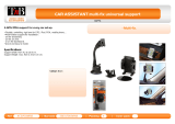
2.8 Installing the hardware in a vehicle
We recommend using a special cradle for your PDA in order to ensure
the safe operation of the navigation system in a vehicle. This will ensure
that the display is always easy to read and that the driving instructions
from the system are well understood.
You can purchase a special cradle for your mobile phone in specialist
stores.
2.9 Power supply for the PDA and GPS receiver
It is recommended to connect the PDA and GPS receiver to an external
power supply, especially for long trips.
Charging cables for connection to the cigar lighter socket are available
for almost all devices in specialist stores. These cables are often also
available online from the PDA manufacturer or GPS receiver
manufacturer.
If you want to power several devices from your vehicle's cigar lighter
socket, you will need a multiple adapter which you can obtain from a
specialist dealer.
2.10 Navigating with GPS
GPS is based on a total of at least 24 satellites orbiting the Earth and
continuously transmitting signals of their position and time. The GPS

User’s manual MN7 PDA
Before you begin - 13 -
receiver receives this data and calculates its own geographical position
on the basis of the information transmitted by the various satellites.
Data from at least three satellites is required for positioning with an
acceptable degree of accuracy. With data from four or more satellites it
is possible in addition to determine the position's altitude above sea
level. Positioning is accurate to within three metres.
Once the navigation device has determined your position, this position
can be used as a starting point for calculating a route.
The map data on your navigation device includes the geographical
coordinates of all digitally recorded points of interest, streets and
places. This enables the device to calculate a route between a starting
point and a destination.
Calculation of the current position and its representation on the map
takes place once every second. In other words, your current position is
always shown on the map.
2.11 Important safety information
In your own interest, read the following notices and safety information
carefully before starting up your navigation system.
2.11.1 Navigation safety information
Use the navigation system at your own risk.
Caution! To prevent accidents, do not operate the navigation system
while driving.
Caution! Do not look at the display unless it is absolutely safe to do so!
Caution! Traffic regulations have priority over any instructions from the
navigation system.
Caution! Follow the instructions of the navigation system only when the
circumstances and the road traffic regulations allow you to do so! The
navigation system will still guide you to your destination even if you
deviate from the calculated route.
Caution! Check that the cradle is secured and adjusted properly before
each journey.
Note: If you have not understood the spoken instructions or are unsure
about what to do next, you can refer briefly to the map or schematic
view of your navigation system.

User’s manual MN7 PDA
- 14 - Before you begin
2.11.2 Safety information for external GPS receivers
Caution!Do not lay the cable directly next to safety-relevant devices
and supply lines.
Caution! After installation, check all safety-relevant equipment in the
car.
Caution!Remove the plug from the power supply of the GPS receiver
when you park the car, as the receiver consumes electricity and could
discharge the car's battery.
Caution!Ensure that the GPS receiver is installed in such a way as not
to impede the safe operation of the vehicle.
2.11.3 Safety guidelines when installing the device in your car
Caution! Fasten the cradle so that the navigation device is easy to see
and operate by the driver. Make sure that the driver's view of the traffic
is not impeded.
Caution! Do not attach the cradle within the working zone of any
airbags.
Caution! Do not fasten the cradle too close to the steering wheel or
other controls. The driver must not be obstructed in operating any car
functions.
Caution! When installing the cradle, make sure that it will not pose a
risk in the event of an accident.
Caution! Do not run cables directly next to safety-relevant devices and
power supplies.
Caution! Check that the cradle is secured and adjusted properly before
each journey. The suction cup may become loose after a while.
Caution! After installation, check all safety-relevant equipment in the
car.

User’s manual MN7 PDA
Operating the navigation software - 15 -
3 Operating the navigation software
3.1 Volume
The volume of the spoken driving instructions can be adjusted during
navigation.
You have started navigation. The map is open in Navigation or
Destination search mode.
1. Tap on
(Volume).
The volume bar opens. It contains three buttons for adjusting the
volume.
(Louder), (Quieter), (Volume on/off).
2. Tap on
(Volume) again or wait a few seconds.
The volume bar closes.
3.2 Information
Symbols located at the top of the screen are used to display
information.
GPS
The GPS symbol can indicate the following GPS reception states:
No GPS (No symbol): The built-in GPS receiver is not operational.
Contact customer service if the problem persists.
No Signal: Data is being received from less than three satellites.
Position cannot be calculated.
GPS Ready: Data is being received from at least three satellites.
Position can be calculated.
For details of the GPS status refer to chapter "
GPS Status, saving the
current location" on page
45.
Energy
The Energy symbol can indicate the following states of the integrated
battery:
The device is being supplied by an external power source. The battery
is fully charged.

User’s manual MN7 PDA
- 16 - Operating the navigation software
The device is being supplied by an external power source. The battery
is being charged.
The device is being supplied by its internal battery. The battery charge
is sufficient.
The device is being supplied by its internal battery. The battery charge
is low.
Compass
The Compass symbol indicates in which direction you are currently
heading. It can indicate the following points of the compass: N, NE, E,
SE, S, SW, W, NW.
TMC (Traffic Information)
If your device has an integrated TMC receiver, or if you have connected
an external TMC receiver, the navigation system will have the latest
traffic information available. If necessary it can change your route
dynamically, for example in order to avoid a traffic jam.
Note: This function is only available if TMC traffic messages are being
transmitted in the country in which you are travelling. This is not the
case in all countries.
The TMC symbol can display the following TMC reception status:
No symbol: There is no TMC Traffic Receiver connected, or the
connected or built-in TMC Traffic Receiver is not operational.
Tuning: The TMC receiver is operational but cannot find a station that
is transmitting TMC signals. There are no active traffic messages.
Tuning: The TMC receiver is operational but cannot find a station that
is transmitting TMC signals. Traffic messages are active however. This
can be the case, for example, when travelling through a tunnel.
TMC on Standby: Traffic messages can be received.
For details of the TMC function refer to chapter "
TMC (Traffic
Information)" on page
47.
3.3 Software keyboard
A software keyboard appears on the screen when text entries are
necessary.

User’s manual MN7 PDA
Operating the navigation software - 17 -
All entries can be made on the software keyboard using your fingertips.
Only capital letters can be entered.
When entering town or street names you need not enter any special
characters or umlauts. The navigation system fills in these characters
for you automatically. For example, if you are looking for the town of
"Bärnau", then simply type in the word "BARNAU". Special characters
may be helpful however when naming saved destinations and routes.
3.3.1 Special keys
inserts a space.
deletes the character in front of the cursor.
opens the keyboard with numerals.
Latin, Cyrillic and Greek alphabet
opens the keyboard with the Latin alphabet.
opens the keyboard with the Cyrillic alphabet.
opens the keyboard with the Greek alphabet.
When you want to enter addresses, names or POIs, the keyboard with
the alphabet for the country in question will open automatically.
When you want to save a destination to Favourites or when you enter a
POI category or a country, the keyboard with the alphabet of the user
interface will open automatically.
You can also switch from the Cyrillic or Greek keyboard to the Latin
keyboard. Many addresses can then also be entered as transliterations
or in the language of the user interface.
Example: The language of the user interface is English. You want to
navigate to Moscow. You have the following options:
► "Москва" (Cyrillic)
► "Moskva" (transliterated)
► "Moscow" (English).
Note: Street names and place names can be entered only in the
language of the user interface if that is how they exist in the map's
database.
Note: The maximum number of keyboards is always 2.

User’s manual MN7 PDA
- 18 - Operating the navigation software
Umlauts, accents and other letters
Another keyboard with special characters is available for each alphabet.
opens the keyboard with Latin special characters.
opens the keyboard with Cyrillic special characters.
opens the keyboard with Greek special characters.
As soon as you have entered a special character the letter keyboard
reappears.
Note: The Cyrillic alphabet has more letters than places available on
the Cyrillic keyboard. The missing letters are included on the keyboard
with Cyrillic special characters.
3.3.2 Entering data
Often, lists appear from which you can select an entry. This is the case,
for example, when you enter a location.
As soon as you enter the first letter, the largest city in the given country
that begins with this letter appears.
As soon as you enter the second letter, a list appears with all locations
that begin with the letters entered.
If you enter additional letters, the list adapts to your entries. It only
contains entries that begin with the text that has been entered or
contain the text in the name. The more letters you enter, the shorter the
list will become.
You can use the
(Up) button and the (Down) button to move
through the list.
To accept an entry from the list, simply tap on it.
The list closes once an entry has been selected.
3.4 Options
Some windows offer options that lead to more functions.
A description of all available options can be found in the chapter
"
Options in the navigation application" on page 34.
3.5 Menus
Some buttons have menus which open when activated.

User’s manual MN7 PDA
Navigation - 19 -
Tap on a menu point to execute its function.
If you would like to quit the options list without selecting a function, tap
on the button you used to open the menu.
4 Navigation
Use the navigation system at your own risk.
Caution! Be sure to refer to the safety information in the chapter
"
Important safety information" on page 13.
Impaired GPS reception
If GPS reception is impaired, navigation will be interrupted. The
navigation software remains active.
As soon as GPS reception is restored, the navigation system calculates
any change of position which has occurred in the meantime. You can
then simply continue navigating.
Arriving at your destination
When you have reached the specified destination, a message to this
effect will be displayed.
Only your current position (orange arrow) will now be shown on the
map.
Quitting MN7 PDA
If you would like to quit the navigation software, tap in the M
AIN MENU
window on
(Exit).
4.1 Starting MN7 PDA
1. Turn your PDA on.
2. Tap on the navigation software symbol.
Each time you start the navigation software , the following message
will appear:
"The navigation software on this device is designed to provide route
suggestions and does not replace the need for driver attentiveness
or the requirement to adhere to road traffic regulations, good driving
practice and legally posted directions. For safety, posted road
signs and directions should always take precedence over the
directions of this unit. Do not operate this unit while driving."
3. After you have read and fully understood the message, tap on OK
.

User’s manual MN7 PDA
- 20 - Navigation
4. If you do not want to accept this notice, tap on Cancel in order to
quit the navigation software.
The M
AIN MENU window is opened. You can reach any of the
navigation software functions via this window.
4.1.1 Initialising the GPS receiver
As soon as the navigation device has been switched on, initialisation of
the GPS receiver will begin.
The integrated GPS receiver is not initialised for the first time until the
navigation application is started for the first time. It can take up to
20 minutes to initialise the GPS receiver for the first time.
Note: If the GPS
symbol indicates GPS Ready after far less than
20 minutes, it is advisable to leave the navigation device switched on
for at least another 15 minutes in order to ensure reliable operation of
the receiver.
Each time you switch on the navigation device after this, GPS reception
will start within a short time.
If the navigation device has not been switched on for more than a week,
it can take up to 10 minutes to re-initialise the receiver.
In the top right hand corner of the display, you will see the GPS
symbol.
As soon as data from at least three satellites is received, the icon will
change to
(GPS Ready).
Note: Initialisation takes the least time if you do not start driving until
the initialisation has finished.
For more details about the GPS
symbol refer to chapter "GPS" on
page
15.
Returning to the Main Menu window
The MAIN MENU window opens when the navigation application is
started.
If another window of the navigation application is open, tap on
(Back
). This will return you to the window you came from.
► Tap on (Back) repeatedly until the MAIN MENU window is
opened.
/