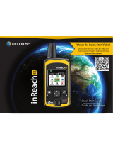
Garmin A04354 User manual

Type
User manual

Garmin A04354 is a satellite communicator with messaging, tracking, and SOS functions, designed to provide reliable communication and emergency assistance in remote areas. It uses a satellite network to send and receive text messages, track your location and send it to contacts or to a tracking website, and initiate an SOS rescue in case of emergencies. The device requires a clear view of the sky to operate and should be tested before use. Additional features include predefined check-in messages, the ability to navigate back to the starting point, and weather updates.

Garmin A04354 is a satellite communicator with messaging, tracking, and SOS functions, designed to provide reliable communication and emergency assistance in remote areas. It uses a satellite network to send and receive text messages, track your location and send it to contacts or to a tracking website, and initiate an SOS rescue in case of emergencies. The device requires a clear view of the sky to operate and should be tested before use. Additional features include predefined check-in messages, the ability to navigate back to the starting point, and weather updates.

A04354
Quick Start Manual .................................4
Manuel de démarrage rapide ..........................16
Manuale di avvio rapido .............................30
Schnellstartanleitung ...............................43
Guía de inicio rápido ...............................57
Manual de início rápido ............................0
© 2022 Garmin Ltd. or its subsidiaries
Garmin®, the Garmin logo, ANT+®, h®, and k® are
trademarks of Garmin Ltd. or its subsidiaries, registered in the USA and
other countries. Garmin Explore, Garmin r, and MapShare
are trademarks of Garmin Ltd. or its subsidiaries. These trademarks may
not be used without the express permission of Garmin.
m® is a registered trademark of Other
trademarks and trade names are those of their respective owners.
El número de registro COFETEL/IFETEL puede ser revisado en el manual
a través de la siguiente página de internet.
Quick Start Manual
Introduction
WARNING
See the Important Safety and
Product Information guide in
the product box for product
warnings and other important
information.
Getting Started
When using your device the
first time, you should complete
these tasks to set it up and get
to know the basic features.
1Press to turn on the
device.
2Select your language.
3Download the Garmin
r app to your
smartphone, and follow
the on-screen instructions
to pair and activate your
device (page6).
4Sync your device with the
Garmin app
(page8).
5Test your device before
you begin your trip
(page8).
4 Quick Start Manual
EN
Device Overview
USB port (under
weather cap)
Buttons
SOS button (under
protective cap)
Power button
Buttons
Press to scroll through
menus, options, and
settings.
Press to scroll through
menus, options, and
settings.
OK
Press to choose an
option or to acknowl‐
edge a message.
From the home page,
press to open home
page actions.
Quick Start Manual 5
EN
Press to turn the device
on.
Press to open the
power menu.
Press and hold to turn
the device off.
Turning On the Device
Press .
Pairing Your Phone and
Activating the Device
WARNING
Before you can use the
h® features of your
device, including messaging,
SOS, tracking, and
Weather, you must activate it.
The device works best
when it is paired with the
Garmin app. The
app allows you to compose
and send messages using your
phone, and to sync contacts
and check-in messages with
your device.
1Turn on the
device.
2Bring your compatible
phone within 10m (33ft.)
of your device.
3From the app store on
your phone, download the
Garmin app,
and follow the on-screen
instructions to complete
the pairing process.
6 Quick Start Manual
EN
4Select Activate Now.
5Follow the on-screen
instructions to activate a
service plan.
6Wait while the device
communicates with the
m® satellite network.
After the devices are paired,
they connect automatically
when they are turned on and
within range.
Garmin App
You can use the Garmin
app for text
messaging, tracking, SOS,
weather, and managing your
service plan. The app works
over both the satellite
network and the internet
(using a wireless connection
or cellular data on your
phone). The app provides
a messaging experience for
users and their
friends and family. Anyone
can download the app and
connect their phone, allowing
them to communicate using
the internet to other app users
(no login is required).
Satellite Network
Your device requires a clear
view of the sky to transmit
messages and track points
over the satellite
network. Without a clear
view of the sky, your
device attempts to send the
Quick Start Manual 7
EN
information until it acquires
satellite signals.
TIP: For the best connection
with satellites, the top of
the device should be oriented
toward the sky.
Syncing Data
After you make edits to
your data, such as plan
changes, contacts, or check-
in messages, you must sync
your device using the Garmin
app.
1Open the Garmin
app.
2Wait while your data
syncs.
TIP: You can check status
and see the last time
the device synced on the
Device tab in the app.
Testing the Device
You should test the device
outdoors before using it on
a trip to ensure your satellite
subscription is active.
1From the home page,
press or to scroll
through the main menu
options.
2Select Service Plan > Test
Service.
3Press OK.
4Select Begin Test.
Wait while the device
sends a test message.
When you receive a
confirmation message,
8 Quick Start Manual
EN
your device is ready to
use.
Features
WARNING
Before you can use the
features of your
device, including
messaging, SOS, tracking,
and Weather, you
must have an active satellite
subscription. Always test your
device before you use it
outdoors.
Ensure you have a clear
view of the sky when
using the messaging, tracking,
and SOS functions, because
these features require satellite
access to operate properly.
NOTICE
Some jurisdictions regulate or
prohibit the use of satellite
communications devices. It
is the responsibility of the
user to know and follow
all applicable laws in the
jurisdictions where the device
is intended to be used.
Messages
Your device sends
and receives text messages
using the satellite
network.
Sending a Check-In
Message
Check-in messages are
messages with predefined text
and recipients. You can use
Quick Start Manual 9
EN
the Garmin app to
customize recipients.
1From the home page,
press OK to open the
home page actions.
2Select Check In.
3Press or to
scroll through the check-in
messages.
4Press OK to select a
message.
5Press OK to send the
message.
Tracking
You can use the tracking
feature on your
device to record track points
and transmit them over the
satellite network at
the specified send interval.
Track points appear on the
Garmin Explore website and
the MapShare tracking page.
Starting Tracking
1From the home page,
press OK to open the
home page actions.
2Select Start Tracking.
SOS
WARNING
Before you can use the SOS
function, you must have an
active satellite subscription.
Always test your device before
you use it outdoors.
Ensure you have a clear view
of the sky when using the SOS
10 Quick Start Manual
EN
function, because this feature
requires satellite access to
operate properly.
NOTICE
Some jurisdictions regulate or
prohibit the use of satellite
communications devices. It
is the responsibility of the
user to know and follow
all applicable laws in the
jurisdictions where the device
is intended to be used.
During an emergency, you
can use your device
to contact the Garmin®
International Emergency
Response Coordination Center
(IERCC) to request help.
Pressing the SOS button
sends a message to the
Garmin IERCC, and they notify
the appropriate emergency
responders of your situation.
You can communicate with
the Garmin IERCC during your
emergency while you wait for
help to arrive. You should only
use the SOS function in a real
emergency situation.
Initiating an SOS Rescue
You can initiate an SOS rescue
with the device turned on or
off if the device has battery
power.
1Lift the protective cap
from the SOS button .
Quick Start Manual 11
EN
2Press and hold the SOS
button.
3Wait for the SOS
countdown.
The device sends a
default message to
the emergency response
service with details about
your location.
4Reply to the confirmation
message from the
emergency response
service.
Your reply lets the
emergency response
service know that you
are capable of interacting
with them during the
rescue. If you do not reply,
the emergency response
service will still initiate a
rescue.
For the first 10 minutes
of your rescue, an updated
location is sent to the
emergency response service
every minute. To conserve
battery power after the first 10
minutes, an updated location
is sent every 10 minutes.
12 Quick Start Manual
EN
Canceling an SOS Request
If you no longer need
assistance, you can cancel an
SOS request after it is sent
to the emergency response
service.
1Lift the protective cap, and
hold the SOS button.
2Select Cancel SOS.
3When prompted to confirm
your cancellation request,
select Cancel SOS.
Your device transmits
the cancellation request.
When you receive a
confirmation message
from the emergency
response service, the
device returns to normal
operation.
Navigating Using
k®
You can navigate back to the
beginning of your path.
NOTE: This can be helpful if
you get lost and need to find
your way back to camp or the
trail head.
1From the home page,
press or to scroll
through the main menu
options.
2Select
3Select Start.
Quick Start Manual 13
EN
Device Information
Getting the Owner's Manual
The owner's manual includes
instructions for using device
features and accessing
regulatory information.
Go
to garmin.com/
manuals .
Getting More Information
You can find more information
about this product on the
Garmin website.
Go to support.garmin.com
for additional manuals,
articles, and software
updates.
Go to buy.garmin.com,
or contact your
Garmin dealer for
information about
optional accessories and
replacement parts.
Charging the
Device
NOTICE
To prevent corrosion,
thoroughly dry the USB
port, the weather cap, and
the surrounding area before
charging or connecting to a
computer.
NOTE: The device does not
charge when it is outside the
approved temperature range
(page15).
14 Quick Start Manual
EN
1Lift the weather cap .
2Plug the small end of
the power cable into the
charging port on the
device.
3Plug the other end of
the power cable into
a compatible AC power
adapter.
4Plug the AC power adapter
into a standard wall outlet.
The device displays the
current battery charge
level.
Specifications
Operating
temperature
range
From -20° to
60°C (from
-4° to 140°F)
Charging
temperature
range
From 0° to
45°C (from
32° to 113°F)
Wireless
frequency/
protocol
2.4 GHz @
5.4 dBm
maximum
1.6 GHz @
35.9 dBm
maximum
Quick Start Manual 15
EN
EU SAR
(limb)
0.30 W/kg
simultaneous
EU SAR
(body)
0.30 W/kg
simultaneous
Manuel de démarrage
rapide
Introduction
AVERTISSEMENT
Consultez le guide
Informations importantes sur
le produit et la sécurité inclus
dans l'emballage du produit
pour prendre connaissance
des avertissements et autres
informations importantes sur
le produit.
Mise en route
Lors de la première utilisation
de l'appareil, vous devrez
effectuer les opérations
suivantes pour le configurer
et vous familiariser avec les
fonctions de base.
1Appuyez sur le bouton
pour allumer l'appareil.
2Sélectionnez votre langue.
3Téléchargez l'application
Garmin sur
votre smartphone et
suivez les instructions
à l'écran pour coupler
et activer votre appareil
(page18).
16 Manuel de démarrage rapide
FR
4Synchronisez votre
appareil avec l'application
Garmin
(page20).
5Testez votre appareil
avant de commencer votre
trajet (page21).
Présentation de l'appareil
Port USB (sous le
capuchon étanche)
Boutons
Bouton SOS (sous le
cache de protection)
Bouton Marche/Arrêt
Boutons
Appuyez sur ce bouton
pour faire défiler les
menus, les options et
les paramètres.
Appuyez sur ce bouton
pour faire défiler les
menus, les options et
les paramètres.
Manuel de démarrage rapide 17
FR
OK
Appuyez sur ce bouton
pour choisir une option
ou confirmer la lecture
d'un message.
Sur la page d'accueil,
appuyez sur ce bouton
pour ouvrir les actions
de la page d'accueil.
Appuyez sur ce bouton
pour allumer l'appareil.
Appuyez sur ce bouton
pour ouvrir le menu
Marche/Arrêt.
Maintenez ce bouton
enfoncé pour allumer/
éteindre l'appareil.
Mise sous tension de
l'appareil
Appuyez sur .
Couplage de votre
smartphone et activation de
l'appareil
AVERTISSEMENT
Avant de pouvoir utiliser
les fonctions sur
votre appareil, y compris la
messagerie, les SOS, le suivi
et Météo vous devez
activer votre appareil.
L'appareil fonctionne
mieux lorsqu'il est couplé
à l'application Garmin
L'application vous
permet de rédiger et d'envoyer
18 Manuel de démarrage rapide
FR
des messages à l'aide de votre
smartphone, de synchroniser
des contacts et des messages
prédéfinis avec votre appareil.
1Allumez l'appareil
2Placez votre smartphone
compatible dans un rayon
de 10m (33pi) de votre
appareil.
3Dans la boutique
d'applications de votre
smartphone, téléchargez
l'application Garmin
et suivez les
instructions à l'écran pour
terminer le processus de
couplage.
4Sélectionnez Activer
maintenant.
5Suivez les instructions à
l'écran pour activer un
abonnement.
6Patientez pendant que
l'appareil communique
avec le réseau satellite
Une fois les appareils
couplés, ils se connectent
automatiquement l'un à l'autre
lorsqu'ils sont allumés et à
portée.
Application Garmin
Vous pouvez utiliser
l'application Garmin
pour les SMS,
Manuel de démarrage rapide 19
FR
le suivi, les SOS, la météo
et la gestion de votre
abonnement. L'application
fonctionne à la fois sur le
réseau satellite et
sur Internet (à l'aide d'une
connexion sans fil ou des
données cellulaires sur votre
smartphone). L'application
fournit des fonctions de
messagerie aux utilisateurs
à leurs amis et à
leur famille. Tout le monde
peut télécharger l'application,
connecter son smartphone et
communiquer avec les autres
utilisateurs de l'application via
Internet (aucune informations
de connexion requises).
Réseau satellite
Vous devez avoir une vue
dégagée sur le ciel pour
que votre appareil puisse
envoyer des messages ou
points de tracé via le réseau
satellite Sans cela,
votre appareil essaie d'envoyer
des informations jusqu'à
l'acquisition des signaux
satellites.
ASTUCE: pour une connexion
optimale avec les satellites,
orientez le haut de l'appareil
en direction du ciel.
Synchronisation des
données
Si vous modifiez vos
données (changement d'offre
20 Manuel de démarrage rapide
FR
  • Page 1 1
  • Page 2 2
  • Page 3 3
  • Page 4 4
  • Page 5 5
  • Page 6 6
  • Page 7 7
  • Page 8 8
  • Page 9 9
  • Page 10 10
  • Page 11 11
  • Page 12 12
  • Page 13 13
  • Page 14 14
  • Page 15 15
  • Page 16 16
  • Page 17 17
  • Page 18 18
  • Page 19 19
  • Page 20 20
  • Page 21 21
  • Page 22 22
  • Page 23 23
  • Page 24 24
  • Page 25 25
  • Page 26 26
  • Page 27 27
  • Page 28 28
  • Page 29 29
  • Page 30 30
  • Page 31 31

Garmin A04354 User manual

Type
User manual

Garmin A04354 is a satellite communicator with messaging, tracking, and SOS functions, designed to provide reliable communication and emergency assistance in remote areas. It uses a satellite network to send and receive text messages, track your location and send it to contacts or to a tracking website, and initiate an SOS rescue in case of emergencies. The device requires a clear view of the sky to operate and should be tested before use. Additional features include predefined check-in messages, the ability to navigate back to the starting point, and weather updates.

Ask a question and I''ll find the answer in the document

Finding information in a document is now easier with AI

in other languages