Page is loading ...

PGPFPD5
- 2 - - 3 -
RANGE OF APPLICATION MOUNTING THE GPS DEVICE
The GPS device is designed for use as a global positioning
system.
The GPS device serves mainly for the measurement of
distances, speed, altitude and navigation by using the
US-American 24 satellite network.
The device is not usable for demanding applications such as
paragliding, sky diving or soaring.
The GPS device is designed for private use
and not suitable for commercial use.
- 1 -
SPD = speed in km/h (or miles/h)
VTS = vertical speed in metres (or feet) per minute
TG = cumulated ascent in metres (or feet)
TL = cumulated descent in metres (or feet)
Max. display 99,999 metres or 327,996 feet Hold SET to clear
Max. display 99,999 metres or 327,996 feet Hold SET to clear
CLK = Current Time
Data GPS device
Power supply: 1 1.5V AA (LR6) battery or
1 1.2V AA rechargeable battery of at
least 2200 mAh
Memory for GPS data: 351hours
Accuracy GPS: 5 metres
The indication of the accuracy is derived from the so called 50 %
CEP (Circular Error Probability). This means that 50 % of all
measurements during very good satellite reception are within the
stated radius of 5 m. However this also means that half of the
measured points are outside this radius.
It is furthermore the case that 95 % of all measured points a within
a circle of twice the stated radius. This means that during very
good satellite reception almost all points are within a circle of 10 m
radius. The determined position is in the worst case practically
always accurate to about 10 m.
Accuracy of Positioning
5m
10m
50% of all
measuring points
95% of all measuring points
- 4 -
For mounting the GPS device, an arm belt with holder as well as
a bicycle holder is available. The correct mounting with both
methods is described in the following items:
A further method of securing your GPS device is to attach it to a
bicycle with the included bicycle holder.
• Put the bicycle holder on the handlebar of your bicycle.
• Push the GPS device into the arm belt holder from below.
• Secure the arm belt with the Velcro fastener to the bicycle
holder.
Mounting with Bicycle holder
- 5 - - 6 - - 7 -
- 10 - - 11 -- 9 - - 12 - - 13 - - 14 - - 15 -
- 8 -
ST/SP/SET
button
SELECT
button
MODE button
ON/OFF/ LIGHT
button
Battery
compartment
and cover
No Satellite Reception
We recommend placing the GPS sport computer in an open area
with free view of the sky some minutes before you start your
training. Please regard the note in item “GPS Reception”.
Message „GPS turned off“
The message „GPS turned off“ on the GPS sport computer means
that it has not received a satellite signal or it has lost all satellite
signals. Please regard the note in item “GPS Reception”.
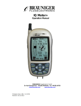
INSTRUCTION MANUAL
ACCESSORIES
Please take care that the GPS device has a clear view of the
sky to ensure a faultless reception of the signals. Otherwise a
limitation of the performance and the accuracy could result.
Take care that the GPS device is not covered by clothing...
The reception could be distinctly reduced by this. You can read
more about GPS reception in item “GPS Reception”
Mounting using Arm Belt with holder
The correct attachment of the included arm belt is conducted as
follows:
• Push the GPS device into the holder from below. The holder
can be turned 360°.
• If necessary, you can extend the arm belt with the included
extension. That way you can attach the arm belt either to the
wrist or the upper arm.
FUNCTION BUTTONS OF THE GPS DEVICE
ALTITUDE MODE
TO TURN ON AND DISPLAY DIFFERENT MODE
FAQ/TROUBLESHOOTING
TECHNICAL DATA
1. Press and hold ON/OFF/LIGHT button for 3 seconds to turn on
the GPS device.
2. Press MODE button to switch between different mode.
SPEED Mode ALTITUDE Mode
TIME Mode
NAVIGATION Mode
STOPWATCH Mode
Altitude Speed
Sub Function
Press the MODE button until you are in the altitude mode,
displayed by the following readout:
By pressing the SELECT button, you can change the readout in
the lower part of the display as follows:
On the display of the GPS device is a transparent protective film.
You can remove this or leave it on the display to protect it from
scratching.
Tip:
Place your GPS device some minutes before you start your
journey or drive in an open area with free sight of the sky and
switch it on by press and hold the ON/OFF/LIGHT button for
about 3 seconds.
INSERTING THE BATTERY
Unscrew the cover of the battery compartment (possibly with the
aid of a small coin). Insert the included battery (1 1.5V AA (LR6)
battery) with the + pole pointing to the top. Put the cover of the
battery compartment back on and screw it tight.
Best possible
reception
Very good
reception
The GPS device automatically starts to search for a GPS
signal, visible by the blinking satellite symbol in the top left of
the display.
Weak
reception
Good
reception
Speed Vertical speed Cumulated Ascent
Clock Cumulated Descent
Switch on the GPS device:
Hold the ON/OFF/LIGHT button for about 3 seconds.
Switch off the GPS device:
Hold the ON/OFF/LIGHT button for about 3 seconds.
Arm belt & Extension Belt
Docking Station
with USB cable
Mounting Shoe
Holder (Rotate 360°)
Battery
(1.5V / AA)
Installation CD
SPEED MODE
Press the MODE button until you are in the speed mode, display
by the following readout (graphics on the left).
Current Speed
Sub Function
Press the MODE button until you are in the time mode, displayed
by the following readout:
To set a different time zone, please follow item
Setting Time Format, Unit of Measurement and Time Zone.
TIME MODE
During satellite reception (see item GPS Reception) time
anddate are set automatically.
Setting the time manually is not possible.
Notice: Please note that the GPS signal sends Greenwich
Mean Time (GMT), and it may be necessary to set a different
time zone.
Display of Position:
When the GPS device is connected to the satellites, the
latitude and longitude for every position is displayed. An N is
added to the latitude (north of the equator) or S (south of the
equator).
A W is added to the longitude (west of the prime meridian) or
E (east of the prime meridian).
The position is displayed in the common format degrees °
minutes ’ seconds ”
1 degree is subdivided into 60 minutes, one minute is 60
seconds.
Example:
N 48° 8’ 41.4”
E 14° 0’ 45.0”
= 48 degrees 8 minutes 41.4 seconds northern latitude
14 degrees 0 minutes 45.0 seconds eastern longitude
N = North = North northern latitude
S = South = South southern latitude
E = East = East eastern longitude
W = West = West western longitude
Since satellite signals react very sensitively to outside influences,
bad weather conditions ( such as strong snowfall) as well as a
disturbed reception area (GPS device is covered by clothing or
other objects, high buildings or narrow valleys and gorges prevent
reception) can seriously impair the performance and accuracy of
the GPS device.
The GPS reception in buildings is very reduced or impossible.
Near windows, as well as in rooms with large windows and free
sight of the sky, the position can be determined in certain
circumstances, depending on the current position of the satellites.
In closed rooms and in cellars the GPS reception is practically
always impossible.
Only during clear weather (clear sky) and suitable reception
area - open area and clear view of the sky – can a faultless
satellite reception be ensured.
GPS Reception
To use the GPS function of your GPS device optimally, it is
imperative that the following instructions are follows.
The GPS device is a global positioning system (=GPS), which
mainly serves for the measurement of distances, speed, altitude
and navigation by using the US-American 24 satellite network.
The United States of America operate this 24 satellite network
and are responsible for its accuracy and maintenance.
CLEANING AND MAINTENANCE
Clean the GPS device and the docking station only with a
soft, moist, lint free cloth.
Do not use solvents, acidic or gaseous cleaning agents.
Take care not to leave any water drops on the display of the
GPS device. Water can cause permanent discolorations.
Do not expose the display to bright sunlight nor to ultraviolet
radiation.
Clock Compass Odometer
Trip timerDistance Average Speed Max Speed
DST = Daily distance
TM = Training time (displays the time moving, i.e. during
standstill the time is stopped, if the movement continues,
the time continues as well. GPS reception provided!)
AVS = Average speed
MXS = Maximum speed
ODO = Total distance
CPS = Compass (an arrow shows the direction (N, E, W or S) in
which you are moving)
N = North E = East W = West S = South
CLK = Current Time
By pressing the SELECT button, you can change the readout in the
lower part of the display as follows:
If the GPS device has not received a Satelite signal after 15
minutes, the message "GPS turned off" appears on the display.
By switching the GPS device off and switching it on again, the
search for a GPS signal is automatically start again.
Please note that it can take up to 15 minutes from the first start in
new surroundings until the first satellite reception occurs. Then
the satellite symbol appears permanently on the display. The
more "waves" are displayed around the satellite symbol, the
better the reception:
The GPS device is a navigation system. By using the 24 satellite
network circling the earth, the position of the user can be
determined. This is possible at any time and everywhere in the
world.
A use different than described in this instruction manual is not
permitted and can lead to damage or injury. We assume no
liability for damages resulting from improper use. Further
directions and explanations can be found in the instruction
manual.
Setting Time Format, Unit of Measurement and Time Zone
Notice:
The saved GPS data is not deleted by a battery change.
Notice:
We recommend the use of high-quality batteries.In case of
frequent use, we recommend to replace the 1 1.5V AA (LR6)
battery with a1.2V AA NiMH rechargeable battery of at least
2200
The state of the battery is constantly shown in the top of the
display.
A battery change is necessary, if the display gets weaker or it
fades totally. If the battery is weak, the battery symbol starts to
blink and the message "Low Battery" appears.
Required battery: 1 1.5V AA (LR6) battery
Unscrew the cover of the battery compartment (possibly with the
aid of a small coin).
Take the depleted battery out of the GPS device and insert a new
battery (1 1.5V AA (LR6) battery) with the + pole pointing upwards.
Put the cover of the battery compartment back on and screw it
tight.
LIGHT FUNCTION
BATTERY CHANGE
Time format
Unit of
measurement
Time zone
To set the time format, unit of measurement and time zone you
must be in the time mode:
1. Press the ST/SP/SET button for about 3 seconds. „24HR“
starts to blink.
2. Choose the desired time format by pressing the SELECTION
button (12HR for 12 hour display or 24HR for 24 hour display)
and confirm your choice by pressing ST/SP/SET again. „KM
metre“ starts to blink.
3. Choose the desired time format by pressing the SELECTION
button („KM meter“ for metres or „mile feet“ for miles) and
confirm your choice by pressing ST/SP/SET again. Now the
setting of the time zone follows.
4. Set the desired time zone by pressing the SELECTION button.
Notice:
During standard time GMT + 01:00 applies for Germany During
daylight saving time GMT + 02:00 applies for Germany
Confirm your choice by pressing the ST/SP/SET button again.
The settings are now concluded.
By pressing the ON/OFF/LIGHT button, the display is illuminated for
about 3 seconds. Once the backlight is ON, pressing the
ON/OFF/LIGHT button will keep the backlight permanention.
Press the ON/OFF/LIGHT button again will then turn off the backlight.
A permanent illumination of the display is not recommended. Please
note however that the illumination of the display requires more
electricity, which results in a shorter lifespan of the battery.
SELECTSELECT
Home
Navigation
Route
Navigation
Current
location
NAVIGATION MODE (Function only with Satellite Signal)
Current Location
SET
SET
Home Navigation
Home Navigation :
The arrow in the middle show the direction of destination, lower digits
show the distance from home. In navigation mode, press SET button
to show Home lock time and Home location.
Download route from computer
(Please see appendix how to download route).
At the starting point of the route, turn GPS on.
Middle arrow show the direction on current, checkpoint below digit
show the distance remaining to the route destination.
REMARK:
In the beginning or when the user is not moving, the arrow points
forward. When user start to move, the arrow will point to the direction
of the home position.
Route Navigation
Once the current checkpoint is reached. The next checkpoint will be
approached and the Route Navigation display will then be updated
automatically with new direction to next checkpoint and updated
distance remaining to the route destination.
Until the final destination is reached, the distance remaining will be
down to 0.00 and a icon will be shown on the middle Hold SET
button to reset route navigation from beginning.
Press SET to change the display to current route checkpoint location.
Then press SELECT button to show next checkpoint.
when current route checkpoint location
displayed.
Hold SET button to use current checkpoint
as navigation checkpoint and back to route
navigation display.
Hold SET to reset DST, TM, AVS
Hold SET to clear MXS, ODO
Press the SET button for about 3 seconds while the current location
displayed to save it as home position.
navigation
1. Press the ST/SP/SET button to start the Stopwatch.
When the Stopwatch is running, Data is recorded by the
GPS unit. The unit can store up to 350 hours of data.
Before the memory go to zero, please import the data in
your computer.
2. Press ST/SP/SET to stop the Stopwatch, GPS will in
the same time stop recording data.
3. You can resuming recording for the same record by
starting the stopwatch again.
4. To start a new record, hold the ST/SP/SET button for 3
seconds until the stopwatch reset to zero.
5. Repeat the procedure of recording will start recording
for a new set of Record.
Clearing the all record from Memory :
You can clearing all memory in the watch with 2 way
1. Importing the data to the computer – (please see the
software user manual)
2. When the stopwatch is at zero, hold the ST/SP/SET
button for 5 second.
A message “Clear all memory?” will pop out from the
screen Confirm delete by pressing ST/SP/SET button.
Decline delete by pressing SELECT button.
www.pyleaudio.com
Art No.:PYLE_SPORTS-PGPFPD5
SO_1448N_GS29D-EL-GB
6-Dec2011
Size: 70x130mm
/