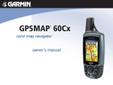
GPSMAP
®
60Cx and 60CSx
©
2006 Garmin Ltd. or its subsidiaries
Garmin International Inc.
1200 East 151st Street
Olathe, Kansas 66062, U.S.A.
913/397.8200 fax 913/397.8282
Garmin (Europe) Ltd.
Unit 5, The Quadrangle
Abbey Park Industrial Estate
Romsey, SO51 9DL, U.K.
44/1794.519944 fax 44/1794.519222
Garmin Corporation
No. 68, Jangshu 2nd Rd.
Shijr, Taipei County, Taiwan
886/2.2642.9199 fax 886/2.2642.9099
www.garmin.com
Specifications are preliminary and subject to change
without notice.
*
Subject to accuracy degradation to 100m
2DRMS under the U.S. Department of Defense
imposed Selective Availability Program.
**
These units are also able to transfer waypoints,
routes and tracks between the PC and GPS
using MapSource.
™
With enhanced street
map detail from
optional MapSource
software, you can look
up destinations and
view automatic point-to
point routes.
0206 M01-10155-00
Electronic compass feature:
(GPSMAP 60CSx only)
Accuracy: ±2 degrees with proper calibration
(typical); ±5 degrees extreme northern
and southern latitudes
Altimeter feature: (GPSMAP 60CSx only)
Resolution: 1 foot
Range: –2,000 to 30,000 feet
Elevation computer: Current elevation, resettable minimum and
maximum elevation, ascent/descent rate,
total ascent/descent, average and maxi-
mum ascent/descent rate
Pressure: Local pressure (mbar/inches HG)
Power
Source: Two “AA” batteries (not included)
Battery life: 18 hours, typical; up to 30 with
battery saving
Physical
Size: 2.4W x 6.1H x 1.3D inches
(61mm x 155mm x 33mm)
Weight: 7.5 oz. (213 g) est.
Display: 1.5 x 2.2 inches (38.1mm x 56mm) 256-color
transflective TFT (160 x 240 pixels)
(160 x 240 pixels)
Case: Waterproof to IPX-7 standards
Temp. range: 5ºF to 158ºF (-15ºC to 70ºC)
Accessories
Standard: 64 MB microSD data card
Belt clip
USB PC interface cable
MapSource Trip & Waypoint Manager CD
Users manual
Quick reference guide
Wrist strap
Optional: Automotive Navigation Kit
(includes City Navigator™)
Automotive mount
Marine mount
Suction cup mount
Carrying case
12-volt adapter cable
Power/data cable
Remote GPS antenna
Navigation features
Waypoints/icons: 1000 with name and graphic symbol,
10 nearest (automatic), 10 proximity
Routes: 50 reversible routes with up to 250
points each, plus MOB and TracBack
®
modes
Tracks: 10K point automatic track log; 20 saved
tracks 500 points each let you retrace
your path in both directions
Trip computer: Current speed, average speed, resettable
max. speed, trip timer and trip distance
Alarms: Anchor drag, approach and arrival,
off-course, proximity waypoint,
shallow water and deep water
Tables: Built-in celestial tables for best times to
fish and hunt, sun and moon rise, set
and location
Map datums: More than 100 plus user datum
Position format: Lat/Lon, UTM/UPS, Maidenhead, MGRS,
Loran TDs and other grids, including
user UTM grid only
GPS performance
Receiver: 12 channel SiRFstar III
™
high-sensitivity
GPS receiver (WAAS-enabled)
continuously tracks and uses up to 12
satellites to compute and update your
position
Acquisition times*:
Warm: <1 sec
Cold: <38 sec
AutoLocate
™
: <45 sec
Update rate: 1/second, continuous
GPS accuracy:
Position: <10 meters, typical
Velocity: .05 meter/sec steady state
DGPS (WAAS) accuracy:
Position: <5 meters, typical
Velocity: .05 meter/sec steady state
Protocol messages: NMEA 0183 output protocol
Antenna:
Built-in quad helix receiving antenna,
with external antenna connection (MCX)
Moving map features
Basemap: Detailed routable basemap with cities,
highways, interstates, exit info, rivers,
lakes; preloaded with worldwide cities
Uploadable maps: Accepts downloaded or plug-in microSD
map detail from a variety of optional
MapSource media (64 MB microSD
card included)
The GPSMAP 60 series
accepts downloaded
map detail, including
topo maps with
elevation information.
Garmin’s “sensor version”
GPSMAP 60CSx also
features a large,
easy-to-read electronic
compass display.
The barometric altimeter
feature on the GPSMAP
60CSx provides elevation
profiles for climbers and
hikers.