© 2023 DJI All Rights Reserved.
11
AGRAS T40/T20 P Unmanned Aircraft Flight Manual
Fruit Orchard on Flatland and Mountain Land
Both Fruit Orchard on Flatland and Mountain Land are suitable for Route and A-B Route operations. Fruit
Orchard on Flatland is suitable for terrain without obvious surface elevation changes. Mountain Land
is suitable for undulating terrain covered with mountain crops and fruit trees. Flying vertically to bypass
obstacles takes priority in Mountain Land mode. Both modes have the same operation instructions.
1. Select the corresponding task terrain.
2. Enable Terrain Follow and Obstacle Bypassing. After a Route or A-B Route operation is started,
the aircraft will fly above the vegetation at the pre-set height and bypass detected obstacles
automatically. Moving the control stick can pause auto bypassing. The aircraft will hover in place if
bypassing fails. Users can bypass the obstacle by manually controlling the aircraft.
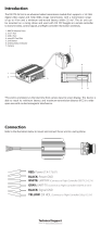
Radar Usage Notice
DO NOT touch or let your hands or body come in contact with the metal parts of the radar
module when powering on or immediately after ight as they may be hot.
Maintain full control of the aircraft at all times and do not rely completely on the radar module
and DJI Agras app. Keep the aircraft within VLOS at all times. Use your discretion to operate
the aircraft manually to avoid obstacles.
In Manual operation mode, users have complete control of the aircraft. Pay attention to the
ying speed and direction when operating. Be aware of the surrounding environment and
avoid the blind spots of the radar module.
The obstacle avoidance functions are disabled in Attitude mode.
When sensing objects such as an inclined line, inclined utility pole, or power line at an inclined
angle against the ying direction of the aircraft, the radar detection performance will be
affected since most of the radar electromagnetic waves are reected to other directions. Fly
with caution.
The radar module enables the aircraft to maintain a xed distance from vegetation only within
its working range. Observe the aircraft’s distance from vegetation at all times.
Operate with extra caution when ying over inclined surfaces. The recommended maximum
inclination at different aircraft speeds are 10° at 1 m/s, 6° at 3 m/s, and 3° at 5 m/s.
Comply with local radio transmission laws and regulations.
The sensitivity of the radar module may be reduced when operating several aircraft within a
short distance. Operate with caution.
The radar module is a precision instrument. DO NOT squeeze, tap, or hit the radar module.
Before use, make sure that the radar module is clean and the outer protective cover is not
cracked, chipped, sunken, or misshapen.
Keep the protective cover of the radar module clean. Clean the surface with a soft damp cloth
and air dry before using again.