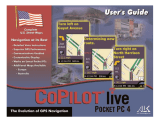
ALK Technologies S60 User manual

Category
Navigators
Type
User manual

This manual is also suitable for

Contents
Welcome to CoPilot! .........................................................i
About GPS Technology .............................................................................1
Safety Warning ............................................................................................1
Getting Started ..................................................................2
Requirements .............................................................................................2
Connecting Your Smartphone .................................................................2
Installing CoPilot ........................................................................................3
Product Key Entry and Activation .........................................................4
Hardware Setup .........................................................................................5
Map Download to Your Smartphone ................................6
Selecting a Data Area ................................................................................7
Region ...................................................................................................7
City Radius ..........................................................................................7
Map Area ..............................................................................................8
Trip ........................................................................................................9
Data Download ..........................................................................................10
CoPilot QuickStart Application Download ..................................10
POI Download Options ...........................................................................11
Trip Transfer ................................................................................................11
Importing Custom Places ........................................................................12
Editing Custom Places ..............................................................................13
Using CoPilot for Guidance ..............................................14
Address Entry .............................................................................................14
Stop Menu Options ...................................................................................16
Entering Your Home Address ..................................................................17
Entering Your Work Address ...................................................................17
Favourites ....................................................................................................18
Intersections ...............................................................................................18
Entering an Outlook Contact .................................................................18
Finding Points of Interest .........................................................................19
Picking Stops From the Map ...................................................................20
Start Driving! ..............................................................................................21
Safety View ...........................................................................................21
Map Views ............................................................................................21
Itinerary View ......................................................................................22
Trip Editing ..................................................................................................22
Menu Options on the Road ....................................................................23
Calculating a Detour .................................................................................23
Avoiding Roads ...........................................................................................24
Optimising Your Stop Order ...................................................................24
Saving a Current Location as a Favourite .............................................24
Getting ETA’s and Distances ...................................................................24
General Options ........................................................................................25
GPS ........................................................................................................25
Routing ..................................................................................................25
Guidance ...............................................................................................26
Map ........................................................................................................26
POI Alerts .............................................................................................26
Licence ..................................................................................................27
Favourites .............................................................................................27
Power ....................................................................................................27
Live Setup .............................................................................................27
CoPilot Modes ...........................................................................................28
Trip Planning On Your Smartphone .................................29
Trip Planning On Your Desktop ........................................30
Reference: CoPilot On Your Desktop ...................................................34
Copilot Live Communications ..........................................37
Real-Time Traffi c Information ..........................................38
Creating/Using Your Own Voice ........................................40
CoPilot Technical Support .................................................41
Licence Upgrade ........................................................................................41
Adding a Data Region ...............................................................................41
Region Selection ........................................................................................42
Using Help Files ..................................................................42
Software Registration ........................................................42
Licence Agreement ............................................................43
- 1 -
Welcome to CoPilot!
Imagine…a CoPilot at your side that always
knows where you are, where you’re going, and
exactly how to get there. Now confi dently drive
anywhere while CoPilot, using the latest, most
accurate GPS technology, shows you all the correct
turns to take to reach your destination.
Better yet, if you should miss a turn, encounter heavy
traffi c, or simply decide to go a different way, CoPilot’s dynamic directions
automatically provide you with an updated route to your destination. Keep
your eyes on the road and your hands on the wheel as CoPilot’s unique
voice technology speaks the directions to you. In addition, detailed street
maps show your passengers the current street location and the route to
your destination.
About GPS Technology
The Global Positioning System (GPS), developed by the U.S. Department
of Defense, is a constellation of 24 satellites that orbit the Earth twice daily.
Each satellite contains an atomic clock that is accurate to the nanosecond
and constantly emitts radio waves toward Earth. GPS sensors (hardware
devices for receiving data) can receive these signals from the satellites and,
using their own internal clock, can calculate the amount of time it has taken
for the signal to be received. GPS relies on the fact that radio waves travel
at the speed of light to calculate distances, and the exact location of the
sensor is fi gured by combining the data received from four satellites.
Using the data from these four satellites, GPS is able to give you the latitude,
longitude and elevation of your present location, and also your road speed
and direction of travel on a route. Given the right conditions, a GPS sensor
can identify your geographic position anywhere in the world within a few
meters.
How CoPilot Uses GPS
CoPilot uses the GPS positional data that it receives from your hardware
unit to display your current position on a map as you drive. This is called
“tracking”. CoPilot also uses the GPS data it receives to guide you along
a planned route if you enter a destination on your Smartphone. CoPilot
guides you with audible prompts and on-screen directions as you drive.
GPS Accuracy
The GPS signal CoPilot receives from the constellation of satellites has a
rated accuracy of within 5 - 10 meters. This means that 95% of the time
the reported location is within 15 - 30 feet of your exact position. If
CoPilot initially places you on the wrong road (this happens only rarely),
keep driving and CoPilot will automatically correct itself and fi nd your
proper position.
Occasionally, CoPilot’s GPS tracking will be less accurate or fail to work
at all because your GPS receiver is unable to receive satellite signals.
Heavy foliage, tall buildings, or any other structures obstructing
communications will interfere with CoPilot’s ability to track your loca-
tion. Like your car radio, GPS tracking can also be affected by weather
conditions if severe. CoPilot will continue tracking as soon as adequate
signals are available. Despite these limitations, you can expect CoPilot
to provide you with useable and accurate information most of the time.
CoPilot will alert you if accurate information is unavailable.
CoPilot’s personal, portable GPS navigation system gives you the
freedom to explore and the confi dence that you’ll never get lost again!
Safety Warning
Always keep your hands on the steering wheel and eyes on the
road when driving!
Do not use this product in any way that interferes with safe and
attentive operation of a vehicle. When used in a vehicle, do not place
the GPS receiver, antenna, power supply, or your computer where it
may strike the driver or passengers if the vehicle turns sharply or stops
abruptly. This product is designed, manufactured, and intended as an aid
to planning and navigating routes. The accuracy of the map data, driving
directions, and GPS tracking system is insuffi cient for this product to be
used for automated navigation or in any situation in which the failure
of the product could lead directly to death, personal injury, or physical
or environmental damage. The driver must remain alert at all times to
actual road conditions and obey all posted signs and traffi c regulations.
ALK Technologies assumes no responsibility for any damage or
injury resulting from the use of this product.
- 2 -
Getting Started
This User Guide includes complete instructions for installing your
CoPilot software and using CoPilot on your phone to guide you to your
destination or to plan trips.
Requirements
Desktop PC Requirements
To install CoPilot on your desktop or laptop PC, you must have:
• Microsoft Windows 2000, ME, or XP
• 400 MHz processor or better
• 16X CD-ROM or better
128 MB of RAM and a hard drive with 1 GB of available disk space
for map data
Nokia PC Suite for transferring map data or other fi les to or from
your mobile phone (supplied with your phone by Nokia)
Smartphone and GPS Requirements
• Symbian S60 2nd Edition phone
• Bluetooth GPS receiver
Connecting Your Smartphone
NOTE: If a Quickstart installation memory card was included with
your purchase of CoPilot, you do not need to do this before installing.
In order to successfully transfer data from your desktop or laptop PC to
your mobile phone, you must have Nokia PC Suite installed on the PC.
This software is necessary to connect the two machines and is provided
by your phone manufacturer. You will need to have this software
installed if:
1) You are installing CoPilot Live using CoPilot installation CDs (rather
than a Quickstart installation memory card);
2) You need to download map data to your phone; or
3) You need to transfer pictures or other fi les from your phone to your
desktop or laptop PC.
Follow the steps below to connect your PC and your mobile phone:
1. Insert the Nokia PC Suite CD in your CD-ROM drive. Do not plug
your phone into your PC until AFTER this software is installed on
your computer.
2. Follow the steps in the Installation Wizard that opens.
3. Click Finish when the installation is complete.
4. Plug the USB cable that came with your phone into a free USB port
on your computer.
5. Plug the other end of the cable into the Pop-port™ connector at the
bottom of your phone.
6. Turn on your phone. Your phone and computer are now connected.
- 3 -
Installing CoPilot
Installing From a Quickstart Installation Memory Card:
1. Set up your phone and charge the battery following the
instructions in your phone’s manual.
2. You must set the correct date and GMT time on your phone for
optimal GPS functionality.
3. Your CoPilot Live satellite navigation software is supplied pre-
loaded on a storage card. Insert your CoPilot storage card into
the slot of your phone.
4. On your Smartphone, open the File Manager and navigate to the
memory card.
5. Select the .SIS fi le on the memory card and open it.
6. Click Ye s’ to install on phone.
7. If you receive a security warning, click ‘Yes’ to install anyway.
8. Press Ye s’ when asked whether to ‘Install CoPilot Live?’
9. Select Install’.
10. Select whether to install to the phone memory or the
memory card. It is recommended to install on your phone
memory for slightly faster performance.
11. When the installation is complete, a CoPilot icon will be placed
in the Menu screen on your phone.
12. To open CoPilot, press the menu key on the phone, then fi nd and
select the CoPilot application in the Menu screen.
13. You will be asked to activate CoPilot within 4 days the fi rst time
you open the application. Press Activate to activate now, or
Exit to activate later
Installing From CD’s
You can install CoPilot to your desktop or laptop computer using the
CoPilot Live CD’s you received with your purchase. You can then use
CoPilot’s extensive desktop trip planning software on your PC to
generate routes and printable driving directions and maps. The desktop
installation also provides the necessary fi les to install CoPilot Live on
your phone from the desktop if you choose.
Before installing, your desktop/laptop and Smartphone should both be
turned on and the phone should be connected through either a USB or
Serial port. You should also have the Nokia PC Suite software that came
with your phone running on the PC.
To install, insert the CoPilot Live CD into your PC’s CD-ROM. An
Installation Wizard will open. Follow the instructions to install the desk-
top software. A CoPilot .SIS fi le will be placed in the CoPilot installation
folder. To install CoPilot on your phone, double-click this fi le.
- 4 -
c. On a desktop/laptop go to the Internet site http://activate.alk.
com and enter the information. You will be given an activation
code.
d. Enter the activation code into the phone when prompted and
select Next.
e. Once complete, you will see the message licence activated
successfully’.
f. Select Done. Activation is now completed.
3. Phone Activation
a. Press Options > Telephone.
b. You will be asked to choose your region.
c. Call the telephone number supplied in the next screen to contact
a technical support representative at ALK Technologies who can
process your CoPilot activation.
Product Key Entry and Activation
The fi rst time you launch CoPilot on your phone you will be prompted
to enter your product key.
After entering your product key you will be asked to activate your
CoPilot licence within 4 days. Press Options and select Automatic
for automatic activation (requires that your phone is connected to the
internet), Manual for manual activation (requires an internet-connected
computer), Telephone to activate over the phone, or Cancel to
activate later.
Four Ways to Activate:
1. Recommended: Automatic Activation using your phone’s
Wireless Internet Connection
a. Press Options > Automatic.
b. Enter your e-mail address and press NEXT. CoPilot will now
activate over the Internet.
d. Once complete, you will see the message licence activated
successfully’.
e. Select Done. Activation is now completed.
2. Automatic Activation via an Internet-connected Desktop PC
or Laptop
Connect your Smartphone to an Internet-enabled Desktop or
Laptop using the supplied Synchronisation cable. Make sure your
desktop/laptop is connected to the Internet, then follow the steps
outlined above.
3. Manual Activation (requires an Internet-connected
computer)
a. Press Options > Manual.
b. On the next screen you’ll see your Product Key and Licence ID.
You need this information to manually activate CoPilot as follows:
- 5 -
Hardware Setup
WARNING: Your GPS receiver is temperature-sensitive. Never leave your
mobile phone or GPS receiver in a closed vehicle that exceeds 140
o
F.
Confi guring the Bluetooth GPS Receiver:
Once you have installed CoPilot Live on your phone, you will be prompted
to set up your remote Bluetooth GPS receiver from the GPS Status screen.
CoPilot uses the Bluetooth GPS receiver to enable you to obtain a GPS fi x
for CoPilot to calculate your route and provide navigation guidance.
IMPORTANT NOTE: Please ensure that the correct date and GMT time
are set on your phone before commencing with setting up your Bluetooth
GPS receiver.
1. Switch on your Bluetooth GPS receiver (slide the switch to 1). Green
and blue lights should turn on if the GPS receiver is properly charged
(see Troubleshooting, next page, on proper charging).
2. Open CoPilot. CoPilot will now check whether Bluetooth is switched
on. If not, select Options > Turn On Bluetooth.
3. Search for your GPS receiver. Select Options >
Search for GPS. After a few minutes the
system should display a list of Bluetooth devices.
Your Bluetooth receiver will be identifi ed by a code
BTGPS xxxxx .
4. Highlight the GPS receiver and press SELECT.
The GPS screen should now change to ´GPS
Signal: Found´ and the GPS information displayed.
5. Select Done. Now you can enter a destination and start navigating!
LED STATUS LIGHTS:
Blue LED Light indicates the Bluetooth connection status.
Flashing every 1 second: GPS was just powered on and waiting for a
connection. Flashing every 2 seconds: GPS is connected to mobile phone.
Green LED Light indicates GPS status.
Light Constantly on: GPS was just powered on and attempting to acquire a
GPS position. Light is Flashing: GPS has acquired a GPS position.
Orange/Red LED Light indicates Battery status.
Red Light Constantly on: Battery is Low. Orange Light is Constantly on:
Battery is charging. No Light (off): Battery is fully charged.
GPS Troubleshooting:
1. Unable to switch on Bluetooth
a. Close CoPilot by selecting Exit’ from the Options menu.
b. Switch your phone off and then on again using the power button.
c. Restart CoPilot, and select GPS from the CoPilot Live screen.
d. You will be asked to activate Bluetooth, press Ye s .
e. Scroll down to GPS Signal, press Options > Search for GPS.
f. Bluetooth should now be switched ON and your phone should be
connected. If not, see below.
2. Proper Charging Techniques (IMPORTANT)
The Bluetooth GPS only needs to be charge for a maximum of 1
hour or until the Battery LED is off. Do not leave the Bluetooth
GPS receiver connected to the charger at all times, as it will degrade
the battery life and eventually drain the battery completely. Normal
battery life is 8 hours.
3. ‘No devices found’ in search for GPS
a. Close CoPilot by selecting Exit’ from the Options menu.
b. Ensure that your Bluetooth GPS receiver is switched ON: Switch
the GPS receiver off and on. The green and blue lights will turn
on if the GPS receiver is charged up and working properly.
c. Restart CoPilot and select GPS from the CoPilot Live screen.
d. Select Options > Search for GPS.
e. Your Bluetooth receiver should appear with the name
BTGPS xxxx xxxx’.
4. Unable to get a GPS Fix.
If you can’t get a GPS signal after setting up your receiver, ensure
that your Bluetooth GPS receiver is switched on, charged up, and
working properly by switching it on and off. The green and blue
lights will turn on if the GPS receiver is properly charged. To avoid
unnecessary delays, make sure that your phone’s date and time are
properly set.
- 6 -
Map Download to Your Smartphone
NOTE: If your CoPilot product came with a Quickstart installation
memory card, you don’t need to download map data (it’s already on your
Quickstart card). You can skip to Using CoPilot for Guidance, p. 14.
To download map data from your Desktop PC or Laptop to your mobile
device, you select the data to download from one or more regions that you
specify in the CoPilot application on your desktop. It’s a simple process.
See p. 7-10 for more detailed descriptions of the basic steps outlined below.
CoPilot gives you two options for downloading data:
· Download directly to your Storage Card Reader — follow steps (1),
(2), and (3a) below.
· Download to a hard drive on your computer, then manually copy the
data to your Smartphone Storage Card using Nokia PC Suite — follow
steps (1), (2), and (3b) below.
(1) Choose a Storage Location:
1. Open the CoPilot application
on your desktop/laptop, then click
the Data Download Wizard
icon in the sidebar on the left. Make sure
your Smartphone is synchronized. CoPilot
will scan your computer to detect which
drive options are available.
2. Click on the Drive Name pick list that appears and select either the
drive letter of your Storage Card Reader (if you are using one) or the drive
letter of your Hard Drive (e.g. C). Click Next.
(2) Select a Data Area:
Select a data area using one of three methods (see Selecting a Data Area
p. 7-9 for a description of each method):
City Radius to select an area around a town or city;
Map Area to select an area directly from the map;
Trip to select a corridor along a route between two places.
Region to select a whole region.
(3) Download the Data:
NOTE: For more on data download options, see p. 10.
(3a) Using a Storage Card Reader:
1. Make sure the Storage Card for your Smartphone is inserted in the
Storage Card Reader.
2. Clicking the Download icon will take you to a screen
where Available Area(s) for download are displayed on the left.
To designate an area to include in the download, highlight it
and then click on the right arrow button to move it to the
Data Included in This Download list on the right. To take an area
off the list, highlight it and click the left arrow button.
3. After confi rming that the area(s) you would like to download are in
the Data Included in This Download list, click Download to complete the
map data download process (see Data Download, p. 10).
4. Remove the Storage Card from the Storage Card Reader and insert
it into the Smartphone. Your data is now ready to be used by CoPilot.
(3b) Using Nokia PC Suite
1. Ensure that your Smartphone is connected to the desktop/laptop via
Nokia PC Suite.
2. Clicking the Download icon will take you to a screen
where Available Area(s) for download are displayed on the left.
To designate an area to include in the download, highlight it
and then click on the right arrow button to move it to the
Data Included in This Download list on the right. To take an area
off the list, highlight it and click the left arrow button.
3. After confi rming that the area(s) you would like to download are in
the Data Included in This Download list, click Download to complete the
map data download process (see Data Download, p. 10).
4. On the desktop, open Nokia PC Suite then click File Manager.
Navigate to the drive letter you downloaded the data to. The data you
downloaded will be in a folder named “CoPilot”. For example, if you
chose Drive C, the data would be in the folder “C:\CoPilot\”.
5. Copy the CoPilot folder: right click on it and select Copy.
6. In Nokia PC Suite, navigate to the Smartphone’s storage card. Right
click on the storage card and select Paste to copy the folder.
- 7 -
Selecting a Data Area
After you specify a location where the data will be stored, you will be
prompted to select a region on the map to download. CoPilot gives you a
choice of four ways to select a data region, described on p. 7-9 below.
Region
To download a whole CoPilot data region, click the Region option in the
Data Download Wizard, then select a region in the next screen and click
Next.
The region you select must be included in the region that was installed on
your Smartphone (if not, a warning will appear and you won’t be able to
proceed with the download). Region downloads generally take the longest
amount of time, depending on the size of the selected region.
1. Click the City Radius icon in
the Data Download Wizard.
2. Enter a City, Country
or Postal Code, and a mile
radius around the area that you
would like to download. Click
Next to verify that the area is
correct.
3. Using the Data Download
Wizard toolbar you can zoom
in or out, change the radius, or
go back to the previous screen.
When you are satisfi ed with
your selection, click Next.
Note: CoPilot’s available
memory calculations subtract
a certain amount from the
available memory on your
storage card (if you are using
one) to account for support fi les.
City Radius
This method allows you to quickly select data in the shape of a circle
surrounding any city on the map. In the Data Download Wizard you
type a city name and state/country abbreviation or postal code and
enter the number of miles/kilometers you would like the radius to
extend around the city, then click Next.
The Wizard displays a map that shows the city and the radius you chose.
At this point you can zoom the map in and out using zoom buttons and
adjust the size of the data area by altering the radius of the circle.
Follow these steps to download City Radius data:
- 8 -
1. Click the Map Area icon in
the Data Download Wizard.
Map Area
This method of selecting data allows you to choose an area of data by
drawing a box on the Data Download Wizard’s map screen.
In the Wizard, you enter a city name near which you would like to select
data, then click Next. The map will zoom to that location. Then you
create a box around the desired area by clicking and dragging your mouse
across the map. The street-level data within that box will be selected.
You can zoom the map in and out using the zoom buttons and adjust the
size of the data area by redrawing the box.
Follow these steps to download Map Area data:
2. Enter a City, Country or
Postal Code (address optional)
within the area that you would
like to download. Click Next.
3. Click and hold the left
mouse button and drag the
cursor to draw a box around
a desired area. The size of the
area will be displayed in the
toolbar. Click Next.
Note: CoPilot’s available
memory calculations subtract
a certain amount from the
available memory on your
storage card (if you are using
one) to account for support
les.
4. Name the selection, then
click Next.
5. You will return to the Data
Selection menu where you can
select another data area if you
like, using any method. When
you fi nish selecting data areas,
click the Download icon and
you will be taken to the fi nal
screen where you can build
your download.
4. Name the selection, then
click Next.
5. You will return to the Data
Selection menu where you can
select another data area if you
like, using any method. When
you fi nish selecting data areas,
click the Download icon and
you will be taken to the fi nal
screen where you can build
your download.
- 9 -
1. Click the Trip icon in the
Data Download Wizard.
Trip
This method of selecting data is by far the most customisable method.
It allows you to run a trip and select street-level data specifi c to that trip,
thereby avoiding unneeded data and saving valuable memory space.
Once the trip is run, the Data Download Wizard automatically selects
circles of data around your origin and destination, and a corridor of data
along your route. You can then click Options to adjust the radius of the
circles and the width of the corridor.
The Trip Itinerary for each trip you download will be stored on your
Smartphone (see Trip Transfer, p. 11). Multiple trips can be downloaded
to the Smartphone for later use.
Follow these steps to download Trip data:
2. Enter at least a start and
end place for your trip. In the
Cities and Addresses tab, type
a City, Country or Postal
Code and press <Enter>.
Optionally, you can enter an
address in the same way. Click
the Add Stop button to add
this place to your trip.
You may enter one or multiple
destinations. Use the buttons
to the right of the Itinerary to
zoom to a stop on the map,
change the order of stops, or
delete a stop.
3. To search for a POI, click
the Points of Interest tab, enter
a City, Country or a Postal
Code and click the Find button.
(You can speed up your search
by selecting a POI Category
and/or Type.) Then highlight
a selection on the list, click
Select, then Add Stop to add
the POI as a stop.
Note: For a more detailed
description of trip entry, open
CoPilot Help from the desktop
application (Help menu > Help
Contents and Search).
4. When all your stops have
been entered, click Select
Data.
By default a 20 mile (32
kilometer) radius around
all stops and a width of 4
miles along the corridor
which connects them will be
highlighted. Note: CoPilot’s
available memory calculations
subtract a certain amount from
the available memory on your
storage card (if you are using
one) to account for support
les.
5. To customise these distances
for any trip, click Options
and type a distance in the
appropriate box.
- 10 -
6. You will return to the Data
Selection menu where you can
select another data area if you
like, using any method. When
you fi nish selecting data areas,
click Download. Trip itineraries
that were created using the
Tr ip download method will be
transferred along with map data
(see p. 11 for details).
Data Download
When you’re ready to execute a download, the Wizard will display a list
of Available Area(s) for download on the left side of the window. To
designate an area to include, click on it and then click on the right arrow
button to move it to the Data Included in This Download list. If you
need to move an area off the Included list, click on it and use the left arrow
button.
To delete an area from memory, click on it in the Available Area(s) list
and click Delete below the list.
IMPORTANT: Each data download overwrites any data that was
previously downloaded to your hard drive or storage card reader.
Therefore, your download must include all areas that you wish to have
available on your Smartphone.
Notice that the amount of available map memory and the memory required
for all the areas on the Included list is shown beneath the list. NOTE:
CoPilot’s available memory calculations subtract a certain amount from
your storage card (if you are using one) to account for support fi les.
Check Include EU Highway Network to download CoPilot’s complete
European Highway Network along with your data. This additional download
requires approximately 71 MB of space on your Smartphone. When this
network is loaded, major roads, cities, and some points of interest outside
your selected data region will be shown on the map and you’ll be able to
receive guidance as you drive anywhere in the continental United States.
Check Download Favourites to download your Favourites list from the
Trip Planner window on your desktop along with map data. These addresses
will then be available as Favourites for trip entry on the Smartphone.
Check Create QuickStart to download a QuickStart version of CoPilot
along with the map data. If the CoPilot application fi le (.SIS fi le) was
deleted from your phone’s memory card for any reason, the QuickStart
version can be used to reinstall CoPilot on your phone. Once the .SIS fi le
is downloaded, navigate to it using the File Manager or Explorer on your
phone and press the scroll key to open it and install CoPilot.
POI Download Options
When you download a data region from your desktop PC, you get all roads
within that region. Also included are regional points of interest (POI) such
as gas stations, hotels, restaurants, visitor attractions, etc.
CoPilot now lets you control the number and types of POI that get
downloaded along with map data. You can save space on your Smartphone
by eliminating categories of POI that you’re not interested in seeing.
To select which POI categories you want, choose POI Download
Options from the Edit menu in the desktop application or, when you
rst open the Data Download Wizard, click the Options button in the
Wizard. Check the categories you wish to select (click the plus sign next
to each category to see the included sub-categories).
Click Save Settings to save the set of categories you create. Click
Restore Default to return to CoPilot’s default categories.
Adding OV2 POI Sets
CoPilot supports OV2 POI fi les. You can copy any OV2 fi le into the
CoPilot\Save folder on your storage card to get immediate access to the
POIs it contains.
EXAMPLE: Copy an OV2 fi le named ‘Speedcams’ to Storage Card\
CoPilot\Save. The next time you do a POI search you will see ‘Speedcams’
as a POI Type in the Custom Category.
Trip Transfer
When you use the Trip download option, CoPilot transfers whole trips to
your Smartphone. The trip you create, including its itinerary, is transferred
along with the surrounding data corridor, and it becomes the current trip.
The Trip download option creates a .TRP fi le that is placed in the
Save directory in the CoPilot installation folder on your Smartphone.
Subsequent downloads will add more .TRP fi les to this folder. The number
of trips that may be stored is limited only by the available memory on your
Smartphone.
- 12 -
Importing Custom Places
CoPilot’s Custom Place Import Wizard enables you to import addresses
from your Outlook Contacts database, an Excel fi le, or text fi le. (If you
are using another type of database or contact manager, you can export
your contacts/ locations to an Excel or text fi le before importing them
into CoPilot.) These points are then added to CoPilot’s POI database in
a category and type of your choice (the default category is “Custom”).
Once in the database, they are displayed on maps as pushpins and
included in search results when you search for points of interest on your
Smartphone or in the Trip Planner window on your desktop/laptop.
NOTE: CoPilot now allows importing of multiple POIs with the same
name (e.g. an entire database of “Starbucks”).
To access the Wizard, choose Import Custom Places from the Tools
menu in Planning Mode on the desktop, then follow the step-by-step
instructions given by the Wizard.
Steps for Importing:
1. In Planning Mode on your
desktop/ laptop, choose Import
Custom Places from the Tools
menu to open the Import Custom
Places Wizard.
2. Choose Import from Microsoft
Outlook or Import from an
existing fi le (this can be a .txt or
an Excel fi le). Click Next.
3. In the next Wizard screen, type
the path to the fi le you want to
import or Browse for it, and
use the Category pick list to
indicate a POI category for your
imported places (by default they
are assigned to “Custom”). You
can also choose a Type from the
pick list. To edit the type name,
highlight it on the pick list and
click Edit Type Name below.
Click Next when ready.
4. In the next screen you’ll see the
data from your fi le sorted into
columns. If the columns you see
in the screen have not sorted
the address data correctly, you
need to indicate which delimiter
CoPilot should recognize when
it separates the fi elds in your fi le
into columns. Each fi eld — e.g.
name, street address, city, state,
etc. — needs to be separated by a
delimiter such as a tab, semicolon,
or comma. If your fi le uses a
delimiter other than a comma, tab,
or semicolon, click Other and
type the delimiter in the box to
the right. If the fi rst row of your
le consists of column headings,
you should check Column
headings in fi rst row. Click
Next when ready.
5. Now, following the instructions
on the screen, click each column
heading and match the column
headings with your data. To
be accepted by CoPilot, each
imported place must have at least
four fi elds: Name, Address1,
City, and State. Click Next
when ready.
6. In the next screen, following the
instructions, you can assign a name
to the set of columns you just
defi ned to save you time the next
time you import addresses.
To skip this step, uncheck Save
the columns as a new set.
Click Finish.
- 13 -
Editing Custom Places
After custom places have been added to the database, they can be edited
at any time. Select Manage Custom Places from the Tools menu, then
highlight the custom place you wish to edit, click Edit, and make your
changes. Click Apply when fi nished.
NOTE: By default, addresses entered as Custom Places are assigned to
the Custom POI category. You can change this assignment at any time by
selecting another Category from the drop-down pick list as you edit.
7. When processing is fi nished, the Data Import Status window shows
you how many places in your fi le were matched with addresses in the
CoPilot database. A plus sign in the Accept column indicates a match.
Places that failed to match appear in red and do not have a plus sign.
8. To edit a failed or incomplete match, highlight it and click Edit (see
Editing Custom Places, next page). POI addresses can also be edited after
they are added to the database using the Custom Place Manager.
9. When you are satisfi ed with the list of addresses, click Add to add
these places to the CoPilot database.
Options below the list let you 1) choose whether to add all addresses
on the list to the database, or just those that were accepted, and 2)
determine how CoPilot will handle any address that duplicates one
already in the database.
- 14 -
Using CoPilot for Guidance
In CoPilot’s Guidance Mode on your mobile phone, you will receive turn-
by-turn route guidance information as you travel. For your safety, the
Safety View screen will hide maps when your speed exceeds 16 k.p.h. to
avoid distractions.
1. To launch CoPilot, press your phone’s
Menu key, then navigate to the CoPilot
application in the Menu screen and press
the scroll key to select.
2. In the CoPilot Live screen, select Going To.
3. Press the scroll key on <Add a
Stop> in the Going To screen to enter a
destination.
Step 1
Step 2
Step 4
Step 1
4. The Select Stop screen gives you eight ways
to enter a destination. You can:
1 Enter a new Address
2 Enter your Home address
3 Enter your Work address
4 Select a Favourite
5 Enter an Intersection
6 Enter an Outlook Contact
7 Search for a Point of Interest (POI)
8 Pick From Map
Press the scroll key on the option you want (options are described
on the following pages).
There’s no need to enter a starting location. CoPilot uses GPS
positioning to determine your location automatically.
When you have entered at least one stop in the Going To screen, you
can select Drive and CoPilot will begin guiding you with on-screen and
spoken directions.
If you take a wrong turn or decide to take a different route than the
one CoPilot has generated, no problem! CoPilot will almost instantly
automatically recalculate new directions from your current position.
You simply won’t be able to get lost using CoPilot!
Address Entry
1. After opening CoPilot, press Going To
and then <Add a Stop>. Then select
Address in the Select Stop screen to enter
a town or postal code and (optionally) a
street address as a destination.
Step 3
- 15 -
Step 2
Step 3
Step 3a
Step 3b
Step 3c
Step 4
2. In the Address screen, enter a Street
Name with or without a House Number,
and a City. Scroll down to enter a
Country or Postal Code — press left or
right on the scroll key to scroll down or
up the pick list of countries — then select
Done to continue. NOTE: Street address
entry is optional, if you like you can enter
only a city-country or postal code.
To return to the Select Stop screen to start
over, select Back.
3. The Address Matches screen will display a list
of matches that were found in the CoPilot
database. Highlight your choice and press
the scroll key to continue.
To return to the Address screen, select Back.
3a. To see any match on the map, select
Options > Map.
3b. In the map screen, to zoom your view of a
place in closer or out farther away, press
Options and select one of the zoom
options.
3c. To display the latitude/longitude of any
match, select Options > Details.
Press Cancel to return to the Address
Matches screen.
4. You will see the destination you entered in
the Going To screen.
Press Drive to begin receiving guidance,
then start driving!
See Start Driving! on p. 21 for a
description of CoPilot guidance screens.
- 16 -
Stop Menu Options
In the Going To screen, press Options to access options that include
adding, deleting, moving, editing, and optimising your stops.
To add another destination, choose Add Stop
from the menu. (Another way to do this would
be to simply highlight <Add a Stop> in the
Going To list and press the scroll key .)
Select Delete to delete the highlighted stop,
or Delete All to clear all stops from the list
(you will be asked to confi rm this action).
Select Actions > to access more stop options:
> Move Up/Down — Change the order of
stops on your trip by moving the highlighted
stop up or down on the list.
> Set As WaypointTurn the highlighted
stop into a waypoint. The purpose of
waypoints is to guide your route along roads
you prefer. See p. 24 for more on waypoints.
> Optimize Stops — Reorder stops on the
list to achieve the most effi cient route, keeping
your fi nal destination the same.
> Map — See the highlighted stop on the map.
Select Mode to switch between Guidance,
Walking, and Planning mode — see p. 28 for
a description of each mode.
Select Settings to change routing options
— see p. 25-27.
Scroll down the menu to see these other
options:
Select Help and choose Help for on-screen
instructions about basic CoPilot features.
Choose About for CoPilot version
information.
Choose Welcome to return to the initial
CoPilot Live welcome screen.
To close CoPilot, choose Exit.
Press Cancel at the bottom of the screen to
close the menu.
- 17 -
Entering Your Home Address
To program your home address for quick trip
entry, select Home in the Select Stop screen
and enter your home address as you would a
new address (p. 14). The next time you want to
enter your home address as a stop, just select
Home in the Select Stop screen and your
address will be automatically entered.
To change your home address later, select
Favourite in the Select Stop screen. Then
highlight an address on the favourites list
and press Options > Set as Home. If the
address you want isn’t on the list, you’ll have to
enter it fi rst using the Address option in the
Select Stop screen.
Entering Your Work Address
To program your work address for quick trip
entry, select Work in the Select Stop screen
and enter your work address as you would a
new address (p. 14). The next time you want
to enter your work address as a stop, just
select Work in the Select Stop screen and your
address will be automatically entered.
To change your home address later, select
Favourite in the Select Stop screen. Then
highlight an address on the favourites list and
press Options > Set as Work (you’ll need
to scroll the menu to see this option). If the
address you want isn’t on the list, you’ll have to
enter it fi rst using the Address option in the
Select Stop screen.
- 18 -
CoPilot automatically places every stop you
enter on a list of favourite places for future
quick trip entry. To enter one of these
favourites as a stop, select Favourites in the
Select Stop screen. In the next screen, choose
one of the places on the scrollable list, then
press Select.
MENU OPTIONS:
Press Options at the bottom of the screen to
access these options:
Select — Select the highlighted favourite.
Map — Zoom to the highlighted favourite.
Details View or edit address data for the
highlighted favourite.
Delete — Delete the highlighted favourite.
Delete All — Delete all favourites from your
favourites list.
Set as Home — Set the highlighted favourite
as your Home address for quick trip entry.
Set as Work — Set the highlighted favourite
as your Work address for quick trip entry.
NOTE: When the number of Favourites
on your list reaches 50, each new address
will replace the address that has been
inactive for the longest period of time.
To Save Your Current Location As a Favourite:
You must be receiving GPS data to save your current location as a
favourite. In any display screen press Options, then select Actions >
Save GPS Location.
Intersections
Choose Intersections in the Select Stop screen to enter the
intersection of two roads as a stop on your route. Intersections are
entered just like addresses (see p. 14), except that instead of a house
number you enter a “Street 1” and “Street 2”.
Entering an Outlook Contact
CoPilot allows you to link directly to Microsoft
®
Pocket Outlook to
retrieve address information. Within moments, you can enter a contact’s
home and/or work address as your destination.
To enter a contact, rst select Contacts in
the Select Stop screen. In the next screen
you’ll see your list of contacts.
To select a contact, enter the fi rst few letters
of the contact’s fi rst or last name. The sub-
menu will display matches. Highlight the
contact you want, then press Done.
Select Back to return to the Select Stop
screen. To view or edit a contact’s
address, select Details.
Favourites
  • Page 1 1
  • Page 2 2
  • Page 3 3
  • Page 4 4
  • Page 5 5
  • Page 6 6
  • Page 7 7
  • Page 8 8
  • Page 9 9
  • Page 10 10
  • Page 11 11
  • Page 12 12
  • Page 13 13
  • Page 14 14
  • Page 15 15
  • Page 16 16
  • Page 17 17
  • Page 18 18
  • Page 19 19
  • Page 20 20
  • Page 21 21
  • Page 22 22
  • Page 23 23
  • Page 24 24
  • Page 25 25
  • Page 26 26
  • Page 27 27
  • Page 28 28
  • Page 29 29
  • Page 30 30
  • Page 31 31
  • Page 32 32
  • Page 33 33
  • Page 34 34
  • Page 35 35
  • Page 36 36
  • Page 37 37
  • Page 38 38
  • Page 39 39
  • Page 40 40
  • Page 41 41
  • Page 42 42
  • Page 43 43
  • Page 44 44
  • Page 45 45
  • Page 46 46
  • Page 47 47
  • Page 48 48
  • Page 49 49
  • Page 50 50
  • Page 51 51

ALK Technologies S60 User manual

Category
Navigators
Type
User manual
This manual is also suitable for

Ask a question and I''ll find the answer in the document

Finding information in a document is now easier with AI