Page is loading ...

11/2020
Copyright © 2020
Campbell Scientific, Inc.
Product Manual

Table of contents
1. System description 1
2. Siting and setup 3
2.1 Siting considerations 3
2.1.1 Compass accuracy 3
2.1.2 Proper wind measurement 4
2.1.3 Radio transmission 4
2.1.4 GPS operation 4
2.2 System assembly 4
2.2.1 INTERCEPT display connections 4
2.2.2 Connecting to a computer with USB to serial converter 6
2.2.3 Connecting to a computer with the Ethernet port 6
2.2.4 Tripod and WEATHERPAKM setup 7
3. System operation 10
3.1 INTERCEPT display functions and operation 10
3.2 Observer section 10
3.2.1 Weather Summary 10
3.2.2 WEATHERPAK 11
3.2.3 Display theme 12
3.2.4 Help 13
3.2.5 Logs 14
3.2.6 Graphs 14
3.3 Maintenance 15
3.3.1 Maintenance Dashboard 15
3.3.2 Settings 16
4. WEATHERPAKM and plume modeling software 16
4.1 ALOHA data line interpretation 20
5. Maintenance 21
5.1 Periodic maintenance schedule 21
5.2 Troubleshooting 21
5.2.1 WEATHERPAKM 21
Table of Contents - i

5.2.2 Data receipt 22
5.2.3 Computer 22
5.3 Replacing tower batteries and fuse 23
5.3.1 Tower batteries 23
5.3.2 Tower fuse 24
Appendix A. Vehicle mounting a WEATHERPAKM 25
Appendix B. WEATHERPAKM USB connection and set up 27
Appendix C. Important information for North American users 29
Table of Contents - ii

1. System description
The WEATHERPAK
®
M
1
measures wind speed and wind direction, air temperature, relative
humidity, and barometric pressure. In addition, the WEATHERPAKM calculates the wind stability
class and provides location information. Atmospheric conditions are sampled every second and
the system computes a 5-minute running average. Data is then transmitted every 30 seconds to
the display and plume model.
FIGURE 1-1. WEATHERPAKM with INTERCEPT Display
1
WEATHERPAK is a registered trademark of Campbell Scientific.
WEATHERPAK M 1

WEATHERPAKM was specifically designed for use by Hazardous Materials Responders. The
following is a list of some of the features that make the WEATHERPAKM unique:
l WEATHERPAKM features an advanced electronic interface and unique automatic
networking capability. The advanced electronic interface allows the use of GPS and
SmartDetect™ and future enhancements.
l The ultrasonic wind sensor has no moving parts, is very accurate (particularly at very low
wind speeds), and does not require periodic calibration.
l WEATHERPAKM features a multi-function, 10.1-inch full color, flat panel touch screen
display (INTERCEPT®
1
Display). Multiple windows display data from different
WEATHERPAKM weather stations.
l
Automatically updates CAMEO®/ALOHA®
2
and most other plume modeling software
programs.
l Built-in electronic compass allows the WEATHERPAKM to be set up in any orientation –
will automatically determine True North and give you true wind direction.
l Set-up time is less than one minute.
l The electrical connections are designed to be intrinsically safe and the housing and tower
are constructed of 6061-T6 aluminum, a non-corrosive and non-sparking alloy.
l Designed to withstand decontamination procedures. The WEATHERPAKM housing is
double O-ring sealed and dried with a desiccant to protect the electronics against
moisture.
l All electronics are grounded at a single point to protect the WEATHERPAKM against EMI
(electro-magnetic interference) and RFI (radio frequency interference), thus assuring
reliable data and transmission.
This manual will familiarize you with the installation, operation, and maintenance of the
WEATHERPAKM. Please read all of the instructions before attempting to operate or troubleshoot
the system.
1
INTERCEPT is a registered trademark of Campbell Scientific.
2
Both ALOHA and CAMEO are registered by National Oceanic and Atmospheric Administration (NOAA) U.S.
Department of Commerce FEDERAL AGENCY UNITED STATES.
WEATHERPAK M 2

WEATHERPAKM components:
l Ultrasonic wind sensor
l Barometer
l Air temperature and relative sensor
l INTERCEPT display
l Display power supply and power cable
l Receiver/display box
l Communications options:
o
Wired serial—includes serial cable
o
UHF radio—includes two UHF radios, narrow band antenna, and cables
o
Spread spectrum radio—includes two spread spectrum radios, spread antenna, and
cable
l Mounting options:
o
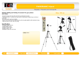
Portable 3 meter quick-deploy tripod—includes tripod and carry case
o
Portable telescopic mast—includes mast and carry case
l WEATHERPAKM carry case
l WEATHERPAKM Quick Deploy Guide for assembly and ALOHA
2. Siting and setup
2.1 Siting considerations
The following siting considerations must be addressed:
2.1.1 Compass accuracy
The WEATHERPAKM contains an electronic compass for automatic alignment to True North. To
prevent erroneous compass readings, install the WEATHERPAKM at least 30 meters (99 feet)
laterally from large vans, buses, cranes, or other large magnetic objects. (The top of a van is
suitable, but next to it is not an ideal location).
WEATHERPAK M 3

2.1.2 Proper wind measurement
Locate the WEATHERPAKM away from obstructions such as trees and buildings. The distance
between wind sensors and the nearest obstruction should be ten times the height of the
obstruction.
2.1.3 Radio transmission
Deploy the WEATHERPAKM as close as safety permits to the hot zone. The WEATHERPAKM
UHF radio has a range of 5 to 7 miles line-of-sight.
CAUTION:
Do not attempt to transmit through structures containing steel, or through hills.
2.1.4 GPS operation
There is a GPS receiver inside the INTERCEPT display and a GPS receiver inside the
WEATHERPAKM. These GPS receivers work together and provide data to the SmartDetect™
firmware, which in turn furnishes direction and distance information for additional
WEATHERPAKM stations operating in the vicinity.
The GPS in the INTERCEPT display must be connected to an external GPS antenna. The receiver
will automatically begin to search for and track GPS satellite signals at power up. The antenna
must have good exposure to the sky.
The performance of a GPS receiver at power-up is determined largely by the availability and
accuracy of the satellite ephemeris data and the availability of a GPS system almanac. When the
WEATHERPAKM is powered-up, the GPS searches for satellites from a cold start (no almanac).
The GPS will begin to compute position solutions within the first two minutes.
NOTE:
Immediately power up the WEATHERPAKM system as soon as you arrive on site to allow the
GPS to find the satellite and computer position.
2.2 System assembly
2.2.1 INTERCEPT display connections
The INTERCEPT display is only available for the WEATHERPAKM. It contains the radio receiver.
The radio antenna receives the signal from the WEATHERPAKM using narrow band UHF or
spread spectrum. In addition, a GPS antenna and electronics allow the WEATHERPAKM location
to be shown in relation to the display location.
WEATHERPAK M 4

1. Connect the external GPS and radio antennas to the appropriate connectors on the side of
the INTERCEPT display (see FIGURE 2-1 (p. 5)).
FIGURE 2-1. Side of INTERCEPT display
2. When outputting data to the CAMEO/ALOHA plume modeling software, connect the USB
to serial data cable. (The Ethernet connection will only be used in rare instances where the
INTERCEPT display will be connected to a network).
3. Plug the INTERCEPT display power supply into an AC power source then insert the power
supply barrel connector into the power jack on the bottom of the display and tighten.
FIGURE 2-2. Bottom of INTERCEPT display
WEATHERPAK M 5

4. The power indicator light on the bezel illuminates as the display starts up. The INTERCEPT
application will automatically launch and begin receiving data from any WEATHERPAKM
units available.
FIGURE 2-3. Front of INTERCEPT display
2.2.2 Connecting to a computer with USB to serial
converter
The INTERCEPT display comes with a USB-to-serial converter cable. Use this cable to connect the
display to a computer or server. The INTERCEPT software can be configured to output ALOHA
messages to the display USB ports.
2.2.3 Connecting to a computer with the Ethernet port
This method is to be employed only if the INTERCEPT display must be connected to a network.
Please contact Campbell Scientific for further information. Refer to the Assistance page at the
end of this document for the procedure of returning components to Campbell Scientific.
WEATHERPAK M 6

2.2.4 Tripod and WEATHERPAKM setup
Assemble the tower in the following manner:
1. Insert and lock the legs onto the bottom section of the tower, forming the tower tripod
base.
2. Align the slot on the WEATHERPAKM with the guide pin on the quick release and push
straight in. The cam lock provides a precision sealed fit and may require an extra push to
seat the WEATHERPAKM properly.
CAUTION:
DO NOT screw the WEATHERPAKM onto the cam lock connector.
WEATHERPAK M 7

3. Once the weather station is properly seated, press the arms of the cam lock down to assure
a tight fit. The battery indicator light (on the tower junction box) should illuminate when
the WEATHERPAKM is properly seated into the cam lock.
4. Place the entire unit (upper tower section and WEATHERPAKM) onto the tripod, engage
the twist-lock and turn clockwise a quarter turn.
5. The WEATHERPAKM is now running and sampling data. When the WEATHERPAKM is
removed from the cam lock connector, it will stop sampling and shut itself off.
WEATHERPAK M 8

FIGURE 2-4. Tower setup
WEATHERPAK M 9

3. System operation
Once set up, the WEATHERPAKM automatically begins sampling weather conditions and
transmits data to the INTERCEPT display every 30 seconds. The INTERCEPT display takes
approximately 20 to 30 seconds to complete a startup routine. When this process is complete, the
plume modeling software requires five minutes of data before a valid plume can be presented.
3.1 INTERCEPT display functions and
operation
The INTERCEPT display is configured at the factory with the ID of the accompanying
WEATHERPAKM and display units. The display can receive and display data from multiple
WEATHERPAKM units, but the factory configured ID will act as the primary WEATHERPAKM.
The touch screen provides access to multiple windows that display weather data in a variety of
ways. There are two sections: Observer and Maintenance (click on either at the upper right
corner). The Observer section is where weather data is displayed. The Maintenance section is
where system status can be checked. In the Observer section there is a tab for Weather Summary
and WEATHERPAK. Additional WEATHERPAKM stations may be added by the user, and a new
tab would be added.
3.2 Observer section
3.2.1 Weather Summary
The Weather Summary tab shows the current, instantaneous values from all reporting
WEATHERPAKM systems available to the INTERCEPT display.
WEATHERPAK M 10

FIGURE 3-1. Weather summary
3.2.2 WEATHERPAK
The WEATHERPAK tab is where current values from the primary WEATHERPAKM system are
displayed. Data from additional WEATHERPAKM systems are displayed in subsequent tabs,
identified by the WEATHERPAKM ID.
FIGURE 3-2. Current values from the primary WEATHERPAKM system
WEATHERPAK M 11

3.2.3 Display theme
The display can be viewed in night or day theme. To change theme, click Display in the upper left
corner. A pop-up window will appear. Choose the desired theme then click Submit.
FIGURE 3-3. Display pop-up window
WEATHERPAK M 12

3.2.4 Help
Click the Help tab and select Contents to display the Help Contents. Navigate to any section to
get instructions and explanations of the software.
FIGURE 3-4. Help contents
WEATHERPAK M 13

3.2.5 Logs
Click the Logs tab and select View Logs. The Log View pop-up will display system data logs.
FIGURE 3-5. Logs
3.2.6 Graphs
Click the Graphs tab and select WEATHERPAK to display the desired graph.
FIGURE 3-6. Graphs
WEATHERPAK M 14

3.3 Maintenance
3.3.1 Maintenance Dashboard
Select the Maintenance Dashboard tab to see a graphical display of the overall system status.
Green lights indicate normal conditions. A red light indicates an alarm for that particular item.
Click the icon for detailed information about the alarm.
FIGURE 3-7. Maintenance Dashboard
FIGURE 3-8. Maintenance Dashboard with message displayed
WEATHERPAK M 15

3.3.2 Settings
Select the Settings tab to adjust specific system information.
FIGURE 3-9. Settings
4. WEATHERPAKM and plume
modeling software
When the WEATHERPAKM is assembled and operational and a computer is connected to the
INTERCEPT display, real-time data is available to run air dispersion plume modeling software.
The following shows of the steps taken to produce an ALOHA plume model on a computer. This
section assumes the user is familiar with ALOHA and that the program is properly loaded onto
the computer. Campbell Scientific recommends consulting the ALOHA website and/or a certified
CAMEO/ALOHA instructor for training, program details, and limitations.
1. Click the ALOHA desktop icon or select ALOHA from the Windows® Programs menu. An
Air Model Limitations dialog box will appear with important notes on program limitations.
Read and click OK.
WEATHERPAK M 16

2. Confirm that your Site Data information provided in the Text Summary window is correct. If
required, use the SiteData drop-down menu to change data.
3. Go to SetUp > Chemical and select the appropriate chemical.
4. Select SetUp > Atmospheric > SAM Station to display series of dialog boxes that require
user observations or assumptions.
NOTE:
Relative humidity is not captured automatically by the ALOHA model but may be
entered manually using data from the WEATHERPAKM display.
5. (Optional) To confirm that WEATHERPAKM data is being delivered to ALOHA, go to SAM
Options > Processed Data and the Processed SAM Data window will display the data
delivered to ALOHA.
NOTE:
The user gets a warning message in both the Text Summary and Processed SAM Data
windows if the WEATHERPAKM has been collecting data for less than five minutes.
6. ALOHA requires the SAM station to be operating for five minutes before selecting the
source of release (tank, pipe, direct, etc.). Go to SetUp > Source and select the leak source
such as tank. A series of dialog boxes will appear requiring user observations or
assumptions.
7. Select Display > Threat Zone and the Level of Concern window will display the default
ERPG ranges. Select OK to show the plume footprint. Displaying the footprint in ALOHA is
essential before the plume can be overlaid on a MARPLOT® or other street map.
WEATHERPAK M 17
/