Page is loading ...

Wireless GPS Logger
RCV-3000
User Manual
Version: 1.1

Table of Contents
Overview.........................................................................................................................4
Packing List ...................................................................................................................5
Main features .................................................................................................................6
Technical Specification .................................................................................................7
Getting Started...............................................................................................................9
H
ARDWARE
D
ESCRIPTION
......................................................................................... 11
RCV-3000
L
OGGER
T
RACK
L
OGGING AND
M
ODE
S
ETTING
.........................................13
B
LUETOOTH DEVICE CONNECTION INSTALLATION
.........................................................15
I
NSTALLATION OF
M
INI
GPS
V
IEWER PROGRAM
..........................................................17
E
XECUTE THE
M
INI
GPS
V
IEWER PROGRAM
...............................................................17
Driver Installation ........................................................................................................18
Troubleshooting ..........................................................................................................19
Federal Communications Commission (FCC) Statement.........................................20

2
Safety Precautions
• About the power adapter:
1. Do not use the power adapter in a wet environment. When hands and feet are wet, do not
touch the power adapter.
2. While using the power adaptor, ensure that the area is well ventilated. Do not let paper or
other material cover the power adaptor, as this will interfere with cooling. Do not use the
power adaptor whilst it is in a bag.
3. Do not attempt to repair the device. If device is damaged or is in a wet environment,
replace the device immediately.
Warranty Statement
• This warranty applies to parts and services that are manufactured and sold through HOLUX.
The warranty length is one year from date of purchase (starting from the date on the sales
receipt). Under normal user operation, HOLUX provides free repair services.
• HOLUX is not responsible for providing repairs or replacements of any software; HOLUX does
not provide any warranty service for third party software/hardware.
• Important instructions
1.
Note: This warranty does not cover damage or malfunction from the below causes:
unauthorized disassembly/modification of unit, abuse or incorrect usage, accidental and
other unpreventable causes, operation under variables mentioned that are different from
those in this product user manual, using parts not made or sold by HOLUX, or repairs done
by anyone other than HOLUX and authorized retail/service providers.
2.
Expendable parts are not covered in the warranty.
3.
HOLUX is not responsible for any program, data, or portable storage media damages or
loss. Please contact your local HOLUX authorized service provider to learn more about
geographical limitations, proof of purchase requests, response time agreements, and other
specific maintenance service requests.

3
Copyright Information
No part of this manual, including the products and software described in it, may be reproduced,
transmitted, transcribed, stored in a retrieval system, or translated into any language in any form or
by any mean, without the express written permission of HOLUX Technology, Inc.
Copyright, All Rights Reserved.
Technical Support
• If there are any questions regarding the use of this product, please log on to the website
www.holux.com and see the FAQ.

4
Overview
The HOLUX RCV-3000 Wireless GPS Logger allows users to store of up to 200,000 GPS
coordinates of latitude, longitude, time, and elevation. The data can be analyzed by uploading to a
computer through its USB/ Bluetooth connection. Once the coordinates and the digital images are
integrated, the tracking history and the location the images were taken can be shared through
ezTour or Google Earth.
The HOLUX RCV-3000 Wireless GPS Logger is a total solution GPS Logger with Bluetooth,
USB interface and built-in rechargeable battery for high sensitivity to tracking signal. RCV-3000
design is based on MediaTek Inc. (MTK) GPS solution-MT3329 low power Architecture.
RCV-3000 is a dual-function GPS Logger. Not only transmit satellite information through the
PDA or Notebook by Bluetooth interfaces but also is a G-Mouse GPS Logger through a HOLUX
designed data cable to deliver satellite signal to the device without Bluetooth interface.
RCV-3000 meets the requirement of field application, such as car navigation, mapping,
agriculture surveying and security use under clear view of sky. RCV-3000 contacts to other device
through Bluetooth interface, and built-in rechargeable Li-ion battery to save satellite information
such as the status of satellite signal, the previous available location, date and time.
With the advanced technology, RCV-3000 can search up to 66 satellites simultaneously, re-acquires
satellite signals in 0.1 microseconds and updates position data per second.

5
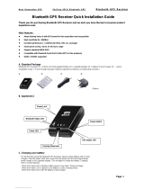
Packing List
Thank you for purchasing the RCV-3000 Wireless GPS Logger. Before you start, make sure that the
following items are included in your package. If any of these items are missing, please contact your
original local HOLUX dealer or distributor.
• RCV-3000 Wireless GPS Logger 1 Set
• Battery 1 Set
• Mini USB Cable 1 Set
• RCV-3000 Quick Guide 1 Pcs
• Warranty card 1 Pcs
Option
• Travel Power Supply 1 Set

6
Main features
1). Built in MTK MT3329 Low power consumption GPS chipset.
2). 66 parallel satellite-search channels for fast acquisition and reacquisition.
3). Superior sensitivity up to -165dBm.
4). Built-in WAAS/EGNOS Demodulator without any additional hardware.
5). Compatible with Bluetooth Serial Port Profile (SPP) completely.
6). Low power consumption. Built-in rechargeable and changeable Lithium-ion battery, the
working time can last 28 hours maximum.
7). Provide expand terminal contact to other system without Bluetooth device.
8). Support NMEA0183 V 3.01 data protocol
9). 3 color-LEDs indicate to show the status of device.
10). FLASH based program memory. New software revisions upgradeable through serial interface.
11). Small, sleek, and lightweight design easily fits in your hand.
12). Over-Temperature protection
13). Enhanced algorithms -SnapLock and SnapStart provide superior navigation, performance in
urban, canyon and foliage environments.
14). For Car navigation, Marine navigation, Fleet management, AVL, Personal navigation, Tracking
System, and Mapping device application.

7
Technical Specification
Basic
Specification
• Chipset: MTK MT3329 chipset.
• Channels: 66 parallel satellite-search channels
• Frequency: 1575.42 MHz
• Receiver: L1, C/A code.
• Built-in 4MB flash memory capable of recording 200,000 points of GPS
data
Acquisition Time
(refer to MTK chip
specification)
• Reacquisition: < 1 second
• Cold start: < 35 seconds
• Warm start:< 33 seconds
• Hot start: < 1 second
Receiver
Accuracy
• Normal: < 3 meters CEP without SA
• Enable EGNOS or WAAS:
Position: < 2.2 meters, horizontal 95% of time
< 5 meters, Vertical 95% of time
• Velocity: within 0.1 meters / second
• Time: 0.1 microsecond synchronized GPS time
Use Limitation
• Altitude: < 18,000 meters (60,000 feet)
• Velocity: < 515 meters/ second (1000Knots)
• Acceleration: 4 G
• Jerk: 20 meters / second
3
, max
Power Supply
• External Voltage: 5V DC +/-5%
• Batteries: Main Power: Built-in rechargeable Lithium-ion for system
power.
• Power Consumption: 50~60mA (Normal mode)/ 25mA (Power Saving).
• Auto Power saving mode.
• Circuit protection on RCV-3000 when over-temperature condition 50°C
occurs.

8
Output and
Interface
• Output
I. Output protocol
Baud Rate: 38400 bps
Data bit: 8
Parity: No
Stop bit: 1
II. Format. NMEA0183 V3.01: GPGGA (1time/1 sec), GPGSA (1
time/5 sec.), GPGSV (1time /5 sec.), GPRMC (1time /1 sec.),
GPVTG (1 time/1 sec), (GLL, or MTK NMEA Command for
optional).
III. Datum: WGS84.
• Input/ Output Interface:
I. Compatible Bluetooth Serial Port Profile (SPP), Version1.2 and
class 2(up to 10 meter range).
II. In/Out Port. GPS signal (Out)/Command(In) with USB Level Mini
USB Type B Connector.
Physical
• Size: 62.5 × 41 × 17.1 mm
• Weight: < 53 g
• Operating Temperature: -10°C to + 60°C (under the un-charging
condition); Charging Temperature: 0°C to + 45°C
• Storage Temperature: -20°C to + 60°C
• Operating humidity: 5% to 95% No condensing
Other Functions
• Bluetooth frequency: 2.4 ~2.48GHz
• Bluetooth Input Sensitivity: -85dBm
• Low sensitivity of receiving satellite signal: -165 dBm
• LED Functions: Indicate Bluetooth status, GPS status, Battery Status
and Battery charging status

9
Getting Started
STEP 1. Charge Battery
Please charge battery till LED off for the first time.
Power cable plug in Power cable connect to power socket
↓
Charge Battery
Battery
indicator light:
Power too low -------------- Red LED on
Charging -------------------- Green LED on
Full or Not in charging --- LED off
Mini USB socket
STEP 2. Turn on the power
Bluetooth Status-
--
-
Power switch
Note: Some PDAs have to re-open Bluetooth manager for Bluetooth device re-connection.
Blue LED blinking
(1 time/ 3 sec)
Transferring…
Blue LED blinking
(1 time/ 1 sec))
Waiting for
reconnection…
Blue LED blinking
(1 time/ 3 sec)

10
GPS Status-
--
-
Put RCV-3000
in clear view of the sky without any obstruction for
better satellite acquiring.
Turn on RCV-3000 power Turn off RCV-3000 power
↓ ↓
Search GPS Power Off
↓
Position Fixed
Orange LED
Steady orange
LED on
Orange
LED blinking
Orange
LED off

11
Hardware Description
RCV-3000 Body description
LED status:
SYMBOL COLOR STATUS DESCRIPTION
1 time / 1 sec Transferring Data
1 time / 3 sec Standby Mode
Bluetooth
Blue Blinking
1 time / 3 sec Search Bluetooth
Device
Red Light on Power too low
Green Light on In charging
Battery
N/A Light off
Battery full or Not in
charging
Light on Acquiring Satellites
GPS
Orange
Blinking 1 time / 1 sec Position Fixed
Power Switch:
Power on Orange light is on.
Power off Orange light is off.
LED of Battery (Red / Green)
Wireless LED (Blue)
LED of GPS (Orange)
Power switch

12
Power Jack & Data Port
Jack type: Mating face of 5 pin Mini USB Type B female.
Pin definitions see following table.
Pin Pin Name Signal and description
1 VCHARG
Positive terminal of DC adaptor that powers the internal charging circuit of
Li-Ion battery. The approved power supply is 5.0V +/- 5%@850mA.
2 D_Minus Receive Data. Form peripheral to organizer. (Voltage level is 3.3V ~ 5.0V).
3 D_Plus
Transmit Data. From organizer to peripheral.
(Voltage Level is 3.3V ~
5.0V).
4 NC
5 GND Signal ground, Battery charging ground.
Optional accessories and connector description
1
5
PC/ Notebook
USB port
Mini
USB
Port

13
RCV-3000 Logger Track Logging and Mode Setting
Data Logging
When the power is turned on, the device will automatically search for satellite positioning (orange
LED on), and then logging will begin. When the power is switched off, the logging will stop. When
the power is turned on again, it will once again conduct satellite positioning and start logging.
GPS Data Logging Mode Setting
1. Install ezTour onto a PC or notebook (see ezTour instructions manual for installation)
2. When the application runs, the following main screen can be seen:
3. From the Menu bar select [Setup GPS Logger] to bring up the settings window

14
4. Make sure that the RCV-3000 is connected to a PC or notebook, and select [reconnect] or
[manual settings]
5. The logger can be set to record by a set time or set distance. The conditions for recording can
be set the following ways:
(1) Select car, bicycle, exercising, or walking mode.
(2) Manually set the time or distance.
6. When the logger’s data storage is full, there are two modes to choose from:
(1) Rewrite: When the data is full, data will begin to be rewritten, overwriting the data from the
beginning.
(2) Terminate: When the data is full, the logger will cease to record any further data.
7. Press [Confirm] to start logging according to the new setting.
Data Read
When the logger RCV-3000 is connected to a PC or notebook through USB or Bluetooth, the data
can be extracted through ezTour. Please see ezTour instruction manual for details.

15
Bluetooth device connection installation
The product includes the application Mini GPS viewer for easy viewing and testing or GPS status.
The following is the steps of software installation to setup on PDA, DELL AXIM x51v with Bluetooth
Manager. For other PDA or laptop device, the steps might vary.
1. In Pocket PC settingsystem panel, enable “manage
GPS automatically”.
Note: The setting may vary in other PocketPC or
Smartphone , please check the manual or consult the
technical service respectively.
2. Tap the Bluetooth icon to start “Bluetooth Manager” on
Pocket PC to enable Bluetooth function.
3. In “Devices” panel , tap “New partnership” to search
Bluetooth devices nearby. If the result is not found, tap
“Refresh” to research again.
4. Choose the Bluetooth device “HOLUX_RCV-3000” and
tap “Next”
5. Connect to “Serial port” or “SPP Slave”, then tap “Finish”

16
6. Go to the “COM ports” panel to tap “New Outgoing
Port”, choose “HOLUX_RCV-3000” device and tap
“Next”.
7. Select the COM port, then tap finish, it will show as right
figure, and tap “OK” to finish the Bluetooth setting.
Recommend not to use “Secure Connection” which
may cause unstable connection.
8. Then you can enable your navigation map program to
enjoy GPS function now.
→

17
Installation of Mini GPS Viewer program
We provide a program “Mini GPS viewer.exe” for end user to watch the satellite signal receiving
status on laptop or PDA device. For Windows 2000/XP OS, you can execute “Mini GPS
viewer_PC” directly. For Microsoft Pocket PC, please copy “Mini GPS viewer_PPC” to SD card or
device, then execute “Mini GPS viewer_PPC”.
Execute the Mini GPS Viewer program
1. The following window is shown after executing Mini
GPS Viewer_PPC, The Windows 2000/XP version is
just different on display.
2. Setup the Baud rate: 38400, then tap “Scan” button to
scan your COM Port. Select your COM Port
respectively, then tap “Open GPS” button. Check log
screen below if the satellite data is receiving correctly.
3. Select “GPS Status” panel to observe the GPS
information status
4. In “setup” panel you can see “Hot Start”、“Warm Start”、“Cold Start”、which allow you to
re-acquisition of Ephemeris and Almanac. Basically the satellites are always moving in the
sky, if Ephemeris and Almanac data in GPS Logger can’t meet real satellites status upon you
if GPS Logger is over 0.5 hour power off but you are no longer in the previous position , it
takes more time for the GPS Logger to get GPS position fix soon. We suggest you can click
“Cold Start” or “Warm start” to re-acquisition. Or you can remove the battery for 3 seconds and
reinsert it, this operation is the same with “Cold Start”.

18
Driver Installation
The following is the steps of installation USB driver.
System Requirement
• CPU: IBM, Pentium III or above, or other compatible PC.
• Memory: above 32 MB
• System: Windows XP SP2 and above (32 & 64 bit)
Windows Vista (32 & 64 bit)
Windows 7 (32 & 64 bit)
Note: the driver is not support Windows 8.
Installation
I. Starts the driver installer from HOLUX website.
II. Connect USB data cable to computer. System will search new hardware and install the driver
automatically.
III. Connect RCV-3000 GPS Logger with USB data cable.
Important
Verify the COM port to start using your own navigation software.
I. Click <Start> menu, select → <Setting>, then enter→ <Controller>
II. After entering <Controller>, and select <System>.
III. Select <Device Manager>.
IV. Find the < Connector (COM & LPT)> and check the Virtual COM Port, which was created by
the USB driver.
Please note that the virtual COM port number might be different from every computer. Before using
navigation software, please confirm the COM Port numbers created by your computer and provided
by your navigation software. Otherwise, the navigating software won’t receive the satellite signal,
because of the un-match COM Port setting.

19
Troubleshooting
Problems Possible Reasons Methods
Weak or no GPS signal at the
place of RCV-3000
Test under open sky at a fix
location and run Mini GPS
Viewer “Cold start” function.
No GPS output but GPS timer
is counting
The ephemeris and almanac
data in GPS memory is no
longer valid after no use for a
long time.
Remove the Battery for 3
seconds and re-insert, then
power on to test again.
Execute fail Bluetooth function unstable
Power On/Off RCV-3000.
Re-Start PDA or PC and refer
to “Bluetooth device
connection installation” to
re-connect.
Can not open the COM port
Bluetooth connection
interrupted or COM port is
conflicted/ occupied by other
programs.
Check the Bluetooth
connection again,
Check and close other
programs that might conflict
with.
Can not find RCV-3000
Poor Bluetooth connection
Re-Start PDA or PC and refer
to “Bluetooth device
connection installation” .
/