MANUZOID
Explore
Explore
Bookmarks
Garmin
GPSMAP 740s
Garmin GPSMAP 740s Important information
Type
Important information
Brand
Garmin
Size
485.99 KB
Pages
36
Language
Danish, German, Greek, English, Spanish, Finnish, French, Croatian, Italian, Dutch, Norwegian, Portuguese, Russian, Swedish, Turkish
View document
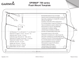
Garmin GPSMAP 740s Installation guide
Type
Installation guide
Brand
Garmin
Size
214.67 KB
Pages
1
Language
English
View document
Garmin GPSMAP 740s Owner's manual
Type
Owner's manual
Brand
Garmin
Size
4.79 MB
Category
Navigators
Pages
104
Language
English
View document
Garmin GPSMAP 740s Owner's manual
Type
Owner's manual
Brand
Garmin
Size
7.59 MB
Category
Navigators
Pages
100
Language
English
Table of contents
Introduction
3
Tips and Shortcuts
3
Manual Conventions
3
Getting Started
5
Front and Back Panels
5
Turning On the Chartplotter
5
Turning Off the Chartplotter
5
Initial Chartplotter Settings
6
GPS Satellite Signal Acquisition
6
Adjusting the Backlight
6
Adjusting the Color Mode
6
Inserting and Removing Data and Memory Cards
6
Viewing System Information
7
About the Home Screen
7
Charts and 3D Chart Views
8
Navigation Chart
8
Automatic Identification System
16
Perspective 3D
19
BlueChart g2 Vision
20
Mariner’s Eye 3D
21
Fish Eye 3D
22
Fishing Chart
23
Showing Satellite Imagery on the Navigation Chart
23
Viewing Aerial Photos of Landmarks
24
Animated Tide and Current Indicators
25
Detailed Road and Point of Interest Data
25
Auto Guidance
25
Combinations
26
About the Combination Screen
26
Combination Screen Configuration
26
Navigation
29
Basic Navigation Questions
29
Navigation with a Chartplotter
29
Waypoints
30
Routes
32
Tracks
34
Navigating with a Garmin Autopilot
36
Where To?
37
Marine Services Destinations
37
Almanac, On-boat, and Environmental Data
40
Almanac Data
40
On-boat Data
42
Environmental Data
45
Device Configuration
48
Basic Device Configuration Questions
48
Simulator Mode
48
Turning the Chartplotter On Automatically
48
Display Configuration
49
Navigation Preferences
49
Information about Your Boat
54
Alarms
55
Chartplotter Data Management
56
Radar
58
Transmitting Radar Signals
58
Adjusting the Zoom Scale on the Radar Screen
58
Radar Display Modes
59
Waypoints and Routes on the Radar Screen
64
About the Radar Overlay
65
Optimizing the Radar Display
66
Radar Display Appearance
70
Radar Overlay Display Appearance
73
Sonar
75
Sonar Views
75
Depth Log
77
Transducer Temperature Log
77
Waypoints on the Sonar Screen
78
Sonar Display Appearance
78
Sonar Alarms
81
Transducer Configuration
82
Digital Selective Calling
83
Chartplotter and VHF Radio Functionality
83
Turning On DSC
83
About the DSC List
83
Incoming Distress Calls
84
Man-Overboard Distress Calls Initiated from a VHF Radio
84
Man-Overboard Distress Calls Initiated from the Chartplotter
84
Position Tracking
85
Individual Routine Calls
87
Making an Individual Routine Call to an AIS Target
87
Appendix
88
Specifications
88
Calibrating the Touchscreen
88
Screenshots
89
Viewing GPS Satellite Locations
89
Using WAAS/EGNOS
89
System Information
89
NMEA 0183 and NMEA 2000
90
Registering Your Device
93
Contacting Garmin Product Support
93
Declaration of Conformity
93
Software License Agreement
93
Index
94
View document
Garmin GPSMAP 740s Owner's manual
Type
Owner's manual
Brand
Garmin
Size
706.65 KB
Pages
48
Language
Danish, German, Greek, English, Spanish, Finnish, French, Croatian, Italian, Dutch, Norwegian, Portuguese, Russian, Swedish, Turkish
View document
Garmin GPSMAP 740s Reference guide
Type
Reference guide
Brand
Garmin
Size
503.83 KB
Category
Car navigation systems
Pages
2
Language
English
View document
Garmin GPSMAP 740s User manual
Type
User manual
Brand
Garmin
Size
5.39 MB
Category
Navigators
Pages
42
Language
English
View document
Garmin GPSMAP 740s User manual
Type
User manual
Brand
Garmin
Size
4.15 MB
Category
Navigators
Pages
100
Language
English
View document
Garmin GPSMAP 740s User manual
Type
User manual
Brand
Garmin
Size
1.45 MB
Category
Navigators
Pages
10
Language
English
View document
Garmin GPSMAP 740s User manual
Type
User manual
Brand
Garmin
Size
4.12 MB
Category
Navigators
Pages
100
Language
English
Table of contents
Introduction
3
Tips and Shortcuts
3
Manual Conventions
3
Getting Started
5
Front and Back Panels
5
Turning On the Chartplotter
5
Turning Off the Chartplotter
5
Initial Chartplotter Settings
6
GPS Satellite Signal Acquisition
6
Adjusting the Backlight
6
Adjusting the Color Mode
6
Inserting and Removing Data and Memory Cards
6
Viewing System Information
7
About the Home Screen
7
Charts and 3D Chart Views
8
Navigation Chart
8
Automatic Identification System
16
Perspective 3D
19
BlueChart g2 Vision
20
Mariner’s Eye 3D
21
Fish Eye 3D
22
Fishing Chart
23
Showing Satellite Imagery on the Navigation Chart
23
Viewing Aerial Photos of Landmarks
24
Animated Tide and Current Indicators
25
Detailed Road and Point of Interest Data
25
Auto Guidance
25
Combinations
26
About the Combination Screen
26
Combination Screen Configuration
26
Navigation
29
Basic Navigation Questions
29
Navigation with a Chartplotter
29
Waypoints
30
Routes
32
Tracks
34
Navigating with a Garmin Autopilot
36
Where To?
37
Marine Services Destinations
37
Almanac, On-boat, and Environmental Data
40
Almanac Data
40
On-boat Data
42
Environmental Data
45
Device Configuration
48
Basic Device Configuration Questions
48
Simulator Mode
48
Turning the Chartplotter On Automatically
48
Display Configuration
49
Navigation Preferences
49
Information about Your Boat
54
Alarms
55
Chartplotter Data Management
56
Radar
58
Transmitting Radar Signals
58
Adjusting the Zoom Scale on the Radar Screen
58
Radar Display Modes
59
Waypoints and Routes on the Radar Screen
64
About the Radar Overlay
65
Optimizing the Radar Display
66
Radar Display Appearance
70
Radar Overlay Display Appearance
73
Sonar
75
Sonar Views
75
Depth Log
77
Transducer Temperature Log
77
Waypoints on the Sonar Screen
78
Sonar Display Appearance
78
Sonar Alarms
81
Transducer Configuration
82
Digital Selective Calling
83
Chartplotter and VHF Radio Functionality
83
Turning On DSC
83
About the DSC List
83
Incoming Distress Calls
84
Man-Overboard Distress Calls Initiated from a VHF Radio
84
Man-Overboard Distress Calls Initiated from the Chartplotter
84
Position Tracking
85
Individual Routine Calls
87
Making an Individual Routine Call to an AIS Target
87
Appendix
88
Specifications
88
Calibrating the Touchscreen
88
Screenshots
89
Viewing GPS Satellite Locations
89
Using WAAS/EGNOS
89
System Information
89
NMEA 0183 and NMEA 2000
90
Registering Your Device
93
Contacting Garmin Product Support
93
Declaration of Conformity
93
Software License Agreement
93
Index
94
View document
Garmin GPSMAP 740s Weather Supplement
Type
Weather Supplement
Brand
Garmin
Size
1.14 MB
Pages
20
Language
English
View document